Ice ,ice and more ice EarthCache
-
Difficulty:
-

-
Terrain:
-

Size:  (not chosen)
Please note Use of geocaching.com services is subject to the terms and conditions
in our disclaimer.
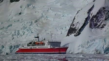
The coordinates are for Pleneau Bay where you can see many ice forms. This Bay can be accessed by yacht and small Expedition ships in the summer months when the ice melts in the Lemaire Channel. The Lemaire Channel runs between the Antarctic Peninsula and Booth Island befor entering Pleneau Bay.The volume and variety of ice in Antarctica is one of the continent’s defining characteristics.
All ice on land is made up of fresh water as it comes from precipitation that falls as snow. The weight of the snowfalls each year compress the flakes which over a period of years turn into graduated balls called firn. After a further few years the firn becomes ice. This process results in glaciers and ice shelves.
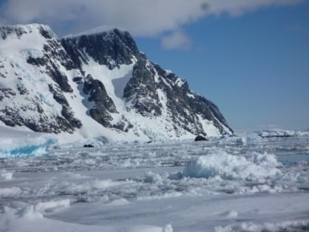
In Pleneau Bay there are many glaciers, Icebergs and floating ice
Pack Ice is formed when the pancake ice grows and solidifies. Pack ice is composed of ice floes and floats around on currents. It is also a resting place for penguins and seals.
Fast Ice When the sea freezes and is attached to land in a solid sheet it is known as fast ice. It is very stable and flat and can support landing planes.
For the purpose of this earth cache you will need to identify the following ice forms to complete the tasks.
Sea Ice: This is formed when the sea freezes every winter and most melts during the Antarctic summer. The surface freezes to the depth of about 2 meters. This ice is opaque. It freezes at – 1.9 degrees.
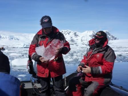 Fresh Water ice: This ice is clear and floats in the water. It can be huge lumps of clear ice ( see photo gallery)It can be chopped up and used as ice blocks in drinks as it is not salty.
Reference ANTARCTICA CRUISING GUIDE Peter Carey, Craig Franklin published by Awa press New Zealand 2009
In order to log this earth cache Please email the owner
Task 1 Look at the pictures in the photo gallery which show the extent of the sea ice towards the end of November. Observe the ice as you enter the bay from the Lemaire Channel near Mt Booth. Please estimate the percentage of the bay which is covered in sea ice when you visit the bay. Please include the date of your visit.
 Task 2 After identifying sea ice and fresh water ice, collect a piece of each sort of ice. Please place each into a container and leave next to each other (in the same room) to begin to melt. After 30 minutes measure or estimate the volume of melted water in each container. You may need to use a coffee mug or similar unless you can access a measuring cup. If the ice has not begun to melt leave it a bit longer. a). Which has melted faster - sea ice or fresh water ice b.) Why do you think that the different ice forms melt at different rates?
Task 3 a)Describe the shapes of the icebergs you see in this bay and say how they differ from the icebergs in other bays. b)Why / how do you think these icebergs get to look like this. Optional please mention the vessel you were travelling on in your log.
Additional Hints
(No hints available.)