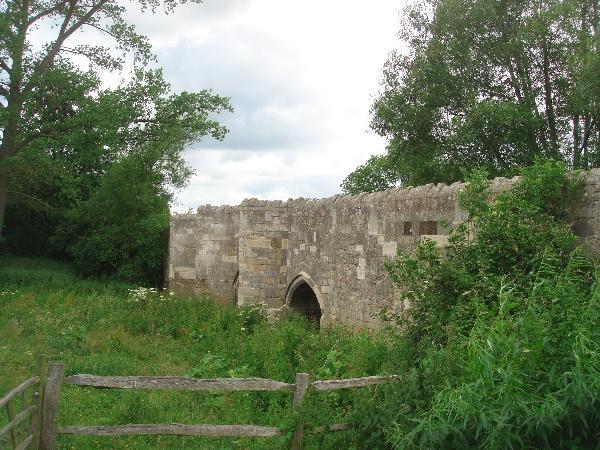
Coombs quarry is located just off the A421 between Buckingham and Milton Keynes. It was a working quarry up until the end of the 19th century. There are the remains of some lime kilns close by. 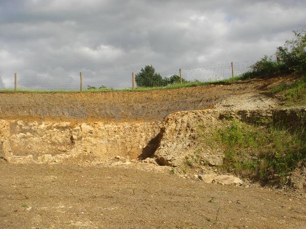 The stone here may have been quarried since at least Roman times. The local medieval Thornborough bridge was certainly made from the local stone.
Coombs quarry is the site of an excellent exposure of Jurassic limestone. The Jurassic period lasted, roughly 55 million years, between 199 to 164 million years ago. These, particular layers of sedimentary rock, are known as Blisworth limestone, and run as a ridge, from Lincolnshire to around Bath.
The sediments here, display two distinctive types. There's a greyish, shelly, fine-grained form, rich in carbonates. The other is a creamier coloured deposit, with characteristic egg shaped particles. Calcium carbonate, CaCO3, was precipitated out of the water onto tiny nuclei. Over time the precipate built up to larger and larger particles all the time being rolled around by the action of the water. This constant agitation led to the particles resembling smooth, small eggs. From these clues, geologists can determine the kind of environment that existed at the time the deposits were being laid down.
For example, the egg shaped particles indicate warm shallow seas with a gentle wave action to round the carbonate particles. The finer grained deposits represent a much deeper marine environment. It is possible to track the change in the enviroment through the section. As you examine to rock faces you will encounter some of these deposits. If you happen to find an ammonite, please let me know!
Overlying the limestone are some younger clay deposits. Blisworth clay is a pale grey and represents a shallower coastal fringe, maybe even a black lagoon. Fossils in this layer are usually of creatures that like brackish water, like oysters.
Overlying this is a layer of Cornbrash. Cornbrash is a more rubbly limestone containing quite a few, mostly broken, fossils. This exposure is only evident due to a fault which drops this layer down along the older Bliswoth limestone and clay layers.
 There are 2 possible parking locations. The one I would recommend is at Thornborough bridge, where you can view the bridge itself and the Romano-British burial mounds.
Suggested parking N51 59.535 W000 56.282
If you walk under the modern bridge you can walk across the fields. Cross the stile where the path splits and walk south directly over the field. Go over the little bridge and across the next field. Before you go through to the next field turn left through another gate and the entrance to the quarry is in front of you. Please note! Sometimes the brook is in flood and the route is impassable. Alternative parking is detailed below
The second parking is in the Thornborough Community Woodland car park. N51 58.942 W 000 55.966. You cross the road, go through the gate and follow the footpath that runs parallel to the road. If you bear left around the building the path opens out opposite the entrance to the quarry.
Please don't park in the entrance to the quarry, or along the roadside.
To claim this cache you need to complete a few tasks.
1. To prove you have been to the site I will need some confirmation. Visit the info board @ N51 59.247 W000 56.048. In the bottom right hand corner, what is the name?
2. What is the specific name given to the, distinctive, "egg" shaped limestone?
3. Go to the eastern end of the quarry to N51 59.236 W000 56.021. Photograph your GPS with the specified co-ordinates. Note the distinctive fault! 
4. Estimate the height of the Cornbrash exposure that lies to the left of the fault..
Email the answers to my geocaching.com profile.
Special thanks to the Buckinghamshire County Council for permission to place this cache and to Bucks Earth Heritage Group for their invaluable assistance.