Welcome to the beautiful Frenchman River Valley! The Frenchman River Valley is a beautiful yet rugged area that was carved by glaciers many years ago. The valley begins on the outside edge of the Cypress Hills. Interestingly, the Cypress Hills were missed by glaciers, and stand as the highest point between the Rocky Mountains and the Atlantic Ocean. It’s climate and vegetation is more closely related to the foothills regions then the surrounding prairies. From the Cypress Hills it loops its way down to Eastend, passing through a more traditional prairie environment. After passing through Grasslands National Park, it eventually joins the Milk River in northeastern Montana.
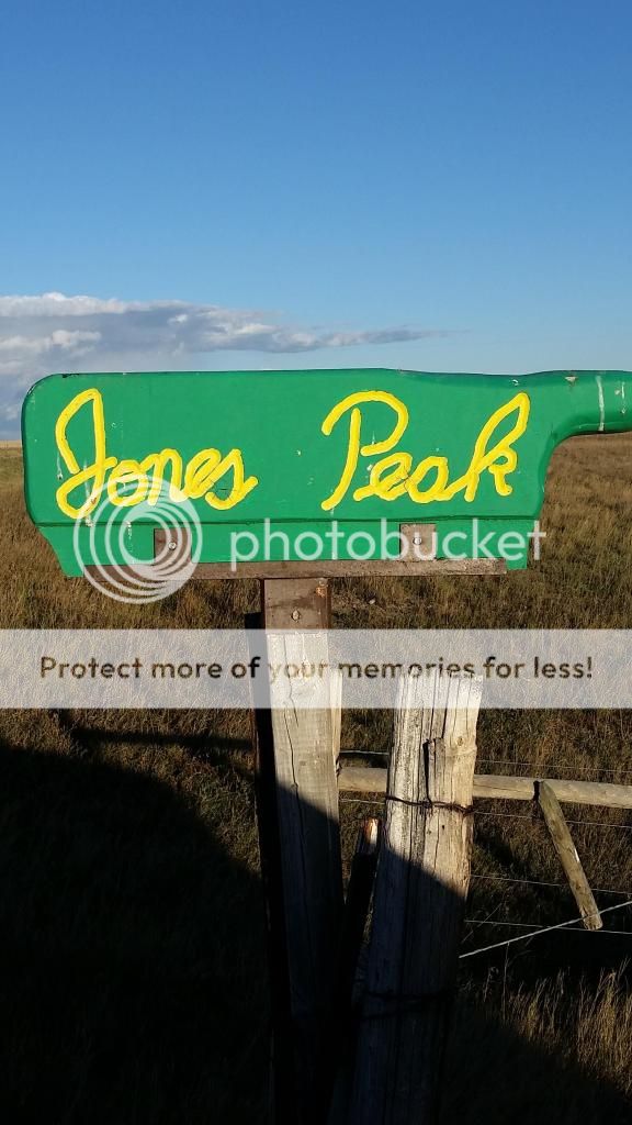
Jones Peak is named after Harold Saunders ‘Corky” Jones. He was a local rancher, amateur palaeontologist and historian. He was very knowledgeable about local history and also found a number of fossils including a Triceratops skull. From the peak, you can see the Frenchman River Valley in all its glory! When one thinks of Saskatchewan, we often think of flat plains and rolling grasslands, but there is much for to Saskatchewan and Jones Peak is the proof. Its strange to think of mountains in Saskatchewan, but Jones Peak is actually considered to be the 4th tallest mountain in Saskatchewan. While it isn't a mountain in the truest sense, as it wasn't formed by volcanic, folds, or via block, Jones Peak is still incredibly tall/steep but it was formed the same way the rest of the valley was formed: Via Glaciation and Erosion.
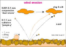
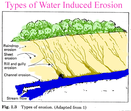
As you stand above the Frenchman River Valley, you will quite quickly notice that the “mountain” you are standing is quite similar to the surrounding hills. As the Glacier advanced across the valley, the massive ice sheet ground the valley and hills to form what is now Jones Peak. Jones Peak is actually made up of layers of sediment that can be dated back to the times of the dinosaurs. It is through the process of deposition that these layers came to be part of the region. The process of deposition describes the accumulation, over time, of layers of mineral material. Different environments such as seas, rivers, or tropical zones, deposit different sorts of clays, silts, and sand.Over the course of millions of years, these sediments become cemented together and form the horizontal layers that we see today. But we can't quite see the layers until Erosion begins to strip back the layers of time to reveal the secrets beneath. Over the course of its existence, steam, rain, and wind erosion have been working at stripping back the surface of Jones Peak. As you look into the valley you can see the effects that erosion has made to the Frenchman River Valley, and the view is nothing short of breathtaking.
The Frenchman River Valley and surrounding country is filled with wildlife such as whitetail and mule deer, antelope, coyotes, rabbits, and perhaps even moose. While best viewed at dusk and dawn, be sure to lower your speed to avoid a potential collision.
Jones Peak is west of Eastend, Sk. From Eastend travel North on Grid 616 (Brady Coulee Road) and take your second left onto Middle Bench Road, which you follow until you come to a green sign that reads “Jones Peak”. Turn left and follow the road to the peak. The gravel road to the peak is incredibly steep. 4X4 vehicle is greatly recommended! Please be aware that this is pastor land and there are cows wondering about. There are also Texas Gates you must cross from time to time to reach your destination.
**** USE EXTREME CAUTION WHILE ON TOP OF JONES PEAK!! THERE ARE NO RAILINGS OR GUIDE RAILS ****
**** NEEDLESS TO SAY, YOU ARE VERY HIGH UP ****
To register this find, you need to answers the following questions. I always try to respond to your emails ASAP, but if I don't respond it is safe to assume your answers are correct. I've also noticed recently that “teams” are having one member send in the answers for the rest of the team. This is fine by me but please note the names in the answer email so I can cross reference the logs with the answers. As always please do not post your answers with your log . . . please email them to me directly:
1. What year was the peak first names Jones Peak?
2. Use your GPS to measure the altitude at ground zero
3. List three ways that Erosion has sculpted the landscape
4. Go to stage 2 (Or simply view from Ground Zero)coordinates and describe the soil colour. What sedimentary formation is this and how old is this layer?
5. (Optional Task) Post a picture of yourself at ground zero. Try not to include pictures that will give away the answers to the questions/
Please note that this is an Earthcache, which means there is not a physical cache at ground zero. For more information on Earth caches, please visit www.geocaching.com or www.earthcache.org.
Sources:
http://www.nps.gov/badl/naturescience/geologicformations.htm
https://www.dmr.nd.gov/ndgs/NDNotes/ndn13_h.htm
http://www.dinocountry.com/?s=286&p=286&0=286