De Friezenberg EarthCache
-
Difficulty:
-

-
Terrain:
-

Size:  (other)
Please note Use of geocaching.com services is subject to the terms and conditions
in our disclaimer.
De Friezenberg behoort samen met de Herikerberg (de hoogste met 47 meter), de Hulpe, de Hemmel en de Dingspelerberg tot de 5 heuvels rondom Markelo. Allemaal zijn ze ontstaan door opstuwing door het gletsjerijs ten tijde van het Saalien.
Tijdens het saalien was het noordelijke deel van Nederland bedekt met gletsjers. In Nederland zijn nog veel resten van deze tijd te vinden. De bekendste zijn wel de Utrechtse en de Sallandse heuvelrug en natuurlijk de Hondsrug in Drenthe.
De Friezenberg ligt in het natuurgebied De Borkeld, een prachtig heide en bosgebied tussen de buurtschappen Elsen en Herike en is onderdeel van de stuwwal van Rijssen. Het is met name begroeid met heide, vliegdennen, eiken en berken en is ongeveer 10 hectare groot.
Zoals vermeld zijn alle heuvels ontstaan de opstuwing van het gletsjerijs. Deze gletsjers hebben zand, stenen maar ook leem achtergelaten. Het zand dat alles later bedekte is door enorme zandstormen tijdens het poolwoestijnklimaat hierheen gewaaid.
De leem werd later gebruikt om stenen en dakpannen van te maken. Vandaar dat er in de omgeving zogenaamde leemkoeln te vinden zijn. De eerste bewonerssporen dateren van zo’n 30.000 jaar geleden. In dit gebied zijn stenen gereedschappen gevonden van jagers. In de heidegebieden rond de Friezenberg vindt u een dertigtal tot 5000 jaar oude grafheuvels. Deze staan op de lijst van beschermde archeologische monumenten.
In de late bronstijd zijn hier ook een aantal urnenvelden ontstaan.
Om deze cache te mogen loggen moet u het volgende doen.
1. Ga vanaf de parkeerplaats naar het volgende coördinaat: N 52.16.389 E 006.30.751. Hier vindt u een informatiebord. Op dit bord kunt u de antwoorden op de volgende vragen vinden:
a) Hoeveel jachtkampen hebben hier gestaan?
b) Vanaf wanneer voor Christus werd het gebruikelijk de doden te verbranden?
c) Hoeveel grafheuvels staan er getekend op het bord?
d) Hoe hoog is de Friezenberg?
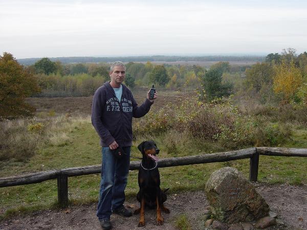
2. Ga naar N 52.16.147 E 006.30.738 en maak een foto van uzelf en/of het team (zie voorbeeld). Voeg deze toe aan je log.
Mail mij de antwoorden, u krijgt van mij zo snel mogelijk bericht of deze juist zijn. Na goedkeuring mag u de earthcache loggen.
Voorbeeld/example:
Deze cache is goed te doen met Rondje Friezenberg (GC1CRF5).
The Friezenberg together with the Herikerberg (highest with 47 mtrs), the Hulpe, The Hemmel and the Dingspelerberg belongs to the 5 hills around the city of Markelo. All hills arose through impoundment by the glaciers ice during the Wolstonian Stage, a stage in the middle Pleistocene stage.
During this stage the northern part of the Netherlands was covered with glaciers. In the Netherlands you can find a lot of remainings of this stage. Well known are the ” Utrechtse heuvelrug” The ”Sallandse heuvelrug” and of course in Drenthe the “Hondsrug”.
The Friezenberg is situated in a nature reserve called “De Borkeld” a beautiful area with moor and forests. It is settled between the settlements Elsen and Herike and is a part of the push moraine of Rijssen. Mostly it is covered with moor, fly pines, oaks and birches and it is aprox. 10 hectare wide.
As mentioned these hills arose by impoundment of the glacier ice. These glaciers left sand stones but also loam behind. Later the sand covered all the area during enormous sandstorms. These storms took place in during the polar desert climate.
This loam was used later on for bricks and tiles. Therefore in this area you can find so called loam holes (leemkoeln). The first traces of humans dated back 30.000 year. In this area tools were found from hunters. In the moors around the Friezenberg you will find about 30 burial mounds. These mounds are 5000 years old. These mounds are mentioned on a list of protected archeological monuments.
In the late bronze age a few urns field arose here also.
To log this cache you have to do following.
1. From the parking lot go to N 52.16.389 E. 006.30.751 . Here you will find an information sign. On this sing you can find the answers to the next questions.
a) How many hunting camps (jachtkampen) were situated on this site?
b) From which year before Christ it became customary to burn the death?
c) How many burial mounds are drawn on the sign?
d) What is the elevation of the Friezenberg?
2. Go to N 52.16.137 E 006.30.738 and make a picture from your team or yourself with your GPS (see example). Add this to your log.
Mail all your answers and as soon as possible you will receive an answer if your answers are ok. After approval you may log this cache.
This cache is great to combine with Rondje Friezenberg (GC1CRF5).
Additional Hints
(No hints available.)