HHS - “Lest we forget” our routes Multi-cache
HHS - “Lest we forget” our routes
-
Difficulty:
-

-
Terrain:
-
Size:  (micro)
Please note Use of geocaching.com services is subject to the terms and conditions
in our disclaimer.
ENGLISH // FRANÇAIS
The Heritage Hide’n’Seek Geocache Series isn’t your typical history or geography lesson. Get ready to explore Northern Ontario and discover how its people, places and events shaped the Canada we know today. Find the caches, answer the questions, collect at least 100 points, and you’ll be eligible for a collectible Heritage Hide‘n’Seek geocoin.
Send your completed passport to:
Parks Canada—Geocache Series, 201 – 201 May Street North, Thunder Bay, Ontario, P7C 3P4
Bring your own pencil, as each cache is only large enough to contain a logbook (no trade items, please).
All geocaches are accessible directly from trails or public areas.
Cache may not be accessible in winter.
This cache is worth 30 points.
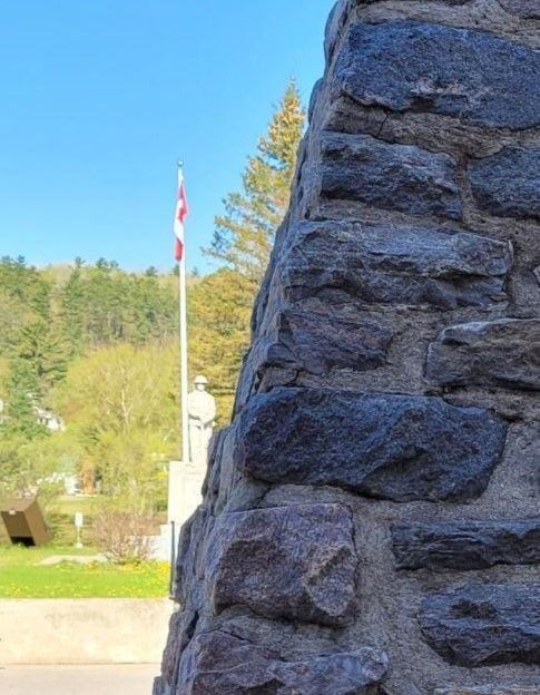
Mattawa Cenotaph (© Parks Canada)
Mattawa is an Algonquian word meaning “junction of waterways”. For the First Nations, the Mattawa River was a vital transportation corridor. Travelled by Etienne Brulé and Samuel de Champlain in 1610 and 1615, Europeans adopted it to access the Canadian interior. During the fur trade, west-bound voyageurs left the Ottawa River here at Mattawa. Travelling "the forks”, they faced 11 portages in the next 40 miles. It was considered by many to be the most difficult portion of the fur-trade route.
When the fur trade diminished and logging began in the 19th century, the route provided valuable access to white pine, adding to the Mattawa’s commercial importance. In 1881, the railway was built to Mattawa, bringing the river’s importance as a commercial route to an end. Today, it remains a popular canoe route for recreational paddlers.
Using the Mattawa Route plaque and the following clues, decipher the coordinates for the actual cache location:
N 46° 19.__3 W 78° 4_.385
| First Blank: |
Number of portages found in the next 40 miles |
| Second Blank: |
Number of centuries this route was used |
FRANÇAIS
Le Cache-cache patrimoine série de géocaches est complètement différent d’un cours d’histoire ou géographie traditionnel. Préparez-vous à explorer le Nord de l’Ontario et à découvrir comment cette région a façonné le Canada que nous connaissons aujourd’hui. Trouvez les caches, répondez aux questions, obtenez au moins 100 points et vous pourriez vous mériter une géopièce du Cache-cache patrimoine à collectionner.
Envoyez votre passeport rempli à l’adresse suivante :
Parcs Canada – Série de géocaches, 201, rue May Nord, bureau 201, Thunder Bay (Ontario) P7C 3P4
Apportez votre propre crayon, car les caches peuvent uniquement contenir un registre (aucun article à échanger, s’il vous plaît).
Toutes les géocaches sont accessibles directement à partir des sentiers ou des aires publiques.
Les caches pourraient ne pas être accessibles en hiver.
Cette cache vaut 30 points.
Cénotaphe de Mattawa (© Parcs Canada)
Mattawa est un mot algonquien qui signifie « jonction des voies navigables ». Pour les Premières Nations, la rivière Mattawa était un corridor de transport essentiel. Elle est empruntée par Étienne Brulé et Samuel de Champlain en 1610 et 1615, puis par les Européens qui l’utilisent pour accéder à l’intérieur du Canada. À l’époque du commerce des fourrures, les voyageurs qui se dirigent vers l’ouest quittent la rivière des Outaouais ici, à la rivière Mattawa. La traversée des « fourches » nécessite 11 portages sur 40 miles. Nombreux sont ceux qui considèrent cette portion de la route du commerce des fourrures comme la plus difficile.
Lorsque le commerce des fourrures décline et que l’exploitation forestière commence au XIXe siècle, la route offre un accès parfait au pin blanc, ce qui ajoute à l’importance commerciale de la rivière Mattawa. En 1881, un chemin de fer est construit jusqu’à Mattawa, supprimant ainsi toute l’importance de la rivière en tant que route commerciale. De nos jours, il s’agit d’un parcours de canotage très prisé.
À l’aide de la plaque sur la route Mattawa et ses indices ci dessous, trouvez les coordonnées exactes de la cache.
N 46° 19.__3 W 78° 4_.385
| Premier blanc : |
Nombre de portages nécessaires sur 40 miles |
| Deuxième blanc : |
Nombre de siècles pendant lesquels la route a été utilisée |
Additional Hints
(Decrypt)
Fgnaq ba "thneq"