The woodland contains other geocaches which takes you all around the woods which is a lovely place to walk. So while you are not looking for the geocaches, take in the scenery in and around the beautiful woodland.
Soil
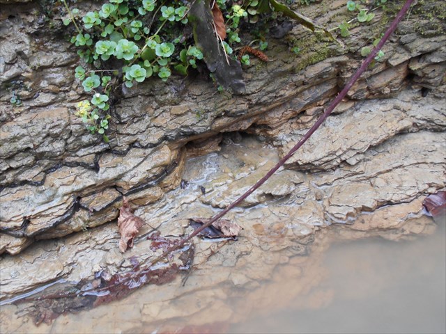
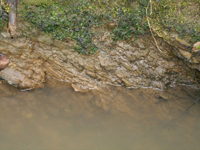
The soil in East Grinstead is mostly sand and clay. Springs are often found where the permeable sand and impermeable clay soil meets. This is because rain water filters through the layers of sand before reaching clay. At that point the water cannot travel any further downwards, so works its way back out of the ground. Where these springs form, it becomes very muddy in the winter and makes great conditions for wet woodland plants to grow.
Down by the streams deposits of a variant of marble called Sussex Marble can sometimes be found.
Streams in Ashplats Wood
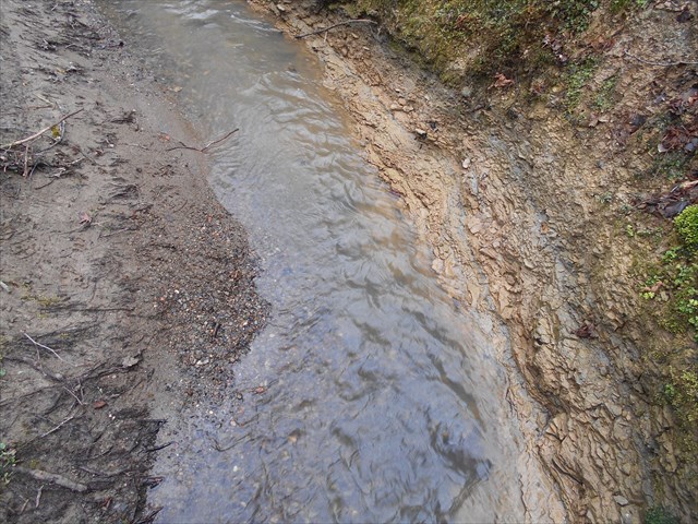
Where streams form the ground must be impermeable so that water can flow above the ground. The soil by streams in Ashplats Wood is solid, but the shape of the stream often changes due to blockages from sticks, leaves, and deposited sediment.
The Questions
Feel free to log your visit at the same time as you send the email, as I will not always be able to reply quickly.
Update May 2016: If you are finding this EarthCache with someone else, to prevent 'fake' logs, please can either your entire group send their answers, or if one person is sending the answers, please specify the usernames of all the people who found the answers with you. Thank you.
To claim this EarthCache, send me an message through the Message Center with the answer for the questions below. Please note that answers sent by email will not be responded to.
1) On the bank of the stream at the given coordinates, there is a wall of a layered material. Is this sand or clay? Describe how it feels and explain why you think it is this soil type. (Please don’t break any of it off, this will erode the bank of the stream)
2) Some of the layers have different colours and textures. Explain why this is. This may need a little research.
3a) Sometimes, a hole may appear in this wall and a spring appear. Explain why you think this is. The information board at N 51° 07.810 E 000° 00.157 may help. An example of this is shown below
3b) [Optional] If you can find a spring, take a photo of it and upload it to your log. Springs are usually most visible after long periods of heavy rain.
4) Along the stream, the layers stop being horizontal. Why do you think this might be?
5) As the stream goes around a bend, one side is solid and the other is a sediment. Why do you think this is?
6) [Optional] It would be great to see a photo of your team, or just a selfie of yourself, uploaded to your log!
As stated above, to claim this EarthCache, send me an message through the Message Center with the answer for the questions above. Please note that answers sent by email may not be responded to.
This cache is also available on opencaching.uk (OK031B)