ORVEC: Historic Falls of The Ohio EarthCache
ORVEC: Historic Falls of The Ohio
-
Difficulty:
-

-
Terrain:
-

Size:  (other)
Please note Use of geocaching.com services is subject to the terms and conditions
in our disclaimer.

Falls of The Ohio
_________________________________________
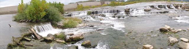 Falls Pano
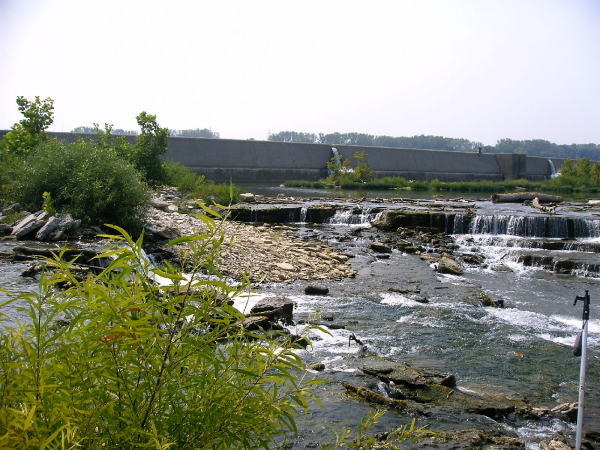
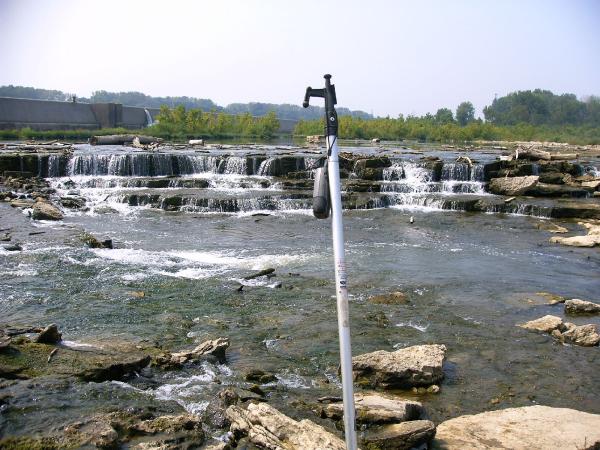
The listed coordinate will take you to the only visible occurrence of a waterfall along the entire 981 mile length of the Ohio River. The limestone ledge and waterfall in these images is roughly halfway down the 'Falls Of The Ohio's' 2.5 mile length. The majority of the 26 foot drop in elevation occurs here.
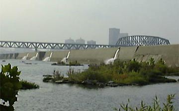
In the early days of steamboat navigation on the Ohio River the major physical hurdle that delayed travel was the falls of the ohio near Louisville. Steamboats could only maneuver over the falls during periods of high water, which were not consistent. It was more practical for the steamboats to drop off passengers and freight on one end of the falls and transport them over land to another steamboat. This resulted in Louisville becoming a customary last stop for vessels on both legs of the Ohio.
Waterfalls are most commonly formed when a river is young. At these times the channel is often narrow and deep. When the river courses over resistant bedrock, erosion happens slowly, while downstream the erosion occurs more rapidly. As the watercourse increases its velocity at the edge of the waterfall, it plucks material from the riverbed. Whirlpools created in the turbulence as well as sand and stones carried by the watercourse increase the erosion capacity. This causes the waterfall to carve deeper into the bed and to recede upstream. Over time, the waterfall can form a canyon or gorge downstream as it recedes upstream. The McAlpine Dam halted this natural process and improved river navigation at the falls.
The falls drops the river elevation 26 feet over a distance of 2.5 miles. During most of the year the entire site is submerged under up to fifty feet of floodwater. But during the dry fall months it is exposed and accessible on foot.
View from upper wetland
______________________________________________________

The park and the fossil beds are open to the public. Please feel free to explore any areas you wish. But also be aware of the dangers (see sign) and NOTE that this is a protected area and removal or collecting of fossils is not allowed!
______________________________________________________
Optional: To share your experience, please post photo of yourself or your GPSr at the listed coordinate (see my photo above) with the waterfall in the background
And to demonstrate the educational value of this EC, please send answers to the following questions:
1. Name two types of waterfalls seen here.
2. In your estimation, how far does the water drop to the river channel below and over what distance?
3. What formed the waterfall?
4. What is the immediate source (within 25 feet) of the water which falls here?
______________________________________________________
Do not wait on a reply from me. FOUND IT logs which do not meet requirements will be quietly removed.
Additional Hints
(Decrypt)
502.775.5056 Gur ybjre tnhtr zhfg or orybj 20' be guvf srngher vf JNL haqre jngre.