Copper Canyon (Barrancas del Cobre)
N27° 31.991 W107° 49.485

One
of the largest canyon systems in the world, Copper Canyon is
a land of mountains, rivers, waterfalls, desert and forest. Four of
the canyons are deeper than Arizona's famous Grand Canyon,
although none of them are as wide. Perhaps the most famous
attraction for visitors is the Chihuahua al Pacífico
Railway, a scenic journey that crosses 36 major bridges,
travels through 87 tunnels and climbs to a height of 2438m (8000ft)
before descending back down to sea level. The Sierra
Tarahumara mountains are inhabited by Tarahumara Indians, who
live in isolated communities along the railway line.
Click for enlargement
GEOGRAPHY
You'll
find a variety of climates. It can snow in the mountains while
tropical temperatures reign in the valleys.
The average altitude here is 2,275 meters above sea level, while
the highest point, Cerro del Mohinora, is 3,306 meters and the
lowest point, at the confluence of the Septentrion and Chinipas
Rivers, is around 220 meters. Note that the average rainfall in
Copper Canyon is close to 15 inches per year. Most of the rainfall
takes place during the months of July, August and September.
To journey into this rugged and isolated terrain with knowledge of
its spectacular biodiversity and history is one of Mexico's best
adventures. Carl Lumholtz explored the Sierra Madre and the
Barranca de Sinforosa in 1892, and his well-documented adventures
have inspired generations of canyon enthusiasts.
A trip into the canyons and the Sierra requires a good base of
operations, such as the town of Creel, most travelers' hub of
choice. Multiple-day treks are arranged by many of the hotels in
Creel, though you can find independent guide services in any of the
towns by asking hotel owners or visitors. There are numerous towns
along the railroad and in the valley including Batopilas, Cusárare,
Divisadero, Bauchivo and Cerocahui.
Click for enlargement
CANYON HISTORY
The
barrancas are one of Mexico's youngest geological formations and
the largest in North America. They were formed about 30-40 million
years ago, during a period of intense volcanic activity in what is
present day Northwestern Mexico. Thousands of volcanoes erupted,
throwing lava and ash onto the surrounding plateau and creating the
Sierra Madre Occidental.
The tectonic activity also created deep fractures in the earth's
crust. Because the rocks are relatively soft, the rivers
originating in the high Sierra cut deep canyons on their descent to
the Gulf of Mexico. The canyons bear the names of these powerful
rivers: Chinipas, Candameña, Urique, Tararecua, Batopilas and
Verdes.
To
log this earthcache, perform the following tasks:
-
Name me 4 of the deepest Canyons (out of 7) of the region with
their depths in Meters or Feet.
-
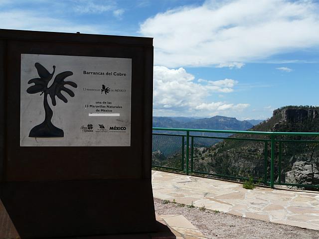
Name
me since when is the Copper Canyon one of the 13 nature wonders of
Mexico (maravillas naturales de mexico) and take from there a
picture of you or GPS with the copper canyon in the
background.
-
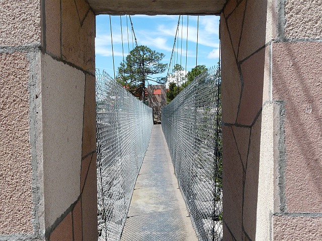
Bridge
over Canyon: N27° 31.973 W107° 49.505
Please go to the bridge and provide a picture of you, your group or
GSP at the gateway over the bridge and add the picture to your log
and