Skip to content

Jumpin' GeoCache! Traditional Geocache

Hidden : 9/15/2002
Difficulty:
2.5 out of 5
Terrain:
3.5 out of 5

Size: Size:   regular (regular)

Join now to view geocache location details. It's free!

Watch

How Geocaching Works

Please note Use of geocaching.com services is subject to the terms and conditions in our disclaimer.

Geocache Description:

Located just below the summit of Jumpingpound Mountain. See hike #333 in the Kananaskis Country Trail Guide. The hike is 3.5 km with 417 M height gain. Park at N50 56.339 W114 56.093 on the Powderface Trail. Please note this road is closed to vehicles between December 1st and May 15th.

Jumpingpound Mountain's name comes from the nearby Jumpingpound Creek. The name in Blackfoot is "ninapiskan" meaning "men's pound". In Stoney, it is "to-ko-jap-tab-wapta".

The name Jumpingpound refers to a buffalo jump near the confluence of Jumpingpound Creek to the Bow River.

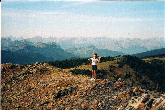
This is a great hike up Jumpingpound Mountain with 360 degree views of Moose Mountain and Calgary to the east and the Fisher Range to the west. The cache is well hidden behind some rocks. Please rehide the container well.

Please be careful of the sensitive vegetation.


Be sure to stop at the bench at N50 56.684 W114 55.209 for a rest. Also make sure you turn left at the intersection at N50 56.814 W114 54.803.

The cache container is a 2 KG peanut butter container covered with duct tape.


Additional Hints (Decrypt)

Gur pnpur vf jryy uvqqra va n penpx va n ynetr obhyqre naq pbirerq ol fznyyre ebpxf whfg rnfg bs n ybar fcehpr gerr.

Decryption Key

A|B|C|D|E|F|G|H|I|J|K|L|M
-------------------------
N|O|P|Q|R|S|T|U|V|W|X|Y|Z

(letter above equals below, and vice versa)