Take a tour of Turanganui A Kiwa, following in the virtual foot steps of famous navigator JC, almost 250 years ago.
English navigator, Captain James Cook set sail from Plymouth, England in August 1768 on the H.M. Bark Endeavour. After sailing to Tahiti to record the transit of Venus across the sun, he continued south in search of a southern continent.
At Waypoint One, what legend represents this voyage?
On 6th October 1769, Nicholas Young, the surgeon's boy, sighted the coastline of New Zealand from the masthead of The Endeavour. The headland Te Kurī-a-Pāoa was named Young Nick's Head by Cook in memory of the event. Two days later, on 8th October the Endeavour sailed into a bay, and laid anchor here at the mouth of the Tūranganui River.
At Waypoint Two, what is holding a key below Young Nick?
This site commemorates the first landing place of Captain James Cook in 1769. It is believed to be within a short distance of the actual landing site where he first set foot on New Zealand soil. This was also the first landing place of the Horouta and Te Ikaroa-a-Rauru waka (canoes) which carried Maori to the area. Nearby Te Toka a Taiau, was where the first significant meeting between Maori and Europeans also took place.
The landing site has changed a great deal since that time, it is now situated on an area of reclaimed land close to the edge of the Pacific Ocean. The old shore line is marked only by a noticeable dip in the ground in front of the obelisk.
At Waypoint three, what is on the second step at the back of the obelisk? Who owns it? What is written on the last line?
Cook was eager to make friendly contact with the Maori people. However, a series of unfortunate encounters, both on the day of the landing and the next day, resulted in the deaths of several Maori. The following day, the Endeavour headed south. Initially Cook had planned to call the bay he landed in, Endeavour Bay, but instead he named it Poverty Bay “because it afforded us no one thing we wanted”.
This statue of ‘Cook’ looks suitably naval, as befits a ship’s captain. It was erected to commemorate the bicentenary of his visit, in 1969, but in fact is an ‘imposter'… Who is he? We have no idea!
At Waypoint four, who planted what within 6 metres of this Imposter?
When HMS Endeavour appeared in Poverty Bay in October 1769, the course of New Zealand history changed forever.
"The land on the Sea-Coast is high with steep cliffs, and back inland are very high mountains...the face of the Country is of a hilly surface and appeares to be cloathed with wood and Verdure"
Captain Cook's journal, 8th October 1769
The Endeavour left New Zealand on 31st March 1770, Cook had just chartered 2,400 miles of New Zealand coastline, in under 6 months. He was to return to New Zealand on two further occasions, once in 1773 and again in 1777 in command of the Resolution. During his three voyages to New Zealand, James Cook mapped the outline of the country with considerable accuracy. His observations of Maori culture, and natural history, combined with the observations recorded by his men provided a rich source of information.
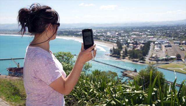
At Waypoint five, Visit the "Plane Table Map" take a photo of yourself (mugshot is optional) and/or your GPS with "Waypoint 1" clearly seen in the background, as per the sample photo below

Logging this Virtual
Feel free to log this Virtual after you have emailed your answers to the cache owner, no need to wait for confirmation. Please include the name of this virtual cache in the email.
Note: Any online finds without proof of visiting the actual Points of Interest may be deleted without warning.
Virtual Reward - 2017/2018
This Virtual Cache is part of a limited release of Virtuals created between August 24, 2017 and August 24, 2018. Only 4,000 cache owners were given the opportunity to hide a Virtual Cache. Learn more about Virtual Rewards on the Geocaching Blog.