[SLO]
V skriti grapi med Planjavo (poleg Kamniškega Vrha) in Kržiščem (Pokovše poleg Krvavca) se na potoku Korošak na nadmorski višini od 730 do 1050 metrov nahaja najmanj devet slapov in kaskad.Njihovo število je odvisno od količine vode, saj se ob velikem pretoku številne brzice spremenijo v lepe mogočne slapove. V sušnih dneh neredko tudi povsem presahnejo, zato si jih je vredno ogledati takoj po močnejšem deževju.
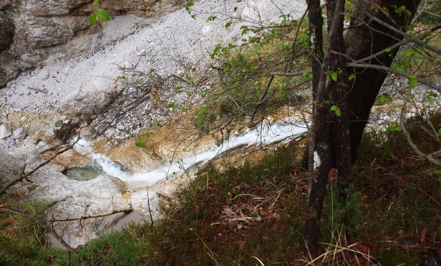
Potok Korošak nastane iz več izvirov, najmočnejši med njimi se nahaja pod Planino Osredek in se nato izliva v Blatnico, od koder skupaj nadaljujeta pot kot Bistričica. Relativno visoki izvir studenca pogojuje geološka zgradba. Tam se mešata keratofir in vulkanski pepel z dolomitom in apnencem. Tako nepropustna podlaga povzroča relativno visok prodor talne vode na površje. Voda je nato zaradi različno odporne kamnine v grapi izdolbla nekje globoko, drugje pa plitvejšo strugo, tako da čez vmesne pragove pada v nižjih ali višjih slapovih. Obisk Korošaških slapov je lahko lep družinski izlet, nekateri slapovi so relativno enostavno dostopni, do nekaterih pa je dostop precej težaven. Vsekakor je potrebna dobra obutev; priporočam uporabo visokih planinskih čevljev, ker je včasih potrebno prečiti (sicer plitvo) strugo potoka. Težavnost dostopa je trenutno nekoliko večja zaradi velike količine podrtega drevja po zadnjem žledolomu februarja 2014, vendar je pot prehodna.
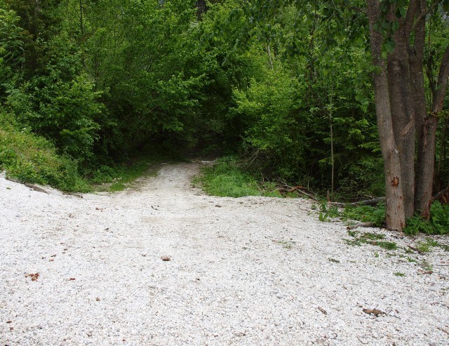
DOSTOP: Po asfaltirani cesti se zapeljemo v dolini Bistričice v Klemenčevo, skoraj do ovinka, ko cesta zavije navzgor in nazaj v Zakal. Parkirate lahko ob koncu asfaltne ceste v bližini avtobusnega obračališča; pazite le, da pustite dovolj prostora.
Od parkirišča se spustimo rahlo v desno in prečimo dva potoka, drugi od njiju je Korošak.
Pot nato nadaljujemo po njegovi levi strani (oz. po desni, če gledamo navzgor) po kolovozu, ki pa je težko prehoden zaradi podrtih dreves. Na razcepih gremo vedno po levi poti, dokler ne pridemo do potoka.
Druga možnost je, da nadaljujemo po makadamu le nekaj deset metrov do manjšega križišča, kjer zavijemo desno čez most. Za mostom pridemo do hiš, kjer zapustimo cesto in gremo desno čez travnike proti potoku do ruševin starega mlina (kolovoza, ki je opisan v vodnikih ni več, spomladi je ta pot neprimerna zaradi visoke trave). Pot nadaljujemo po desni strani ruševin do potoka, ob katerem se nato vzpenjamo.
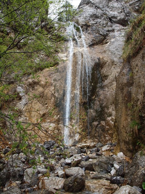
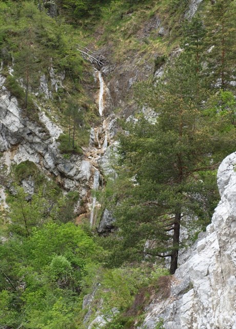
Pot naprej poteka ob potoku in ga tudi nekajkrat preči. Na mestu, kjer pot zavije v desno stran od potoka, opazimo 1. slap, do katerega imamo le minuto hoje po strugi. Od tam naprej pelje dokaj dobra neoznačena steza, ki pa se izogne večini slapov. Do njih je potrebno iskati prehode po včasih bolj, včasih manj vidnih stezicah. Če ste dovolj izurjeni, lahko ponekod sledite tudi strugi potoka, drugače pa vam priporočam, da se vrnete nazaj do glavne steze. Nekoliko višje se od glavne poti desno navzgor odcepi steza proti Planini Osredek, levo pa vodi pot do dvojnega slapa, spodnji meri 20 m, zgornji 10 m. Od dvojnega slapa navzgor je dostop možen s plezanjem levo od slapa in nato prečenje v desno na grebenček. Ta del poti je primeren le za zelo izurjene in izkušene planince, nikakor pa ne za slabo opremljene ali družine z majhnimi otroki!
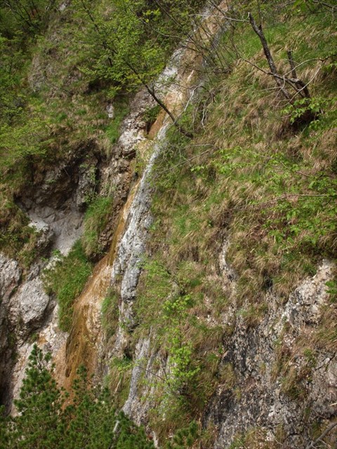
V zgornjem delu grape se nato nahajajo še vsaj štirje slapovi, najvišji le nekaj deset metrov pod Planino Osredek.
Zakladek se nahaja ob glavni stezi malo naprej od odcepa poti za Planino Osredek v bližini dvojnega slapa. Ker so bregovi grape zelo strmi in je tam tudi precej dreves, je vprašljiva natančnost GPS sprejemnika in tudi podanih koordinat. Da bo iskanje lažje, je v opisu podana tudi slika lokacije:

[ENG]
In a hidden mountain gorge between Planjava (located by Kamniški Vrh) and Kržišče (Pokovše near Krvavec) there are at least nine waterfalls and cascades located by the Korošak stream at an altitude ranging from 730 to 1050 m.Their number depends on the amount of water, because in the event of intense water flow many rapids turn into beautiful, magnificent waterfalls. When the days are dry, however, they often completely dry up; it is immediately after heavy rainfall they are most worth seeing.
The Korošak stream comes from several sources; the strongest of them is located under Planina Osredek, outfalling into Blatnica, from where they continue their way joined under the name Bistričica. A relatively high spring is determined by the geological structure. Keratophyre and volcanic ash are mixed with dolomite and limestone. Such impermeable surface causes the underground water to break trough the surface with considerable force. Because of differently resistant rocks in the mountain gorge, the water afterwards scoops out deep riverbed at certain places and a hollower one at others, allowing it to fall either at a lower or higher waterfall level. Visiting the waterfalls of Korošak may prove to be a pleasant family trip, because certain waterfalls can easily be accessed, although some are more difficult. In any case, good footwear is required; I would recommend high-ankle hiking boots, as it is sometimes necessary to cross the otherwise hollow riverbed of the stream. Currently it is somewhat more difficult to access the waterfalls because of the many fallen trees that broke and covered the forest floor after the last ice damage taking place in February 2014, although the trail remains passable.
ACCESS: Down the asphalt road we drive to the valley of Bistričica in Klemenčevo to reach the curve, taking the road upwards and back to Zakal. You can park by the end of the asphalt road close to the bus turning zone; just make sure you leave enough space for others
You make a slight descent to the right after arriving to the parking lot and cross two streams, the second one being Korošak.
You then proceed on its left (or right, if you are looking up) along the cart track, which is difficult to pass because of the fallen trees. You always take your left at the junctions until you reach the stream.
Another option is to continue up the dirt road for some 10 meters until you reach a small junction, where you turn right over the bridge. After crossing the bridge you reach the houses, where you continue off-road, turning right to cross the meadows towards the stream to reach the ruins of the old mill (the cart track, mentioned in the guidebooks no longer exists, as this track is unsuitable in spring because of tall grass). You continue along the right side of the ruins to reach the stream along which you then ascend.
The trail proceeds down the stream with a few crossings. At the point, where it turns right from the stream you can see the first waterfall, to which you only have a 1-minute walk along the riverbed. A fairly good unmarked trail leads from there, but it doesn't let you see most of the waterfalls. In order to reach them you have to find passages by taking more or less visible small trails. If you are well experienced, you can also lead the riverbed of the stream; otherwise I recommend you turn back to the main trail. A couple of meters higher from the main track going upwards, the trail turns right towards Planina Osredek; the left side of the trail leads to the double waterfall, the lower 20 m and the upper 10 m long. It is only possible to go upwards from the double waterfall by climbing left of the waterfall and then crossing right to reach a small ridge. This particular trail is only suitable for highly skilled and experienced hikers; the ones that are poorly equipped or families with small children should not attempt to take it!
There are at least four waterfalls in the upper gorge, in which the highest is located only some 10 meters below Planina Osredek.
The cache is placed by the main track a little further from the branch line for Planina Osredek in the vicinity of the double waterfall. As the gorge banks are very steep and grow many trees, the accuracy of the GPS is questionable and so are the coordinates given. To make your search easier the description also contains the picture of the location, where the container is placed:
Slapovi / Waterfalls
Prvi slap / First waterfall:
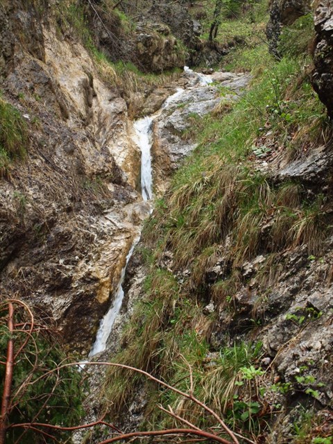
Spodnji slapovi / Lower waterfalls:

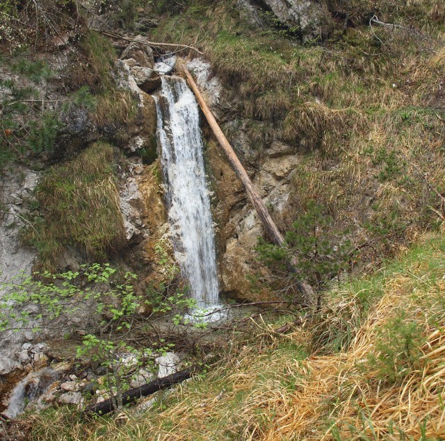
Dvojni slap / Double waterfall:
Pogled na gornje slapove s poti na planino Osredek /
View on upper falls of the way to Osredek:
Gornji slap / Upper waterfall:
Viri / Sources:
http://www.slapovislovenije.info/korosaski.htm
Kamniški občan (1994) - Bojan Pollak: Nekaj znamenitosti Kamniških Alp (IV.)
(TN: A few attractions of the Kamnik Alps)
http://www.gore-ljudje.net/novosti/74893
http://www.hribi.net/gora/korosaski_slapovi/3/895