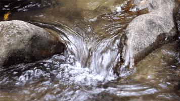
Hovells Creek runs along the western side of the You Yangs. It runs from Granite Road near Staughton Vale down through Lara and into Limeburners Lagoon.
There is a popular walking / riding track that runs along the river from the township of Lara all the way into Geelong via North Shore and into Corio Bay.
The limestone surface on which the marine shells rest has been bored by the marine mollusc Venerupis, and paired shells occur in place in the burrows. It is therefore possible that the benches originated as shore platforms that are now two meters above present sea level. The radiocarbon date of the shells is evidence that a mid-Holocene sea level two to three meters above the present level was responsible for the erosion of the limestone benches and the accumulation of the shell beds.
The valley of Hovells Creek is incised through the crystalline freshwater Lara Limestone which lies above the Newer Volcanics basalt. Upstream from the Princes Highway bridge, the limestone is overlain directly by deposits of marine and estuarine shells, which have accumulated on benches eroded into the limestone on the lower valley slopes. A radiocarbon date of the marine shells returned a value of 5,629 - 90 years.
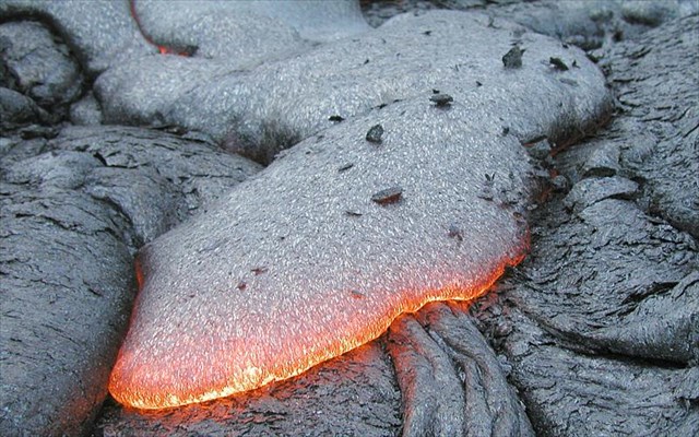
Basaltic Lava
Basaltic lava is another term for mafic lava. Mafic lava is molten rock that is enriched in iron and magnesium and low in silica. When mafic lava cools on the earth's surface, it forms basalt, which is why mafic lava is commonly called 'basaltic lava'.
The most common method of making basaltic magma is by decreasing the pressure of the mantle rocks. Mantle rocks are extremely hot, and the only reason they do not melt is that they are being held at high pressures within the earth. When these rocks ascend toward the surface, the pressure decreases and allows the rocks to begin melting. This process is responsible for the volcanism at mid-ocean ridges, which are the most volcanically active features on earth.
Basaltic lavas are so abundant because they are the product of melting the mantle, which makes up the majority of the earth's volume. Almost all volcanism starts with melts that begin in the mantle, which is why basaltic melts are so plentiful.
The site is one of a small number of dated Holocene shell deposits on the Victorian coast that suggest a mid-Holocene sea level some meters above the present. As dated evidence for such levels is sparse on the Victorian coast, this site is important in contributing to an understanding of the chronology of recent sea level changes.
Q1 At the listed coordinates you will be looking at a small rock embedded in the creek bank. Describe it in colour and texture.
Q2 At WP2 or WP3 describe the bank of the creek on the opposite side.
Q3 At WP4 what do you think has happened here? (eg. man made, erosion, structure?) What is the colour of the bank here?
Once you complete the EarthCache requirements you can post your find without delay, as per the EarthCache guidelines. You will also need to verify your find by sending me a message and provide your answers to the questions.
For a link to my profile, click here - Na'wal
Thanks for visiting this Earth Cache. Hope you enjoy it. Feel free to attached photos to your log (optional).