🌲****************** 🌲******************** 🌲
This cache is part of a series of geocaches called Park Life. Caches are placed within our urban parks, community gardens or country parks. For more details and statistics on how you can expand the Park Life series please visit the Park Life webpage.
🌲*** Friar's Well Park *** 🌲
Friar's Well Park is a quiet park in the southern part of Linlithgow, in which sits Rosemount Wood, and within that, the remains of a Carmelite Monastery fom the 15th Century. The park is also sometimes called 'Rosemount Park' and 'Friar's Brae' on some maps. The wide open grasslands here are popular with dog walkers and local residents. It contains a collection of labelled trees to help identification including Paperbark Birch, Red Oak and Lombardy Poplar.
The park is very close to Linlithgow Canal Basin, on the Union Canal. Linlithgow Union Canal Society is a charity based at the Basin, and they operate tours and barge rentals as part of their activities to promote use of the canal for tourism, heritage and recreation.
The land for the monastery in the park is said to have been a gift from Sir James Douglas of Dalkeith toward a Carmelite chapel of the Blessed Virgin Mary and conventual buildings, as well as a garden. The exact origin date for the monastery is unconfirmed, but the Carmelite house is said to have been pulled down by Reformers in 1559. The foundations were later exposed in October 1905. The East part of the building was probably the chapel. A bronze ring, "of much earlier date than the building" (per archaelogical analysis) was also found. Excavations were carried out on this site in 1953 and trenches were dug across the known walls, There were two areas of rough cobbling, which from their position might represent a North and South cloister walk. There is evidence of a small tower at the external North East angle.
The Site of The Carmelite Friary
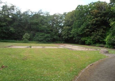
The archaeology indicated that the earliest occupation at the site of the Carmelite Monastery was actually of pre-medieval date but no obvious plans of structures were identified. Early medieval use of the site was demonstrated by the presence of a number of truncated ditches which have been interpreted as being property boundaries.
Over 200 graves relating to pre-friary, friary and the post-friary periods were excavated in various areas over the site. Much of the friary complex appears to have survived relatively intact until the late 1560s with parts of the south and east ranges continuing to be used up to that date. However, soon after this the ranges were systematically demolished and robbed of building materials until in 1624, the place of the Carmelite Friars' was ultimately sold. A well is located in the park, where the inhabitants of the friary used to get water. It is covered with a stone arch, and marked as a reference waypoint for this cache.
The remains of the friary (largely just the foundations/surface stone), have been added as a reference waypoint for this cache in case you fancy taking a look. There is some bench seating there and it's a peaceful little corner of the town.
Finding The Cache
As mentioned above, the Park sits near Linlithgow Canal Centre, which provides a good place to learn more about the operation of the canal and the vessels that travel along it. But you don’t have to visit the Basin to see what’s going on there, because activities at the Basin are viewable 24 hours a day via the Canal Basin Webcam. Some cachers will know that 'Webcam Caches' are now a grandfathered cache type as described here: Webcam Cache Types but that refers to caches you can log just by uploading your photo, taken on the webcam. If you are nostalgic for them then why not try using the webcam here to help you with this cache, you will have to sign the log to claim the find though. The canal centre webcam is broadcast live here:
https://www.lucs.org.uk/linlithgow-canal-centre/webcam-3-2/
The webcam is also broadcast on Youtube.
You can get all the info you need to find the cache from the webcam, or you can just visit the Canal Basin to get it - it's opposite the Canal Basin Parking place marked as a waypoint for the cache. The info you need relates to 2 objects which are often found at the Basin. The advantage of using the webcam to get the info is that these objects aren’t there all the time, but you can rewind the Youtube video webcam to a specific time to get the info by going direct into Youtube (rather than the Canal Society site). Try searching for 'Linlithgow Union Canal - LUCS Basin' on Youtube to find it. If you do visit the Canal Basin then the webcam is an excellent opportunity for some ‘webcam cache’ tomfoolery (eg; strike a pose, sign 'P' for 'park' with your fingers, other questionable gesticulations....whatever) so go ahead and upload a picture of yourself at the webcam along with your log. It’s not mandatory for the find, but it is entertaining. There is a third way of finding the info you need (albeit slightly less reliable) – and that's by brute force web searching - but it’s likely to result in a bit more trial and error to get the right answer.
Info Needed From The Canal Basin
At the Canal Basin, frequently in view of the webcam, you can see two names. They can usually be found very close to each other at the western side of the Basin, and have something obvious in common. The first is associated with Whisky, the second with a famous retailer. You'll need to figure those names out (through the Webcam or by visiting the Basin).
The cache is at: N 55° 58.UVW W 003° 35.XYZ - somewhere in Friar's Well Park, a few minutes walk from the Canal Basin.
Use basic alphabetical substitution code to convert the answers below into numbers based on where the letter is in the alphabet. So, if your answer for missing coordinate U is the letter ‘A’ then A=1 and hence the coordinate for U is 1. Similarly if your answer for missing coordinate W is the letter ‘B’ then B=2 so missing coordinate W is 2 etc.
For the missing North coordinates, look at the shorter of the 2 names:
U = 8th letter
V = 2nd letter minus 1
W = 11th letter minus 2
For the missing West Coordinates look at the longer of the 2 names:
X = 3rd letter
Y = 12th letter
Z = 14th letter plus 1
If you do visit the Basin to collect the coordinate clues, you can look around for the webcam to help figure out which names you are looking for, but be aware that the camera changes directions every few minutes. To help with that, what you are looking for will probably be near a group of benches. But remember that what you are looking for isn't always there, and you may still need to check the webcam to find the answers. There's a checker for the answer below:

You can validate your puzzle solution with certitude.
Please note that there are multiple levels of tree cover at gz so this may make the gps a bit ropey. There is a detailed clue in the checker to help with that.