Istodobno, u kanalu simbolično završava put rijeke Krke, ali i njeno konačno ušće u Jadran. Vidljiv je iz svih dijelova Šibenika i iako je blizu grada i relativno je lako dostupan, zbog povijesnih razloga ostao je izoliran i nepoznat.
Srpanj 2013. godine Šibenčanima i njihovim gostima donio je dugoočekivano otvaranje šetnice kroz kanal sv. Ante, atrakcije koja Šibeniku konačno vraća jedan od najvrjednijih gradskih prostora - obale kanala sv. Ante
Šetnicom su spojena područja koja su nekada bila pod vojnom upravom - uvala Panikovac (bliže gradu) i tvrđava sv. Nikole (na ulazu u kanal sv. Ante). Poveznica je duga oko 4,5 kilometra, a zbog brdovitog terena šetnja traje oko sat vremena.
Putem se pruža nenadmašan pogled na grad Šibenik, kanal sv. Ante i okolna mjesta, poput Zablaća.
Cache se nalazi neposredno prije nego što se popnete na sam vidikovac koji je najviša točka na šetnici i s kojeg se pruža prekrasan pogled 360 stupnjeva uokolo.

Preuzeto s:
http://www.putovnica.net/odredista/hrvatska/sibenik/sto-posjetiti-znamenitosti-u-sibeniku/setnica-kroz-kanal-sv-ante
http://www.kanal-svetog-ante.com/stranica/7/atrakcije-u-kanalu.html
The cache is the forth cache in a row of St. Anthony channel serial.
The St Anthony Channel, also known as «the Šibenik Channel», is part of a wider area «Channel – Port», a significant landscape protected in 1974. It is more than 2000 metres long and between 140 and 220 metres wide. It serves as the door of Šibenik to the open sea and as the entrance to the town. The channel represents the place where the river Krka symbolically ends but at the same time it is the place where the river flows into the Adriatic Sea. It can be seen from all parts of Šibenik and while being situated near the city and relatively easily accessible, it has been isolated and unknown for historical reasons.
July 2013 brought Sibenik inhabitants and their guests the long-awaited opening of footpath through the channel St . Anthony, and that is attractions which Sibenik finally returns one of the most valuable urban space - the The St Anthony Channel.
With the walkways are connected areas that once were under military rule - bay Panikovac (closer to the City) and fortress of St . Nikola ( the entrance to the St . Anthony). The footpath is about 4.5 kilometers long , due to the mountainous terrain walk takes about one hour. Through it you can see unsurpassed views of the city of Sibenik , Canal St .Anthony and the surrounding areas, such as Zablaće.
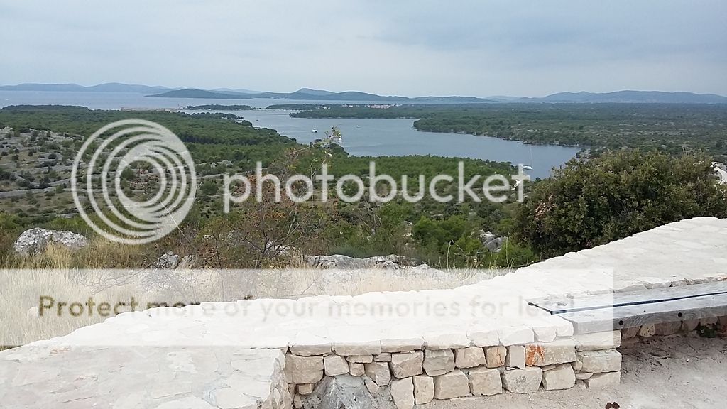
Cache is located just before you reach belvedere (viewpoint). This is the highest point on the footpath with a beautiful view 360 degrees around.