This is
a geocache that is at the site where my biology class is monitoring
Prescotts Creek for IOWATER. Feel free to "disturb" the
container.
IOWATER
is a volunteer water quality monitoring program that’s associated
with people interested in learning about their environment and
helping to make a difference. To begin to get involved a person
must take an inexpensive one day training course. Here’s a
schedule
for the most recent ones. With that course comes a gamut of
materials for testing water for chloride, phosphate, nitrite,
nitrate, pH, dissolved oxygen, water temperature and water
clarity. You get a manual and equipment for catching and
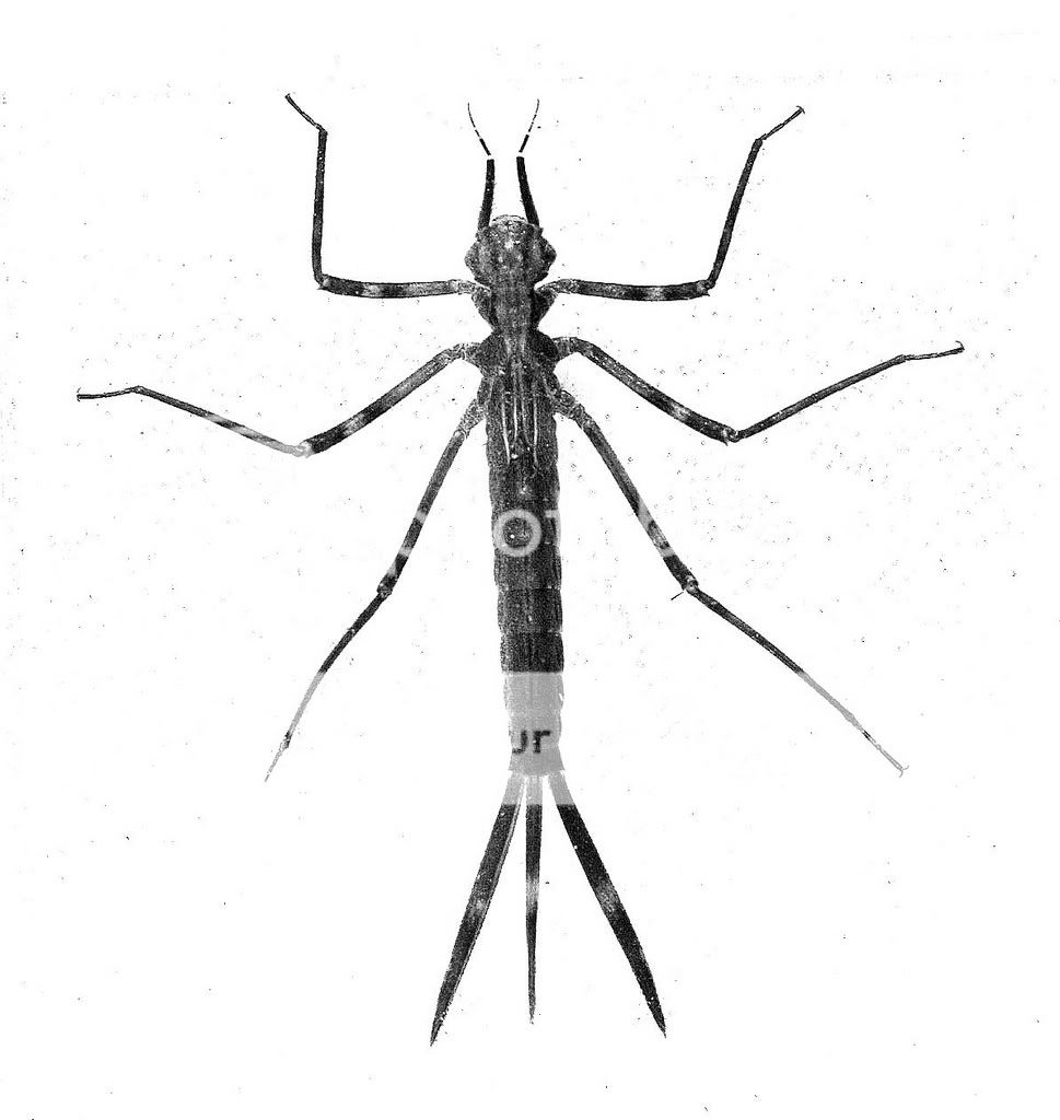
identifying benthic macroinvertebrates (creatures w/o backbones
that live near or on the bottom and are big enough see with your
naked eyes, like the damselfly nymph that I photographed and
show in the image above. Click on that picture to see a
dragonfly nymph we caught. They are jet propelled in that to
rush off they shoot water out their rear end.  ) The velocity and physical nature of
the stream at the point that you make your readings is another
parameter that’s measured. If you want to work with lake water
you get stuff for determining water clarity and color. For that
you need a boat however.
) The velocity and physical nature of
the stream at the point that you make your readings is another
parameter that’s measured. If you want to work with lake water
you get stuff for determining water clarity and color. For that
you need a boat however.
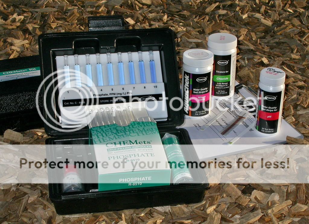
Most of
the chemical testing equipment is shown here. Click on the image to
zoom in. Any adult can participate. It’s not hard to learn at all,
especially once you do it once on your own. It has proven to be a
wonderful add-on to my biology and chemistry classes! For example,
it makes teaching about polyatomic ions come to life in chemistry
class. The kids may still not fully understand the difference
between nitrites and nitrates but they will surely remember
measuring for them!
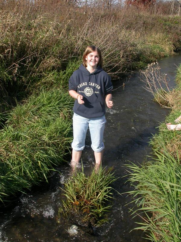
Now here’s a
chance to do IOWATER testing yourself!! Enclosed in the cache you
will find a baggie that contains
two Aquachek bottles and a chart. The directions are on each
container. To get a pH (acid/base) reading, momentarily dip the pH
test strip into the water - wait for 15 seconds. Compare the strip
with the
colored pH scale printed on the bottle. Estimate to the nearest
whole value. Record your data on the chart in the cache and if
you mention it in your online log I'll put what data you could get
in the table below. You can do this every time you stop by
if you like! Before looking for nitrites and nitrates take a
look at
this picture. You will want to estimate both to the nearest
value printed on the bottle. To do this test, dip the strip into
the stream for 1 second. Wait 30 seconds then quickly compare the
nitrite with its colored scale. Remember that reading then
after 60 seconds compare the nitrate color with its scale.
See how easy it is? You have just played a valuable role in
watching this stream for water quality!
Chemical Data
- Prescotts Creek
| Date |
Geocacher |
pH |
Dissolved O2 (mg/L) |
Nitrite (mg/L) |
Nitrate (mg/L) |
Phosphate (mg/L) |
Chloride (mg/L) |
Water Temp °F |
| 11/21/07 |
Iowa Tom |
7 |
10 |
0.15 |
2 |
0.1 |
<25 |
38 |
| 11/30/07 |
Iowa Tom |
6 |
10 |
0.0 |
2 |
0.0 |
<25 |
36 |
| 5/15/07 |
Iowa Tom |
7 |
8 |
0.0 |
5 |
0.0 |
<25 |
43 |
| ____ |
____ |
____ |
____ |
____ |
____ |
____ |
____ |
____ |
In keeping
with the IOWATER theme I created a travel bug, also named
IOWATER. It’s
interactive and its components are in a PVC pipe that’s just
short enough to fit into any ammo box. The person that picks
it up is encouraged to test a natural source of water for pH,
nitrite and nitrate values. Two bottles inside the PVC pipe
contain the tests strips. Simple instructions are on each
bottle. Once the person gets the chemical data they are asked
to submit it along with a coordinate for the water in their
log. I will list the data in the following TB table.
Thanks!
Chemical Data
– for the IOWATER TB
| Date |
Geocacher |
coordinate |
pH |
Nitrite (mg/L) |
Nitrate (mg/L) |
| 1/3/08 |
RLowtek |
42
00.757, -091 39.911 |
7 |
0.15 |
1 |
| ______ |
______ |
______ |
______ |
______ |
______ |
My
biology students thoroughly enjoy the benthic macroinvertebrate
treasures that await their nets. The invertebrates are indicators
of water quality. For instance at Prescotts creek we discovered
caddisfly larvae. They only survive in non-polluted water. We
actually didn’t notice them in the field. When a student spotted
what he said were two sticks that were alive, I knew we had caught
some, and that was back in class. That student was in physical
science class too, not in biology. Hence it pays to leave things
out where many eyes can study them. The nymphs of the caddisfly
sometimes make their home in a piece of hollow plant stem and drag
it around. I was overjoyed to have one! Now I can say that the
creek which I seined minnows in beginning more than 40 years ago is
good! The chemical tests indicated that as well.
The cache
place is accessible from HWY 63. Unless the ground is slick, pull
completely off the highway onto the farm field access drive near
the beginning of the bridge guard rail. It's on the west side of
the road and comes up fast; its right after the point where the
road narrows into two lanes so watch for cars behind you, signal
plenty ahead of time and get completely on the shoulder early. Also
be careful when backing back out onto the shoulder. There's no need
to cross the bike trail with your vehicle. When walking watch for
two downed fences in the grass! The owner of the land told me that
it’s OK to drive onto that access road.

--------------------------------------------------------------------
Now the
manual that you get with the class is pretty intimidating in that
it contains a lot of information. However you don’t need to be an
expert in all that material to do a good job of helping out. So
don’t let that scare you off!
Here is
an example of the Benthic
organism key and a sample of the
chemical assessment datasheet that I fill out. I enter the data
online.
An online
version of the IOWATER Level I program manual begins here.
Following are the locations of pdfs of each of the chapters.
Chapter
1, Welcome and Introduction. Chapter
2, Water Quality in Iowa. Chapter
3, Getting Started. Chapter
4, Watershed Mapping, Chapter
5 Habitat Assessment. Chapter
6, chemical Assessment. Chapter
7, Biological Assessment. Chapter
8, Physical Assessment. Chapter
9, Defining Your Stream. Chapter
10, Standing Water Assessment. Chapter
11, Data Submission. Chapter
12, Data Interpretation. Chapter
13, IOWATER Field Report Forms. Chapter
14, Glossary and References. Chapter
15, Appendices. And finally, Benthic
Macroinvertebrate Indexing.
Here’s
a map showing some of the sites that are being monitored by
volunteers around the state. To find out what water is being
monitored in your area go to the Iowa
DNR Interactive Mapping page and click on Water Monitoring
Atlas.
More
links that I want to keep track of are as follows: View IOWATER Data
On-line [for this site look for "Monitor: Tom Wagner"],
Submit
Data On-line, Register a New
Monitoring Site, IOWATER Newsletter
and NOAA Weather
Data for Waterloo.
There is
some more great info at this out
of state website too.