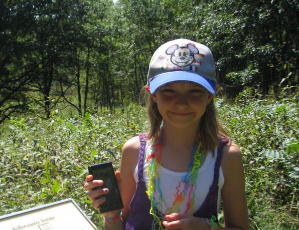
While on the Nature Trail at the Kettle Moraine State Park (Southern) Forest Headquarters my kids commented about how they felt like they were on a rollercoaster. We were walking quickly to avoid the mosquitos so it almost felt like we really were going fast on a rollercoaster! We eventually got to an informational sign that was called “Rollercoaster Terrain” and we thought that this was the perfect place for an EarthCache. It felt like a rollercoaster because of the ups and downs of the different geological features along the trail; some depressing the ground, some elevating.
To find this EarthCache you will need to walk on the Stony Ridge Nature Trail. This trail is a 1 mile loop trail starting and ending at the Forest Headquarters and Visitor Center. It joins the Ice Age Trail for just about .1 of a mile. The trail is well-defined and contains many interpretive signs with information about the area, both geological and historical. If you are here during the summer make sure that you liberally apply your bug spray as the mosquitoes are particularly voracious here. Along the trail you will find a series of signs. The coordinates will lead you to a particular sign entitled "Rollercoaster Terrain" and it is here you will find the answers to the questions.

Kettle Moraine State Forest—Southern Unit
The Southern Unit of the Kettle Moraine State Forest is 30 miles long, extending from the village of Dousman, Wisconsin, almost to the city of Whitewater. Forest Headquarters is 3 miles west of the village of Eagle on State Highway 59. In many of the places at this State Park you will have to pay an entrance fee but you will not for this cache as it is at the Forest Headquarters and no fee is required.
This park was created to preserve and showcase the abundant topographical features in this area. In this park you will see many Drumlins (this is what the park is most known for), Eskers, Kettles, Kames and more.
Visitors to the park will find many things to occupy their time. There are many hiking, horse-back riding and biking trails. There are Picnic areas and campgrounds with a swimming beach. In the winter you can cross-country ski. Visitors may hunt and fish, according to the permits. There are historic sites to visit and nature programs to attend. There are many recreational opportunities, the best of which may be that there are lots of geocaches in the area!
Geological Features
Kettle: A deep, kettle-shaped depression in a glacial drift.
Kettle Pond: A water-filled Kettle.
Drumlin: A long, narrow or oval, smoothly rounded hill of unstratified glacial drift.
Moraine: A ridge, mound, or irregular mass of unstratified glacial drift, chiefly boulders, gravel, sand,
and clay left on the ground by a glacier.
Esker: A serpentine ridge of gravelly and sandy drift, believed to have been formed by streams under or in glacial ice.
Kame: A ridge or mound of stratified drift left by a retreating ice sheet.
Ridge: A long, narrow elevation of land; a chain of hills or mountains.
Submission Requirements
A visit to the Forest Headquarters and Visitor Center is recommended, but not required, as the information you need for logging the cache are found along the trail. The coordinates to the parking lot are N42 52.595 W088 31.516. This is where the Nature Trail loop begins and ends. Inside you will be able to see some excellent historic and scientific displays about the area. Please stay along the trail as there is no need to go off of it and damage the area. To claim this cache you must complete these steps:
1. On the sign at the coordinates titled “Rollercoaster Terrain” there is an animal. What is it?
2. What is the more scientific name for the “steep ridges” where the glacier dumped it’s gravelly load?
3. The sign states that you are standing on a certain geological feature and looking at another one, what is it?
4. Include in your log a photo containing your GPSr somewhere along the trail with some kind of geological feature behind you and state which kind it is. Please do not post a photo of the sign as this would give away the answers for the submission requirements to others.
Permission for the placement of this cache was granted by Amanda Prange, Visitor Services Associate on 8/26/10 and by the conservation biologist, Thomas Meyer on 8/31/10.
| I have earned GSA's highest level: |
 |
Congratulations to ASL Girl for being the FTF!