Kresanica Traditional Geocache
-
Difficulty:
-

-
Terrain:
-

Size:  (small)
Please note Use of geocaching.com services is subject to the terms and conditions
in our disclaimer.
Tato skrysa vas zavedie do Cervenych vrchov, casti Zapadnych Tatier, kam sa da po znackovanych turistickych trasach prist z polskej strany. Je odtial nadherny kruhovy vyhlad na zvysok Zapadnych Tatier i Vysoke Tatry
This cache will take you in Red hills, the part of West Tatras, where you can come on the trails from polish side. From here you can admire the rest of West Tatras and the High Tatras.
Kresanica / Krzesanica 2 122 m n. m.
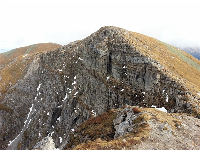
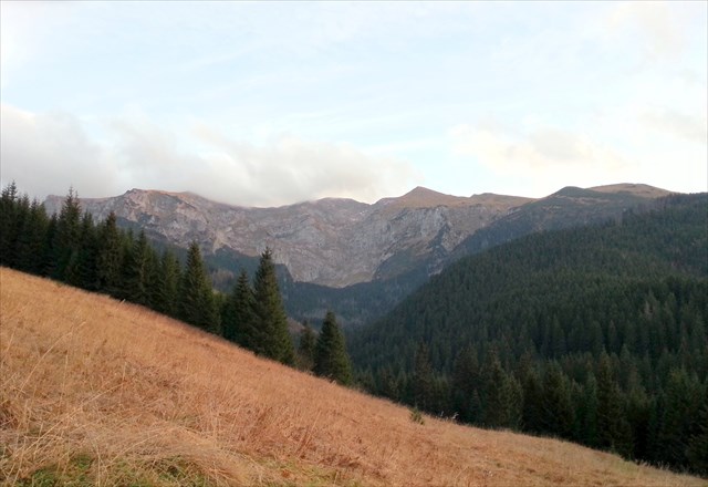
Kresanica (2 122 m n.m.) je najvyssim stitom Cervenych vrchov, casti Zapadnych Tatier a nachadza sa na SK-PL pohranicnom hrebeni medzi Temniakom a Malolacniakom. Vypina sa nad Dolinou Mietusa a Tichou dolinou. Je z nej nadherny kruhovy vyhlad na zvysok Zapadnych Tatier i Vysoke Tatry. Z geologickeho hladiska je tento masiv tvoreny dolomitickym vapencom a nachadza sa tu vela jaskynnych utvarov. V juznej stene na slovenskej strane bolo objavenych asi 50 jaskyn, najhlbšia z nich ma hlbku 166 m. Vo vyske 2110 m je jaskyna Krzesanica II, čo je najvyssie polozena jaskyna v Zapadnach Tatrach. Vzhladom na zlozenie pody tu rastie bohata a vzacna kvetena. Pristup je z polskej strany napr. z Kiry po zelenej TZ cez Dolinu Kosceliska alebo po cervenej alebo modrej TZ cez Przyslop-Mietusi.
Kresanica (2 122 m ASL) is the highest peak of Red Hills, part of the Western Tatras and is located on the SK-PL border ridge between Temniak/Cemniak and Malolacniak. The peak is standing over the valley Mietus and Ticha valley. You have an amazing panoramic view to the rest of Western Tatras and High Tatras. From the geological point of view is this massive build from dolomitic limestone and there are many cave formations. In the south wall of the Slovak side was discovered about 50 caves, the deepest of which is 166 m. The altitude of cave Krzesanica II is 2110 m, which is the highest cave in the Western Tatras. Given the composition of the soil here grows rich and rare flora. Access is from the Polish side, eg. from Kiry on the green hiking trail through valley Kosceliska or on the red or blue hiking trail through Przyslop Mietus.
Cache is located near the top on slovak side in west-south direction ( to Bystra, Blyst and Klin) under the bigger stone (see spoiler) divided into two parts. Kresanica is located on the Polish-Slovak border and is accessible all year around, but finding the cache in the winter depends on the snow cover.

|

Additional Hints
(Decrypt)
Cbq iryxlz xnzrabz ebmqryralz iregvxnyar an qir pnfgv WM bq iepubyh an fybirafxrw fgenar (ivq sbgbuvag)/ Haqre gur ovt fgbar qrivqrq iregvpny vagb gjb cnegf va FJ qverpgvba sebz gur gbc ba gur fybinx fvqr (frr fcbvyre)