The Second-Largest Canyon in the United States EarthCache
The Second-Largest Canyon in the United States
-
Difficulty:
-

-
Terrain:
-

Size:  (not chosen)
Please note Use of geocaching.com services is subject to the terms and conditions
in our disclaimer.
Come visit the second-largest canyon in the United States
right here in the Texas Panhandle. Plan to stay a while because the
views are just breathtaking!
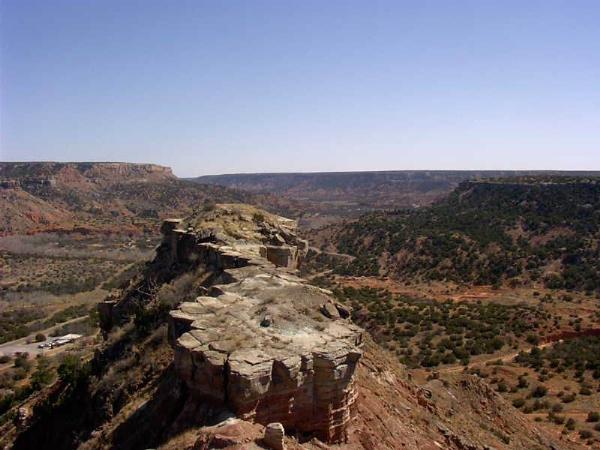
Palo Duro Canyon Rim

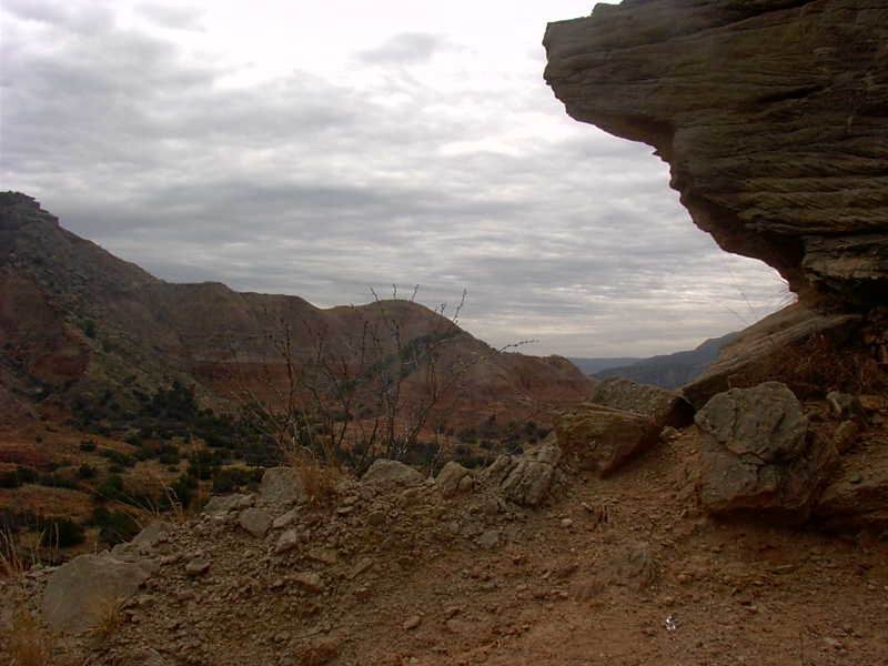
Palo Duro Canyon Mesa
Palo Duro Canyon Up Close
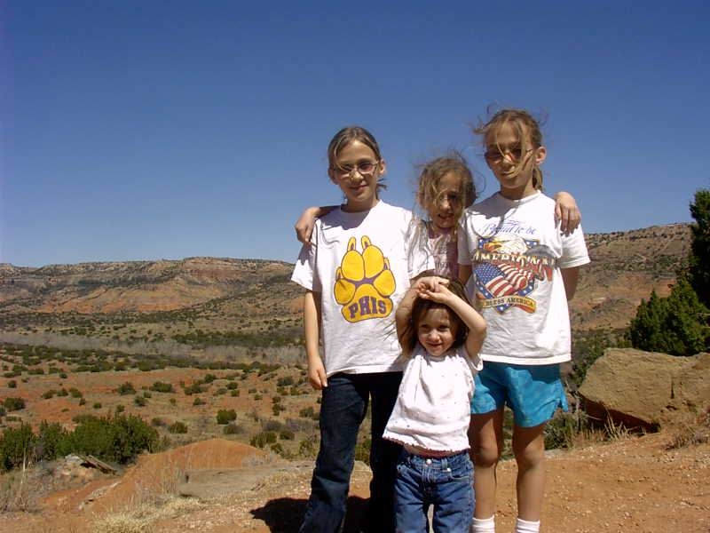
The BiT Kids Enjoying the Sights at Palo Duro
Canyon
Palo Duro Canyon is the second-largest canyon in United States. It
is 120 miles long and a maximum of 20 miles wide. At some points it
is almost 800 feet deep. The largest canyon, the Grand Canyon is
277 miles long, 18 miles wide, and 6,000 feet deep. The name Palo
Duro means "hardwood" and refers to the hardwood shrubs and trees
found in the canyon. Palo Duro Canyon is about 90 million years old
and carved into the eastern Caprock Escarpment of the High Plains
by the Prairie Dog Town Fork of the Red River during the
Pleistocene Epoch. The steep sides of Palo Duro Canyon consist of
bright, banded layers of orange, red, brown, yellow, grey, maroon,
and white rocks that represent four different geologic periods that
span 240 million years. These periods include the Pliocene,
Miocene, Triassic, and Permian.
The top formation or the youngest in geological time is the
Ogallala Formation from the early Pliocene to the late Miocene
Periods. This comprises the cliffs and ledges at the very top of
the canyon which are made of sandstone, siltstone, and eroded
conglomerate. The next is the Trujillo Formation. It is made of
coarse sandstone that forms the canyon ledges. It was formed in the
Triassic Period and is much is harder than the underlying Tecovas
Formation. The Tecovas Formation contains the multi-colored layers
consists of shale, siltstone, and sandstone. During deposition,
there were varying oxidizing conditions and wet-dry cycles that are
typical in stream and swamp environments that helped produce these
varying colored layers. The final and oldest is the Quartermaster
Formation. It is of the Permian age and comprises the red, lower
slopes of the canyon. This was deposited in a shallow marine
environment that alternated with dry tidal flats. The canyon has
some dramatic geological features including the steep mesa and the
multi-colored layers walls similar to the Grand Canyon. It has some
spectacular caves and hoodoos.
Native Americans have inhabited the canyon since Paleoindian
period, about 12,000 years ago. The earliest were the Clovis and
Folsom peoples that utilized the prehistoric flora and mega fauna
(mammoths and giant bison). Later in time, the Apaches, Comanches,
and Kiowas utilized the canyon. The first Europeans to the canyon
may have been members of the Coronado expedition. They are reported
to have been in the area in the late spring to early summer of
1541. The canyon area was occupied at that time by bands of
pre-horse-culture Apache Indians. Like there predecessors they
utilized the local flora and fauna and who depended heavily on
bison. The Plains Indians, in the eighteenth century, acquired
horses and the canyon became a major camping and hunting ground of
the Comanches and Kiowas.
To claim a find, please email me the answers to these questions
below. Also you will need to upload a picture of yourself
displaying your GPSr at the location in Question 1 and another
dramatic geological feature in the canyon. On your second
photograph, try to get something that is different than anything
the previous seekers have photographed.
Question 1: What is a hoodoo? The park has a famous one,
please seek out this and take a picture of yourself displaying your
GPSr with this hoodoo in the background. Note,
round trip is 5.75 miles and it is advised that you take 2 quarts
of water per person and pack out what you pack in.
Question 2: What is the elevation of the canyon rim?
Question 3: When you enter the canyon, what is the amount of
elevation change from the rim to the first water crossing?
Question 4: What is the name of the geological process that formed
this canyon?
As of the date of approval there is $4 perday, per person
13 and older,
staying or day use fee for the Palo
Duro Canyon State Park.

Click To Rate This Cache
Effective 05.16.07, all find logs MUST have accompanying
pictures or they will be deleted.
This is a result of “armchair/desktop” EarthCaching
attempts.
Additional Hints
(No hints available.)