20 Sep 20
 A great view of Mt. Langley! The trackables on top of Trail Peak with a great view of Mt. Langley and a small viewable piece of Horseshoe Meadows. I have some drone footage in the cache log before it crashed and died. I hauled that new container up the mountain so it would last for nearly ever!
|
20 Sep 20
 Trackables overlooking Owens Lake The trackables just climbed from the Owens Lake bottom of about 1100 feet elevation up this hill to about 7600 feet in elevation in just a few short miles. We are not done climbing today, but some of it is going to be tough hiking!
|
9 Aug 20
 So long Proxy! Here is the sweet travel bug hotel I left you in. Good luck!
|
20 Jul 20
 At the Forks of the Kern River! Here are your trackables at the Forks of the Big Kern and Little Kern River! Check the log for some more drone footage.
|
20 Jul 20
 Your trackables in the Lloyd Meadow Basin Be sure to click the drone link in this log to see what these trackables could see from here.
|
11 Jul 20
 Trackables at Powell Meadow Here are the trackables at Powell Meadows. I posted some drone footage in my cache find log here if you want to go check it out.
|
11 Jul 20
 On top of Bald Mountain! Here is your trackable up on top of Bald Mountain. Be sure to click the link in the log to watch drone footage of what your trackable saw!
|
11 Jul 20
 Getting Our Earthcache On! Here is your trackable at an earthcache I finally got published. Mt. Whitney, the highest point in the Lower 48, is off to the left in the distance. I actually made it to the top back in 1999!
|
11 Jul 20
 The Trackables with the Parrot Anafi Drone Here is a photo of your trackables onsite of the old ruins before I took some drone footage of them. Be sure to click the link on your trackable's log to watch the video of where your trackable is at!
|
7 Jul 20
 In front of giant Sequoia redwoods! These trees are absolutely massive! 100% impressive in size and height.
|
7 Jul 20
 At Dome Rock Here are the TBs beside Dome Rock by the Geocache with a good look at the Needles (big granite rocks) off in the distance.
|
7 Jul 20
 LilyLou13 & Jakob at Mt. Dennison View Here are the kids holding up your travelers on a nice day to be out in the back country of Tulare County.
|
22 May 20
 Pirate Yamaha TB Holder at the National Cemetery! Here are all of the trackables on the back of my Pirate Yamaha TB in the back of the Ridgeline at the National Cemetery in Kern County.
|
3 May 20
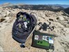
 Trackables at Training Hike Here is a picture of your trackable near GZ. Be sure to check this log for a link to your trackable in some sweet drone footage.
|
19 Apr 20
 A video from on top of Ijhtct! II RIP Skipper! Be sure to click the link in this log on your trackable to see a nice video of the area it was in today.
|
19 Apr 20
 RIP I just had to climb this! A great cache location that just isn't acceptable anymore, but great views for your trackables out here today.
|
19 Apr 20
 On Caliente Ridge Here are all the trackables on Caliente Ridge. I wanted to get some good drone footage of them here, but then the drone threw a prop and crashed. So I had to settle for a video. Check it all out in my cache log for this write note.
|
8 Mar 20
 Long Beach and the Queen Mary The trackables with EliEIO checking out The Pike and Long Beach with the world famous Queen Mary in the background.
|
8 Mar 20
 The Trackables on Santa Monica Beach. Here is your trackable with my kids at Santa Monica Beach by the world famous Santa Monica Pier.
|
20 Feb 20
 The Trackables Over Lake Isabella and Kernville! Here are the trackables I had with me near GZ.
|