Zeeland is the westernmost province of the Netherlands. The province, located in the south-west of the country, consists of a number of islands (hence its name, meaning "sea-land") and a strip bordering Belgium.

The coat of arms of Zeeland shows a lion half-emerged from water, and the text "luctor et emergo" (Latin for "I struggle and I emerge").
Large parts of Zeeland are below sea level which led to several severe floodings in history. The most known flood is the North Sea flood from 1953 (Dutch: Watersnoodramp). This utterly devastating flood was caused by a heavy storm that occurred on the night of Saturday, 31 January 1953 to Sunday morning, 1 February 1953.
A combination of a high spring tide and a severe European windstorm over the North Sea caused a storm tide; the combination of wind, high tide, and low pressure led to a water level of more than 5.6 metres (18.4 ft) above mean sea level in some locations. The flood and waves overwhelmed sea defences and caused extensive flooding. The Netherlands was worst affected, recording 1,836 deaths and widespread property damage. Most of the casualties occurred in the southern province of Zeeland.
After the 1953 flood, governments realised that similar infrequent, but devastating events were possible in the future. In the Netherlands the government conceived and constructed an ambitious flood defence system beginning in the 1960s. Called the Delta Works (Dutch: Deltawerken), it is designed to protect the estuaries of the rivers Rhine, Meuse and Scheldt. The system was completed in 1998, with completion of the storm surge barrier Maeslantkering in the Nieuwe Waterweg, near Rotterdam.
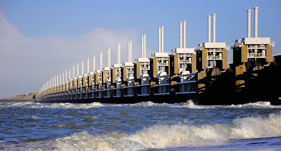
The most known part of the Delta Works is the Eastern Scheldt storm surge barrier (Dutch: Stormvloedkering Oosterschelde). The Oosterscheldekering between the islands Schouwen-Duiveland and Noord-Beveland, is with more than 8 km the largest of the 13 ambitious Delta Works series of dams and storm surge barriers, designed to protect the Netherlands from flooding from the North Sea.
