The Cache: The cache is at the end of the Boulder
River Trail. The cache container is a shoebox sized plastic
container hidden in the gnarled roots of a tree. Once you
reach the end of the trail at the river, follow the way-trail just
a bit farther east to the coordinates. Bark covers the
cache. See the clue below if you need more
information.
I have filled this
cache with great trading stuff so please remember the trading
etiquette.
The
Trail: The trail is the
Boulder River Trail #734 in the Mt. Baker Snoqualmie
National Forest. This trail is available year-round. To
get there, take I-5 and exit at 208, Slyvana/Arlington, and head
east on SR530. Drive about 20 miles, take a right on French
Creek Road, and drive about 4 miles to the
trailhead.
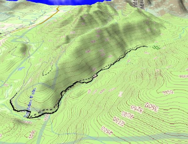 Parking
coordinates are 48° 15.040N and 121°
48.992W
Parking
coordinates are 48° 15.040N and 121°
48.992W
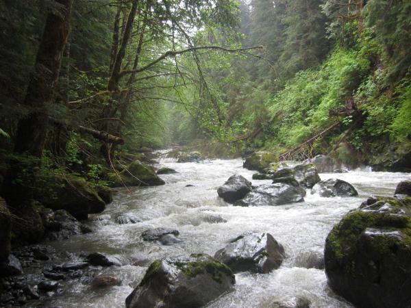
The trail is a pleasant
hike through old growth forest, no big elevation changes, and is
about nine miles roundtrip. You will pass the Boulder Falls Geocache on the
way. There are two large falls visible from the trail
coming from Mt. Ditney on the canyon wall. There are some
bridges of questionable structural integrity along the
route. They are simple enough to get around though, so
play it safe.
Take a picnic lunch and
enjoy it at the trail's end, there is a campsite right at the edge
of the river. The trail doesn't really end here at the river,
in fact, it continues to Three Fingers on the other side. You
should spot the orange ribbon across the river if you decide to
cross. There were a couple blow-downs when we were there, but
nothing that cannot be gotten over or under.
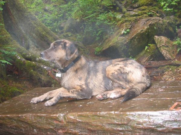 Kids and
Dogs: The Boulder River Trail is family
friendly, including your four-legged family members. The
hike is 4.5 miles to the river and lunch so the kids should
not have too much difficulty getting there. On the way
back just keep walking, they'll keep up. There are no
drastic elevation changes to worry about, and the few
obstacles are easier for children to get over or under than it
will be for you. The only hazards I'll flag are a couple
of the bridges over some small creeks. Take the kids
around these.
Kids and
Dogs: The Boulder River Trail is family
friendly, including your four-legged family members. The
hike is 4.5 miles to the river and lunch so the kids should
not have too much difficulty getting there. On the way
back just keep walking, they'll keep up. There are no
drastic elevation changes to worry about, and the few
obstacles are easier for children to get over or under than it
will be for you. The only hazards I'll flag are a couple
of the bridges over some small creeks. Take the kids
around these.
There are some small
feeder streams for your dog to drink from along the way, but in
summer these may dry up. Don't forget to pack your dog a
lunch, he'll be burning calories too. Dogs of all sizes and
shapes should enjoy the walk. Watch what your dog is doing,
he may alert you to the presence of wildlife with his keen
senses.
Table by Moun10Bike:
DOWNLOADS: