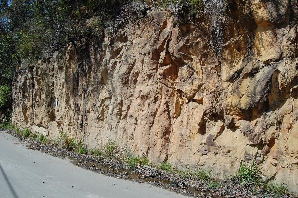
Hawkesbury Sandstone is a sedimentary rock that was laid down in the Middle Triassic period between 180 and 220 million years ago. The Hawkesbury Sandstone consists of massive and cross-bedded sheet bedforms with minor (less than five per cent) siltstone and mudstone beds, which contain fish fossils in some locations. It was deposited mainly on a vast riverine floodplain within the geological feature of the Sydney Basin. The crossbeds were formed by lateral accretion on sandbars within channels of the river system. The quartz-rich, nutrient-poor, sandy sediment was derived from the older continental area southwest of the Sydney Basin. A thick blanket, up to 274 m, of this quartz-rich sediment was deposited over the area.
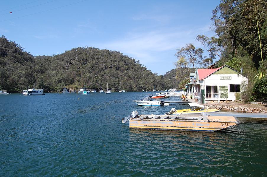
Around Sydney, sandstone is as common as quartz. Most of the city lies on Hawkesbury sandstone, with just a few caps of shale on some of the higher ridges. And even if you dig deeper, down past the Hawkesbury sandstone, there are more sandstone beds in the slightly older Narrabeen Series. The rocks of Sydney form a saucer-like basin, and away from the city, the bottom of the Hawkesbury sandstone is above sea level.
Even going up into the Blue Mountains leaves you on sandstone, for as you rise, the Hawkesbury sandstone rises with you. The Blue Mountains formed when the western side of the Sydney basin was tilted one kilometre up into the sky, and so we stay on the Hawkesbury sandstone, all the way to Woodford and Bilpin. After that, the Narrabeen sandstones start to appear once more, and they run most of the way out to Lithgow.

The sand that formed Sydney's rocks may have come from Broken Hill originally. The sand quite probably made a stop on the north coast along the way, but it has been around Sydney for 200 million years. There are few fossils to be found, and geologists are still arguing about how the sandstone was laid down, but there are some things we do know for sure.
Diagrams explaining sedimentary rocks show beautiful neat layers of sand, laid out horizontally, but more sandstone is laid down, like Sydney's, in river deltas where the sand is moved, sorted, shoved and pushed before it is buried. There are few neat horizontal layers in this type of sandstone. Roadside cuttings near Sydney reveal all sorts of sand banks and ‘washouts’ in the ancient delta, where a wandering river has passed through the sand, leaching and sifting and sorting. The sand left behind in the old stream beds is purer than usual, lower in clays and iron.
This gives us a sandstone which is more strongly bonded, with less clay to weaken and give way. A filled river bed of pure sand makes a fine hard rock, smooth on the surface, free of the ironstone contortions that may be seen in rocks close by. The Eora people of the Sydney region knew this good sandstone when they saw it, just as a modern artist recognises a good canvas. They made good use of it for their rock engravings.
Plants and lichens dig into the surface of even the toughest sandstone, ripping the sand grains away, one by one. Redgum roots infiltrate the joints and burst the stone, tumbling boulders down into gullies where floods can rush over them, wearing the stone back to sand again. Through it all, the silica grains, those tiny rounded pieces of quartz, roll through the eons. The sand grains remain as sand grains, ready to pass through the cycle all over again. They are chemically unchanged and physically constant, shuttling their way between sand and sandstone.
Sooner or later, the sand that has fretted away will settle in water somewhere. If these sand beds are buried deeply enough, the sand may melt and go back to Square One as granite, or it may just form sandstone again. Either way, it ensures that the intelligent beings of the planet earth, a hundred million years from now, will be able to enjoy the same sandstone shapes we find here today.
In order to log the EarthCache you will need to answer the following questions via an e-mail to the developer, cincolcc(at)gmail.com
1. Describe the colouring of the sandstone that you can see and why you think there is such a variety of colours. [You will need to be fairly close up for this exercise!]
2. Can you see any evidence of mosses / lichens / tree roots, etc?
3. Describe what the texture of the face of the cutting feels like when you run the palm of your hand across it.
4. Did you see any similar examples of layered sandstone either en route to the EarthCache or on your way home? If so please post a photograph of your example with your log.
5. At the given co-ordinates, or thereabouts, you will need to take an optional photograph with your GPSr visible and the cutting of the road clearly visible in the background. [No mugshot required - only GPSr in foreground.]
References consulted:-
An article originally written for Geo magazine, and published in the July-August issue of 1995, volume 17(4), 88-98 [all materials shown are free of any copyright restrictions]
http://www.ozemail.com.au/~macinnis/sandston.htm
http://www.berowrawaters.com/index.php?option=com_content&task=view&id=67&Itemid=90
http://friendsberowravalley.org.au/html/landscape_-_geology.html
FTF goes to = Argeisia a Ca