NEBO'S GROTTO EarthCache
-
Difficulty:
-

-
Terrain:
-
Size:  (other)
Please note Use of geocaching.com services is subject to the terms and conditions
in our disclaimer.
You might find a wonderful TREASURE here in our own little grotto!
Grotto:
A grotto (Italian grotta) is any type of natural or artificial cave that is associated with modern, historic or prehistoric use by humans. When it is not an artificial garden feature, a grotto is often a small cave near water and often flooded or liable to flood at high tide. Whether in tidal water or high up in hills, they are very often in limestone geology where the acidity dissolved in percolating water has dissolved the carbonates of the rock matrix as it has passed through what were originally small fissures.
The word comes from Italian grotta, Vulgar Latin grupta, Latin crypta, (a crypt). It is related by a historical accident to the word grotesque in the following way: in the late 15th century, Romans unearthed by accident Nero's Domus Aurea on the Palatine Hill, a series of rooms underground (as they had become over time), that were decorated in designs of garlands, slender architectural framework, foliations and animals. The Romans who found them thought them very strange, a sentiment enhanced by their 'underworld' source. Because of the situation in which they were discovered, this form of decoration was given the name grottesche or grotesque.
Grotto is a synonym for a small cave or a chamber within a cave.
From Wikipedia, the free encyclopedia
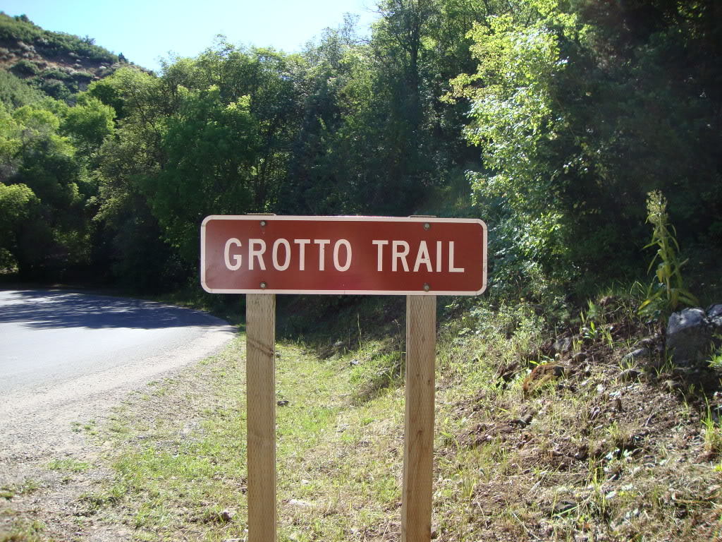
GPS Trailhead and Map
USGS Wimmer Ranch Creek, USGS Payson Lakes (UT). The trailhead starts on the left side of the road as you are ascending the Loop from the Payson side. You can park along the road.
[From Northern Utah County]: To reach the Grotto Trail, get off I-15 at Payson Exit 254, turn left onto Payson Main Street (State Route 77). Continue south until Main Street meets 100 North. Turn left and travel east to 600 East, then turn right, and follow this road south to the entrance to Payson Canyon and the beginning of the Nebo Scenic Loop. The trailhead is about 7 miles up the road.
Distance and Difficulty
About .3 of a mile from the trailhead for an easy hike for the entire family.
Hiking Time
About 45 minutes round trip, depending on how much time you spend at the grotto. Best seasons: Late spring to early fall.
Trail Description
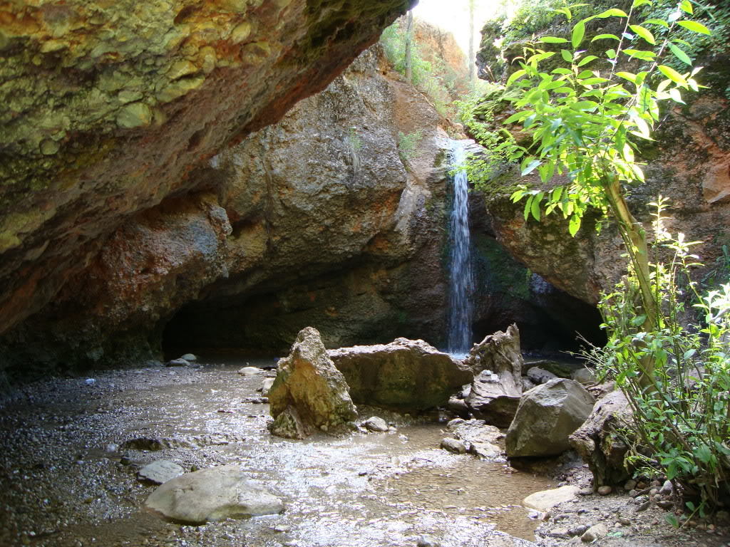
The trail gradually gains about 200 feet of elevation from the trailhead to the grotto, cutting across the stream on log bridges in several places. The trail ends right at the mouth of the grotto, with the stream flowing in from above. A shallow pool of water forms at the bottom of the grotto, but the waterfall rages during the spring runoff.
Perhaps the best and safest time of year for children is from July to September, when the waterflow is lightest and the air temperature is warmest to balance the frigid water from the stream. It is a fun place for kids to play in the water and even stand underneath it. It would also be a romantic place to take someone on a date, but you probably won't be along on busy weekends and holidays.
You can reach the point above the waterfall by hiking up a trail just left before entering the grotto. The trail ends there, but you can follow the creek up for a nice hike through the forest.
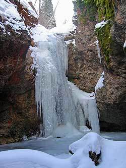
Hiking to the grotto during the winter is also a very fun adventure, especially when the waterfall freezes into an almost solid chandelier. The road is closed farther down the canyon, so you can expect at least an hour hike to reach the grotto, but it is well worth it.
Above information taken from Hiking in Utah.
To log this cache:
Send an email to me with the first line reading GC2CR2A NEBO'S GROTTO. In the email answer the following questions:
1. Estimate the height of the the falls.
2. Estimate the depth of the water in the pool at the base of the falls.
3. Feel the walls of the grotto and brefley describe how they feel also describe the makeup of the walls.
Post A PIC WITH YOUR LOG
As of June 10th, 2019 GC HQ updated the requirements for logging an EarthCache to allow the CO to request the visitor to "…provide a photo of themselves or a personal item to prove they visited the site. A personal item must be an option for those who do not want to photograph themselves. This task is acceptable only as an addition to well-developed logging tasks, not as a substitution."
So as of 06/10/19 "all" logs MUST have a pic attached with either the cacher (or group of cachers) prominently in it OR a personal item (GPS/printed icon/etc.) I will not accept cell phones as a personal item because 1) you more than likely would be using it for the pic 2) Cell phone, in my opinion, is too generic for a "personal item."If you post a group pic you MUST list the cachers names in you log.
Faliure to follow this or any part of the logging tasks will result in disqualification and your log will be "deleted!"
I will only respond if you have incomplete logging requirements.
Go ahead and log your cache.
ANY LOGS POSTED WITH THE ANSWERS ON THIS PAGE WILL BE DELETED!
Now enjoy the area!
 Special Thanks to the US Forest Service for granting permission to place this Earthcache.


Additional Hints
(No hints available.)