Green Hutless (Dunedin, Otago) Traditional Geocache
Green Hutless (Dunedin, Otago)
-
Difficulty:
-

-
Terrain:
-

Size:  (regular)
Please note Use of geocaching.com services is subject to the terms and conditions
in our disclaimer.
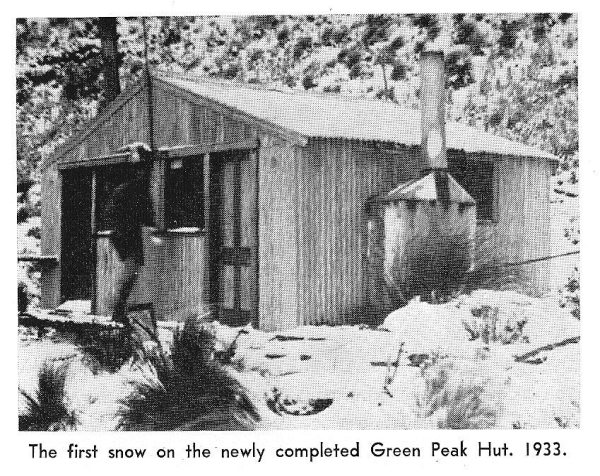
Follow the footsteps of generations of trampers on a one hour walk to the site of Green Hut.
What did they really think of the hut? Read excerpts from the Green Hut book and sing the Green Hut Song- they are included below as a log entry.
Park on Mountain Rd, a half hour drive from Dunedin, just past the corner with Semple Rd. It’s an easy walk on a well-formed track through regenerating manuka and broadleaf. All junctions are clearly signposted. It would be suitable for all the family on a fine day. A one hour walk for the fit, or an hour and a half for the less fit.
Be aware that the weather in the Silverpeaks can change very rapidly. It's safer to walk with a friend. Always tell someone where you are going and when you are due back. Carry warm and waterproof clothing, snacks and drink, a map, cellphone and extra batteries for your GPS. (If you get geographically embarrassed, you can always retrace your route!) See Dept of Conservation website Silverpeaks Routes and Pamphlet Silverpeaks Tracks.
The cache is a 2 litre black screwtop at ground level. Please replace as found and conceal it with leaf litter .
For a superb round trip, continue from Green Hut site down Possum Spur (very steep at the end) to Possum Hut, past Halcyon Days and back up Eucalyptus/Blue Gum or Gold Miners or the steep shortcut back to the road. Walking time only for this round trip would be about 3 hours. Download additional waypoints for this route from Halcyon Days.
Early in the life of the Otago Tramping Club, the question arose as to the feasibility of providing a shelter in the Silver Peaks district where much of the Club's activities were centred.
At the end of 1932 permission was obtained from the Dunedin City Council for erection of the Club’s own hut on a site selected on Section 3, Block X, Silver Peak District. This venture was approved at a special general meeting of the Club on March 16, 1933, when the Committee was authorised to spend 50 pounds on the scheme. A contract of 30 pounds for sledging in the materials and erecting the framework was let to Mr Bill Harris of Waitati, who, along with his team of enormous bullocks, was well known in the district.
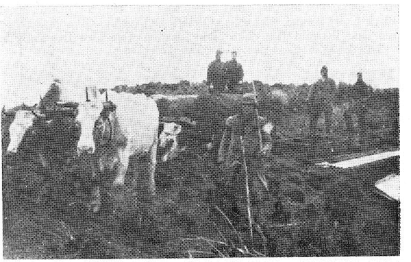
Working parties from the Club, assisted by parties of helpers from the N.Z. Alpine Club, proceeded to get the material transported and hut erected. Access was by the old Sawmill track from near the Leith Saddle, and it was a grand sight to see the team of oxen hauling their sledge up the bush track, then along the narrow ridge from Hightop to Green Peak. In 1933 Club accounts record the total cost of the hut (less donations) at 48 pounds 16 shillings and 10 pence; so it is clear that some good planning and keen financing was involved to keep within the budget. Green Peak Hut was officially opened on June 3 1933, and over the next few years it became the main base for Club activity.
Around 1945 - convinced that the business of segregation of the sexes was being carried too far - three Club members (who shall remain nameless) removed the partition which up to that time had divided the hut down the centre into "his" and "hers", and thus initiated the second "re-building" of the structure.
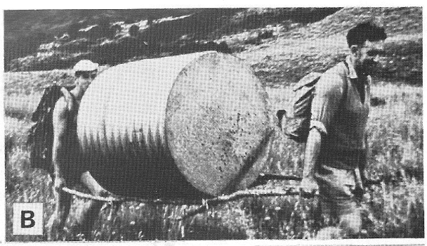
Many enjoyable work hours were spent in re-flooring, replacing existing bunks with shelf bunks, adding a water tank and repairing and repainting.
Two new toilets, each a masterpiece of the bush carpenter's art, were constructed and stategically sited windows permitted one a most comprehensive view of Blueskin Bay and environs as one sat comfortably enthroned.
 Trampers could walk into Green Hut from town on Friday evening via the (Old) Pineapple or Burns Track, spend the weekend in the Silverpeaks, then walk down to Waitati on Sunday afternoon and return to Dunedin by train. The “guns” would stay at Green Hut to the last possible moment before rushing to Waitati. Apparently, one young man swore that he would stay in his pit all day and (with the help of a sleeping bag which unzipped at the bottom) managed to get to the train while still in bed.
Unfortunately the Mountain Track became a bulldozed road when pines were planted in the 1970s, and with increased accessibility came ongoing vandalism. When the main front support was chopped out, the hut had to be removed. It was demolished between 13 and 15 July 1988, just over 65 years from its opening.
Look at the background of the photos to see the change in vegetation around Green Hut. The original beech forest on the Silverpeaks was burnt shortly after Polynesian settlers arrived c. 700 years ago. Since then, fires and later sheep grazing have kept the tops in tussock. Over recent decades the forest has been regenerating. By the 1980s there was low manuka growing in places amongst the tussock along the ridge track to Green Hut. The route from Green Hut up to Green Hill was the worst bit, because the entire area was overgrown with gorse- there were two main routes through, but they were equally painful. However, the gorse was a nursery plant for the manuka forest you see there now. The central Silverpeaks became a reserve in 1985 (yes, it was that late). If you continue to Walkways of Otago: Silverpeaks Route you’ll see large tussocks and beech seedlings all over the tops.
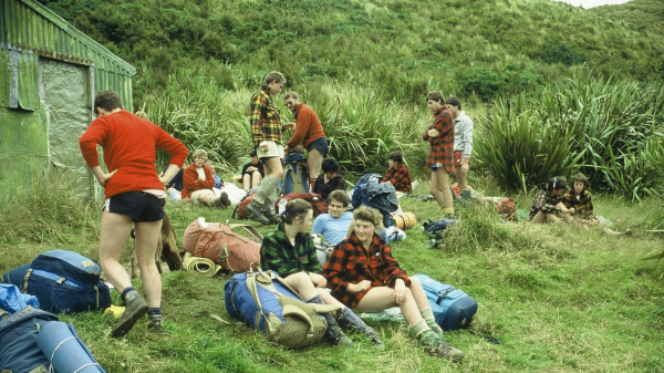
OTMC Bushcraft at Green Hut 1987
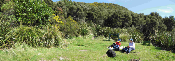
Green Hut site 2010
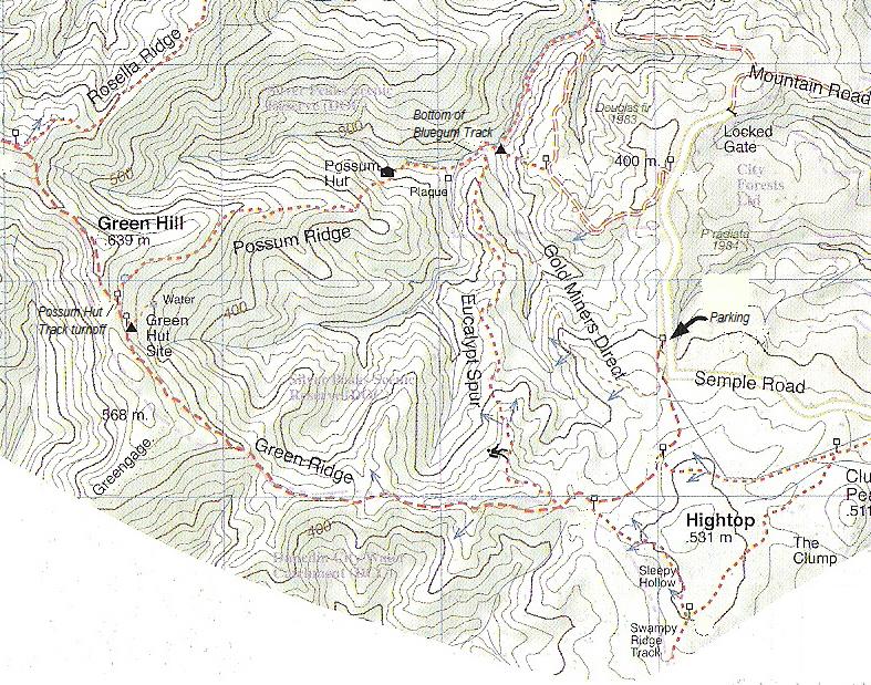
Map of route from Antony Hamel's "Dunedin Tracks and Trails"
(History of Green Hut mainly from OTMC 1973 “Outdoors” 50th Anniversary Issue)
Additional Hints
(Decrypt)
TY, onfr bs oebnqyrns, fvqr pybfrfg gb tenff.