LOCATION: Walnut Brook across from Mine Brook Park,
Flemington, New Jersey.
ACCESSING THE TRAIL: A footpath, located across Capner
Street, can be accessed through the paved parking lot on the north
side of the park. The entrance to the footpath is just before the
electrical transfer station adjacent to the Morales Nature
Preserve. Once on the footpath, proceed north approximately 50
yards, until you see a path to the right angling down toward the
brook. The exposures run north-south along the brook. Good
luck!
200 MILLION YEAR-OLD LAVA FLOW? HOW DID THAT HAPPEN?
Throughout the history of the planet, Earth's plates have merged
together then split and drifted apart. This action is a byproduct
of a well-known geologic theory called plate tectonics. This theory
states that the Earth's surface is broken up into roughly 20 or so
giant pieces of rigid crustal plates that carry the oceans and
continents with them as they move slowly around the planet. About
220 million years ago, at the end of the Permian Period, all land
on earth formed a supercontinent that geologists call Pangea.
Cracking apart or "rifting" of Pangea began in the Late Triassic
Period about 30 million years after the Permian. See
Geologic Time Scale. As the North American Plate moved
westward, separating from what is now Africa, volcanic activity
deep in the earth was triggered and began the early steps that led
to the formation of the Atlantic Ocean. The crust stretched and
thinned as a huge plume of magma (molten rock) from the Earth's hot
mantle began to rise and eventually erupted at the earth's surface
as a lava flow.
See The Breakup of Pangea. This lava cooled and solidified to
form the igneous rock called basalt. Geologists refer to this
basalt as the Orange Mountain Basalt.
Can you imagine 200 million years ago, when dinosaurs roamed the
earth, a huge surge of molten lava erupting from the ground
engulfing all in its path? Well, get ready for it! The eastern bank
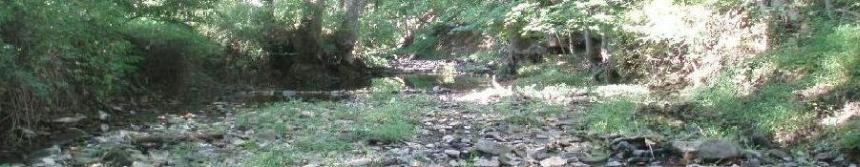
of Walnut Brook uncovers this very episode in Earth's past. There
are sharp contacts (surfaces where two kinds of rocks meet) along
Walnut Brook between the basalt and the older red shale of the
Passaic Formation (fig. 1). The older red shale, indicative of lake
sediment deposits will be discussed in greater detail later in the
text. The basalt in the contact unconformably overlies this shale.
An unconformity is a break in the geologic record, a time gap in
the sequence of strata. In this case, the two different rock types
are parallel and separated only by a small period of time. These
unconformities not only reveal dramatic breaks in the rock sequence
but also past geological events such as the rifting of Pangea.
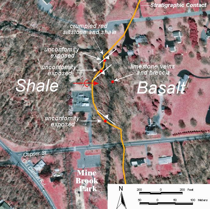
Figure 1. Outcrops along Walnut brook where the contact
is exposed.
The unconformity between the Passaic Formation and the Orange
Mountain Basalt displays many interesting features. We'll show you
three kinds of rock, local copper mineralization, veins filled with
limestone, and basalt breccia.
THREE ROCKS FOR THE PRICE OF ONE!
The oldest rock unit is the brownish-red shale of the Passaic
Formation. Shale is made from fine silt and clay particles that
settled on the floor of shallow lakes and seas many years ago.
Since the shale formed under compressive weight of the overlying
sediments, it exhibits a flaky texture.
Due to the tremendous heat caused by the magmatic intrusion, the
shale closest to the magma underwent intense baking, which
transformed it into a new fine-grained rock called hornfels. This
effect, known as contact metamorphism, is an alteration in a body
of rock caused by exposure to intruding magma.
Lastly, the pride and joy of these events is the Orange Mountain
Basalt, which is our well-known lava flow. Basalt is a very
fine-grained rock, usually occurring in a black color. Conversely,
this basalt has been weathered (altered by exposure to water and
air) to reddish-orange.

Figure 2. Unconformity between the Orange Mountain
Basalt and the Passaic Formation shale.
RED AND GRAY SHALE WITH LOCAL COPPER MINERALIZATION
N 40 30.46' W 74 52.27'
Across from the eastern bank is another unconformity, sometimes
hidden beneath the overhanging banks of the stream near the
footpath (fig. 3). Here the contact includes a sequence of red and
gray shale beds with the uppermost gray shale having copper
mineralization (altered copper minerals) along its base, forming
the copper carbonate mineral malachite. Malachite forms when
carbonated water interacts with copper resulting in a bright green
tarnish upon the rock surface. Since malachite's bright green color
is so distinctive it is not difficult to identify the presence of
copper ore deposits within the area.
Flemington was the site of an early attempt to mine copper in
New Jersey. Gordon’s History of New Jersey, published in 1824, says
“A valuable deposit of copper ore is said to have been lately found
near Flemington.” This copper mineralization is directly related to
the copper mining industry in Flemington. Due to the green hue of
malachite, miners recognized that copper existed in the area. It
was one of the root causes that spurred interest in mining copper
in New Jersey!
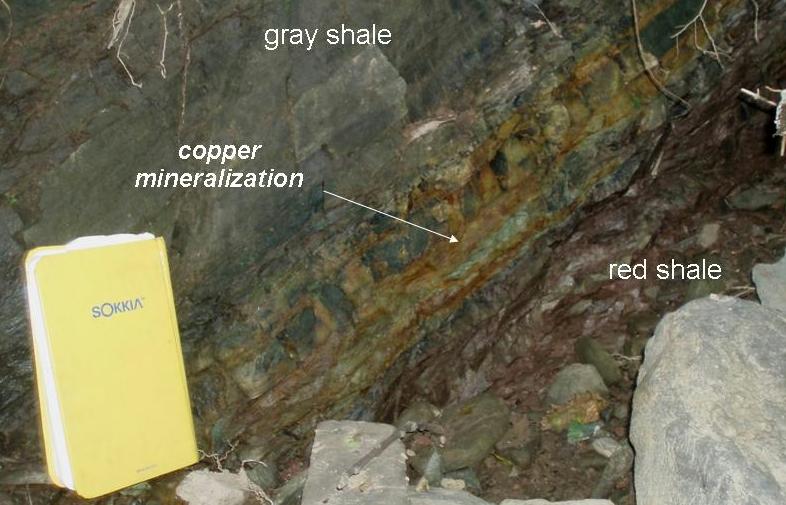
Figure 3. Red and gray shale beds with some local copper
mineralization.
BASALT BRECCIA AND LIMESTONE VEINS
N 40 30.762' W 074 52.438'
A fault zone is a "crack with movement" in the earth expressed
as numerous small fractures. Mine Brook Park contains a variety of
features that are commonly related to fault zones, such as breccia
and mineralized veins.
Breccia is a clastic rock (made up of preexisting rocks)
composed of angular gravel-size fragments. In fault zones, one rock
mass has slid past another, causing them to shatter and eventually
form breccias. These rock fragments were caught up in "the mix"
before there was time to round off any rough edges, which can be
deduced from their jagged shape. This is a basalt breccia composed
of chunks of basalt suspended in limestone cement (fig.4).
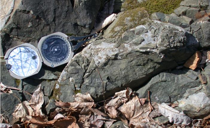
Figure 4. Basalt breccia suspended in a limestone-like
cement.
It is extremely unusual to find basalt and limestone mingled
together! One explanation for this is that the limestone originated
from hot fluids circulating through the fault zone in an
environment were hydrothermal activity existed, very similar to
active hydrothermal deposits found in areas today like Yellowstone
National Park. These hot fluids, rich in dissolved minerals,
traveled along cracks in the rock and as they cooled the minerals
crystallized and filled the gaps. This is reffered to as a
hydrothermal vein deposit.
EARTHCACHE LOGGING REQUIREMENTS
To claim this cache: You must tackle the following steps.
Post your answers in your log. Tell us how many people were in your
group. (You don't have to wait for a confirmation from us to claim
the cache. We trust you!)
1. Describe the differences between the rocks of the Passaic
Formation and the overlying Orange Mountain Basalt. You can start
by describing the color variations and/or textural differences that
distinguish them.
2. Find another location along the brook where the contact
between the basalt and the red shale can be seen. Take a photo of
yourself or your GPS receiver beside this contact. If you are
unable to take a photo, record the GPS location of the unconformity
and a brief summary of what you see.
3. Lastly, locate the exposure of the malachite within the red
and gray shale unit and take a picture of yourself or your GPS
receiver beside it.
REFERENCES
Herman, G. C., 2005, Stratigraphy and structure of the Passaic
Formation and Orange Mountain Basalt at Mine Brook Park,
Flemington, New Jersey: in Gates, A. E., editor, Newark Basin -
View from the 21st Century, 22nd Annual Meeting of the Geological
Association of New Jersey, College of New Jersey, Ewing, New
Jersey, p. 134-144.
Topinka, Lyn. “The Geologic Time Scale.” USGS/CVO, 1997, 2000,
2001, with ages modified in 2006 to match GSA 1999 Geologic
Timescale. New Jersey Geological Survey. 7 Sept. 2007.
http://vulcan.wr.usgs.gov/Glossary/geo_time_scale.html
“The Breakup of Pangea.” USGS/NPS Geology in the Parks Website,
Atlantic Plain Province, August 2001. 7 Sept. 2007.
http://vulcan.wr.usgs.gov/LivingWith/VolcanicPast/Notes/breakup_of_pangea.html
Vosseller, Elias. "A sketch of the Copper Mining Enterprise."
The Flemington Copper Mines. 1891. G.W. Burrooughs, Steam Book and
Job Printer, Cranbury, New Jersey, p.1
This Earthcache is brought to you by the
NEW JERSEY GEOLOGICAL SURVEY
an agency of the New Jersey Department of Environmental
Protection.

Visit us at www.njgeology.org