Story of Dry Falls
During the Ice Age, glaciers to the north blocked the Columbia
River and forced it to find a new route. The river, swollen from
melting glacial ice, began to carve a new channel at this location.
But that was only the beginning.
A river in Idaho found no way around it's ice dam. The river
filled it's valley with a huge lake that flooded many square miles
of Montana - until the ice dam broke. With a flow up to ten times
the combined flow of all the rivers in the world, the lake emptied
across Idaho and onto eastern Washington. Much of the water rushed
through the new chanel opened by the Columbia River. The turbulent
water enlarged the channel and created huge waterfalls. Eastern
Washington was scoured by many such floods, each lasting only a few
weeks.
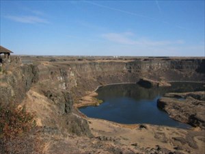
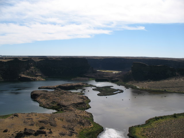
When the last flood subsided, large areas of eastern Washington
were left scarred with dry channels, called coulees. This one, the
Grand Coulee is the largest. Cutting across the coulee is Dry
Falls. This 3.5 mile wide and over 400 foot tall group of scalloped
cliffs was at one time the largest waterfall in the world.
To log this EarthCache please complete the
following:
1. E-mail (do not post) the cache owner the estimated distance
south of the current site where Dry Falls began.
2. E-mail the cache owner (do not post) a description of two
geological features found at the site.
3. E-mail the cache owner (do not post) the approximate height
of the cliffs at the EarthCache site.
4. Post a photo of yourself with GPS in hand at the EarthCache
site.
Enjoy!