(ENG)
The region of many limestone quarries is called
„Amerika“ (stands for Americas in Czech) due to its
romantic appearance although the name probably has an older origin.
High quality limestone has been mined here since the very end of
19th century for iron and steel industry in nearby town Kladno. Due
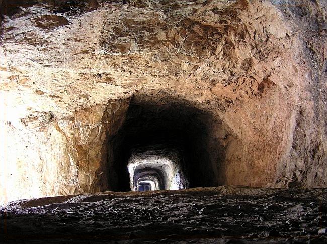
to special geologic conditions was limestone mined from underground
galleries to the surface. By this technology was originated approx.
10 small but deep limestone quarries with minimal negative effect
to neighbouring nature. Mining in this region had been finished in
the middle of Twentieth Century but it took another 40 years till
the area was protected by law. In present time people can admire
deep limestone quarries in this area, surrouded by beautiful
nature. There is an educational trail which leads from Velka
Amerika quarry to Mala Amerika.
And here are my educational goals: To log this Earthcache, take
a photo of yourself in front of „Velka Amerika quarry“
(on the coordinates) and learn when the originally horizontal
limestone strata became steeply inclined. Second goal: how deep is
a beautiful lagoon in „Mala Amerika“ quarry? (see
educational table on QTA coordinates) Please send me your results
via my PROFILE and upload photo with your log. Need not visit
dangerous places, nor climbing cliffs. Entering undeground
galleries and quarries is forbidden and dangerous.
(CZECH)
Malá a Velká Amerika Snad každý alespon jednou slyšel o
techto témer kultovních , bájemi opredených místech. Uprostred
nádherné prírody se nacházejí pozustatky težby vysoce cistých
konepruských a sliveneckých vápencu, lomy Malá a Velká Amerika,
Mexiko a další, pospojované systémem štol. Odhlédneme
li od nesporne velice zajímavého terénu pro trempování a zakázané
lezení po skalách a do podzemí, jsou lomy Morina velice zajímavé z
hlediska zpusobu težby. Mno nic, o tom si mužete precíst
na tabulích, lemujících naucnou stezku. Tak jen prosím nikam
nezahucte a neztratte se v podzemí. Vždyt víte, VSTUP ZAKÁZÁN.
A navíc pro splnení úkolu to není vubec nutné. Takže, fotecku
z úvodních souradnic s Velkou Amerikou v pozadí priložte k
logu. Také zde zjistíte kdy byly puvodne vodorovné vrstvy vápence
prevráceny nasvislo, aby šly lépe težit. (no to je
náhodicka). Na souradnicích (N 49° 57.212 E 014° 10.491) je
další z tabulí na které zjistíte jak hluboké je jezírko na
Malé Americe. Bezedné (jak se traduje) teda není..
No a odpovedi na tyto dve otázky mi pošlete pres muj
profil. Logujte ale hned, maximálne vás vždycky mužu
vymazat :-)