To reach this cache follow Arrow Lakes Dr. west outside of Castlegar past Hugh Keenleyside Dam and park at N 49°20.097 W117°46.891 and then follow the abandoned railway line (which is now a multi-use trail). The cache site is located less than 3km from the parking area. It's a level walk/ride to the cache area. West of the cache site there's a trail that leads down from the rail bed towards the cache site. The tunnel is further down below
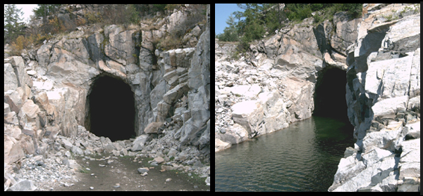
When the water level is low (early spring, late fall), the tunnel is dry and you may walk through it. Conversely - when the water level is high the tunnel may only be passed through with a boat or canoe. The tunnel may be totaly submerged during very high water, but that hasn't happened in years. The picture below shows the tunnel during low water (left), and high water (right).
Cache is a loc n loc. See spoiler pic for extra hint. Enjoy your day.