The Manin Gorge EarthCache
-
Difficulty:
-

-
Terrain:
-

Size:  (not chosen)
Please note Use of geocaching.com services is subject to the terms and conditions
in our disclaimer.
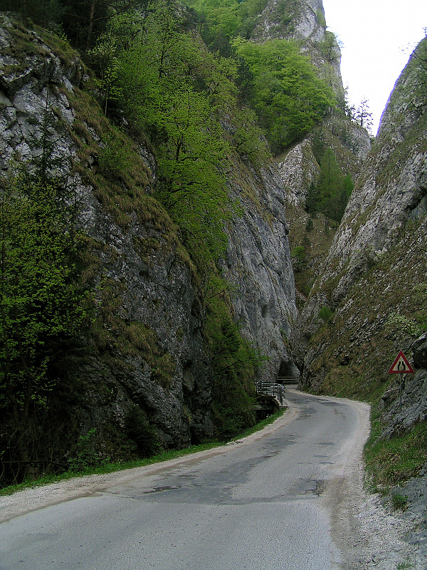
(EN) This earthcache will show you the narrowest gorge in Slovakia - the Manin gorge.
(SK) Tato earthcache Vas zavedie do Maninskej tiesnavy - najuzsieho kanona na Slovensku
Slovenska verzia listingu sa nachadza dole.
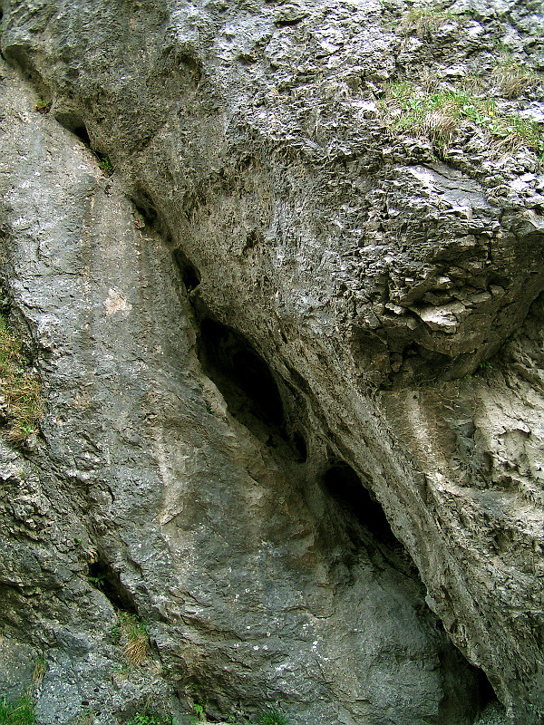
  The Manin gorge was formed by continuous epigenetic process of Manin brook. The klippen belt was divided into two parts - Grand (southern) and Little (northern) Manin. Steep slopes, ridges, stone points, columns and gates were formed in the limestone strata of the Jurassic and Early Cretaceous period. The highest rocks rise up to 200 meters (650ft) high. Karstic processes created swallows, pits and 40 documented caves. The Manin gorge was formed by continuous epigenetic process of Manin brook. The klippen belt was divided into two parts - Grand (southern) and Little (northern) Manin. Steep slopes, ridges, stone points, columns and gates were formed in the limestone strata of the Jurassic and Early Cretaceous period. The highest rocks rise up to 200 meters (650ft) high. Karstic processes created swallows, pits and 40 documented caves.
We shall follow the educational trail which begins near the camping site in Povazska Tepla near the entry to the gorge (waypoint BE1C0BE). Twelve educational panels contain interresting information in slovak and english language about the Manin and Kostolec gorge, their structure, rare flora and fauna. I'd like to draw your attention to the 6th panel right before the narrowest point of gorge describing the geologic processes which have formed the gorge.
Behind this narrowest point (mind the cars!) lies the "Fairy meadow", the most beautiful part of the trail. Let's rest here and take pleasure in the stone splendour around. You might even find a hidden treasure here ;-).
|
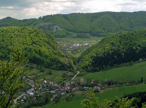
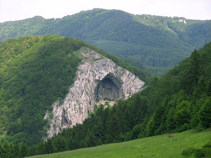
 The trail leaves the Manin gorge through another narrow point and continues to village called Zaskalie (in slovak place behind rocks). Some 500 meters (1600ft) further we enter another - Kostolec gorge. It was formed the same way as the Manin gorge by the epigenetic process of the Manin brook splitting the Drienovka clippen belt into two parts. Whilst the slope of the southern Drienovka eroded into many large boulders and is overgrown today, the northern part of the gorge forms a marvellous preudokarstic stone overhang "Kostolec Cathedral" called also "The Roof of Slovakia". It is one of the largest overhangs in the Western Carpathians and definitely the largest in Slovakia. The trail leaves the Manin gorge through another narrow point and continues to village called Zaskalie (in slovak place behind rocks). Some 500 meters (1600ft) further we enter another - Kostolec gorge. It was formed the same way as the Manin gorge by the epigenetic process of the Manin brook splitting the Drienovka clippen belt into two parts. Whilst the slope of the southern Drienovka eroded into many large boulders and is overgrown today, the northern part of the gorge forms a marvellous preudokarstic stone overhang "Kostolec Cathedral" called also "The Roof of Slovakia". It is one of the largest overhangs in the Western Carpathians and definitely the largest in Slovakia.
|
To log your cache you need to:
- Attach a photo of you with your GPS device in the Manin gorge to the log. (Lone wolves may attach the photo of GPS showing the coordinates)
- Send me an email through my profile with answers to these questions:
-
- Describe with your own words the geological process which has formed the Manin gorge.
I don't want you to rephrase my words from this listing, I'd rather make you think over what made the brook cut its way through the hard limestone? Why didn't it find a more simple way like joining the Domanizanka river in Povazska Bystrica and thus flowing around the klippen belt?
- What is the width of its narrowest point?
- Is this width (which accurately allows a bus to pass) a result of natural processes?
Fell free to log "Found it" right away, I'll contact you, should there be a problem in your answers. |
  Maninska tiesnava vznikla epigenetickym prelomom Maninskeho potoka. Maninske bradlo nou bolo rozdelene na dve casti - Velky (juzny) a Maly (severny) Manin. Vo vapencovych suvrstviach jury a spodnej kriedy tak vznikli strme steny, hrebene, kamenne ihly, piliere ale i obrie hrnce a pereje. Najvyssie skaly maju az 200 metrov. Z krasovych javov nachadzame skrapy, zavrty a vyse 40 zdokumentovanych jaskyn. Maninska tiesnava vznikla epigenetickym prelomom Maninskeho potoka. Maninske bradlo nou bolo rozdelene na dve casti - Velky (juzny) a Maly (severny) Manin. Vo vapencovych suvrstviach jury a spodnej kriedy tak vznikli strme steny, hrebene, kamenne ihly, piliere ale i obrie hrnce a pereje. Najvyssie skaly maju az 200 metrov. Z krasovych javov nachadzame skrapy, zavrty a vyse 40 zdokumentovanych jaskyn.
Cestou nas bude sprevadzat naucny chodnik zacinajuci pri kempe v Povazskej Teplej pred tiesnavou. (waypoint BE1C0BE) Na paneloch najdeme vela zaujimavych informacii o tiesnavach geologickou stavbou bradla pocnuc, vzacnym rastlinstvom a vtactvom konciac. (v slovencine i anglictine)
Nas bude najviac zaujimat panel pred samotnym naujuzsim miestom tiesnavy popisujuci geologicke deje ktore viedli jej vzniku. Za uzinou (pozor na auta!) najdeme "Rozpravkovu lucku", najkrajsie miesto celeho chodnika. Tu sa mozme dosytosti pokochat kamennou nadherou vokol nas a mozno najst i poklad ;-). |
 Dalsim uzkym miestom chodnik Maninsku tiesnavu opusta a pokracuje cez obec s priznacnym nazvom Zaskalie. Asi pol kilometra za nou nas vita dalsia - Kostolecka tiesnava. Vznikla, podobne ako Maninska tiesnava, zarezavanim potoka do vapencového bradla vrchu Drienovka z ktoreho oddelila cast zvanu Kavcia skala. Zatialco jej juzna strana je rozpadnuta do mnohych bral a z vacsej casti zarastena vegetaciou, severna strana vytvara nadherny mohutny dom so skalnym previsom pseudokrasoveho povodu nazyvany "Strecha Slovenska". Je to najvacsi previs na Slovensku a jeden z najvacsich v Zapadnych Karpatoch. Dalsim uzkym miestom chodnik Maninsku tiesnavu opusta a pokracuje cez obec s priznacnym nazvom Zaskalie. Asi pol kilometra za nou nas vita dalsia - Kostolecka tiesnava. Vznikla, podobne ako Maninska tiesnava, zarezavanim potoka do vapencového bradla vrchu Drienovka z ktoreho oddelila cast zvanu Kavcia skala. Zatialco jej juzna strana je rozpadnuta do mnohych bral a z vacsej casti zarastena vegetaciou, severna strana vytvara nadherny mohutny dom so skalnym previsom pseudokrasoveho povodu nazyvany "Strecha Slovenska". Je to najvacsi previs na Slovensku a jeden z najvacsich v Zapadnych Karpatoch.
|
Podmienky zalogovania cache:
- Prilozte k logu fotografiu s GPS v Maninskej tiesnave. (osameli vlci prilozia fotku GPS s citatelnymi suradnicami)
- Poslite mi cez profil email s odpovedami na nasledujuce otazky:
-
- Popiste vlastnymi slovami geologicky proces, ktory vyformoval Maninsku tiesnavu.
Nechcem od vas, aby ste mi len prestylizovali to co som napisal v listingu, radsej by som bol, keby ste sa zamysleli nad tym, preco sa vobec potok zarezaval do tvrdeho vapenca? Preco si nenasiel nejaku jednoduchsiu cestu, povedzme obtiect bralo od severu a vytvorit sutok s rieckou Domanizanka v Povazskej Bystrici?
- Aka je sirka tiesnavy v jej najuzsom mieste?
- Vdacime za tuto sirku, ktora dnes staci akurat pre prechod autobusu, prirode?
"Found it" mozete logovat hned, keby bol nejaky problem s odpovedami, ozvem sa. |
Additional Hints
(Decrypt)
1.dhrfgvba - "Oenuznchgen naq Uvznynlnf" vf gur fnzr fgbel.
1.bgnmxn - Oenuznchgen n wrw gbx i Uvznynwnpu fn ohqr tbbtyvg ynufvr, wr gb gra vfgl cevcnq.