The Secret of Arnold S. Multi-Cache
-
Difficulty:
-

-
Terrain:
-

Size:  (regular)
Please note Use of geocaching.com services is subject to the terms and conditions
in our disclaimer.
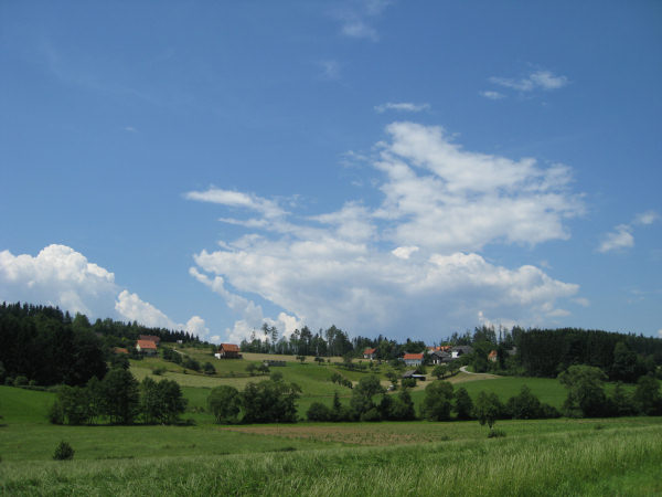
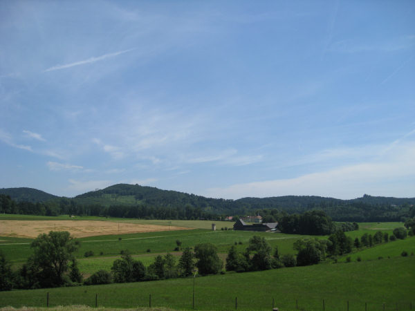
EN: 9km hike along a marked trail, approx 2.5 hours. Paved roads with low traffic volume, forest roads and trails.
DE: 9km Wanderung entlang eines markierten Weges, ca. 2,5 Stunden. Asphaltierte Strassen mit geringem Verkehrsaufkommen, Forststrassen und -wege.
ENGLISH DESCRIPTION
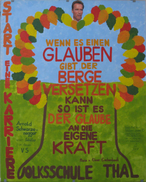
Arnold S? Who? Who is this guy??

Enjoy a hike through a nice region and find out more about the life of this mysterious person.
Maybe you'll even find clues to the secret of his success?
Even if not, you'll find at least a geocache. 
Approach
Car: There are parking lots available near the header coordinates where you can leave your car. If you come from Graz just drive to Thal, then turn left (uphill) right after the town sign.
Public transport: GVB bus #48 "Goesting - Thal" (schedule) until station "Thal-Kirchberg" or "Thalkreuz".
Bike: Bikeway R39 "Thaler Radweg". From Graz go north on the west side of the river mur until the R2 leaves the river bank. Then follow the signs R2/R39 west; you will pass a large InterSpar market. At a crossing not far from the header coordinates you have two possibilities. You can follow the street straight ahead towards "Thal" and then go to the header coordinates, or you can keep following the bikeway until you reach N47° 04.488 E015° 21.839. Here riding a bike towards the header coordinates is not allowed, but I still prefer to use this way than the main street to Thal. Note: While it's possible to ride a bike all the way along this cache there are quite some parts where this isn't allowed.
Now what?
At the header coordinates you will find a box with free maps of the hiking trail that we will follow - together with other interesting information about both the area and our mysterious person Arnold S.
Take one - it will be your guide!
We will follow the blue hiking trail. You will see blue arrows and blue marks along the way.
If there are no maps left you can print this one, but you will miss a lot of information. A full version is also available. In addition there is a single-page basic information sheet as well.
Stage 1 - Church
N 47° 04.584 E 015° 21.690
(Green point of interest #1 on your map)
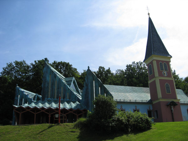
A really interesting church, right? It was designed by Ernst Fuchs, you can find more information in your guide (map) or online.
The rectorate was first mentioned in 1322 and was located at castle "Unterthal" (stage 2). 1772 the church was relocated to a chapel on a nearby hill. Because of the increasing population count the old church became too small and it was therefore rebuilt in 1992-1994.
How many red lamp posts with benches next to them are located around the place in front of the church? = A
Stage 2 - Ruin Unterthal
N 47° 04.359 E 015° 21.787
(Green point of interest #2 on your map)
This castle was constructed in the middle of the 13th century. One of the oldest parts is the tower with a wall thickness of more than 1.5 meters. The castle used to be the location of a church until it was moved to a nearby hill (stage 1). In 1996 parts of the castle were renovated.
Sum up all digits of the house number of the ruin (white tower) and multiplicate the result by 9. =B
Stage 3 - House of Birth
N 47° 04.329 E 015° 21.764
(Green point of interest #3 on your map)
Right next to the House of Birth there is another (yellow) building with an oval sign that tells us the name and purpose of this building. There is a single word (9 letters) in the middle, translate the first letter to a digit (A=1,B=2). =C
Update Jan 2013: The sign seems to be missing; it used to read "Reichsgräfliche herbersteinische FÖRSTEREI Thal", C=6.
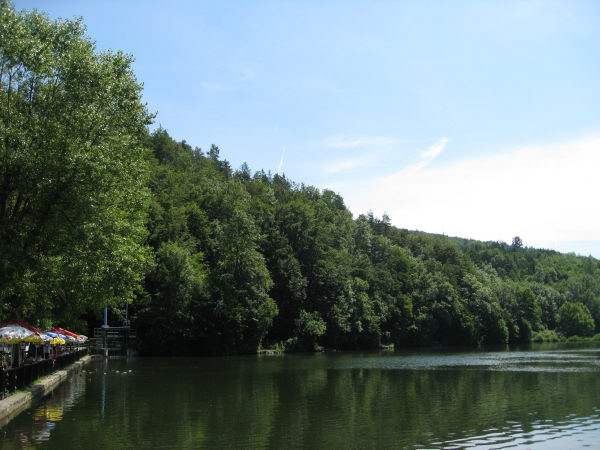
Stage 4 - Lake
N 47° 04.291 E 015° 21.979
(Yellow triangle #2 on your map)
This artificial lake was created in 1920 for the purpose of obtaining ice for cooling purposes. Five years later it was enhanced as a place of recreation by Hans von Reininghaus.
Right next to a large stone there is a post with two hiking signs. Sum up all digits on the first sign "Alt-Eggenberg". =D
Along the way
Stage 5 - Wayside shrine
N 47° 03.400 E 015° 20.722
(Near yellow triangle #4 on your map)
In which year was the construction of this object? 18EF =E,F
Along the way
I have added a trailhead waypoint at N47° 04.001 E015° 20.376 because it looks like this junction lacks a trail-sign. But you shouldn't be able to miss it with the trail-map anyway..
Stage 6 - Wayside commemorative cross
N 47° 04.185 E 015° 20.718
(In the forest on the way to yellow triangle #5 on your map)
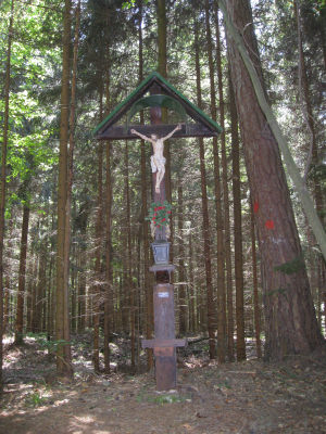
Date of construction. 19GH =G,H
Final stage - Cache
Follow the trail until you reach the stone at the yellow triangle #5 on your map. Take a seat and solve the following, really difficult calculation.
N47 0F.(E-G)(A+1)D
E015 20.(D+2)(B-C+2)(H-A-1)
Note: No multiplications.
There are spoiler pictures available. Take care - there are thorns near the cache location and the cache box!
Good luck.
Afterwards
You can just follow the blue trail back to the header coordinates. Or you can extend your walk and continue along the yellow trail and find out more about Arnold S.
I had planned to hide a traditional cache near castle "Oberthal" (green poi #4), but unfortunately it is on private property with no-entry signs.
DEUTSCHE BESCHREIBUNG
Arnold S? Wer? Wer ist dieser Typ??
Geniesse eine Wanderung durch eine nette Region und finde mehr heraus über das Leben dieser geheimnissvollen Person.
Vielleicht findest du auch Hinweise zum Geheimnis seines Erfolgs?
Aber auch wenn nicht findest du immerhin einen Geocache.
Approach
Auto: Es gibt Parkplätze in der Nähe der Headerkoordinaten. Wenn du von Graz kommst, fahr nach Thal, dann links bergauf gleich nach der Ortstafel.
Öffentliche Verkehrsmittel: GVB Bus #48 "Goesting - Thal" (Fahrplan) bis zur Station "Thal-Kirchberg" oder "Thalkreuz".
Fahrrad: Radweg R39 "Thaler Radweg". Von Graz nach Norden entlang der Westseite der Mur bis zum Punkt wo der R2 Radweg das Murufer verlässt. Dann folge den Schildern R2/R39 nach Westen; du kommst an einem grossen Interspar vorbei. Bei einer Kreuzung unweit der Headerkoordinaten gibt es zwei Möglichkeiten. Entweder der Strasse geradeaus nach "Thal" folgen oder weiter entlang dem Radweg bis zu den Koordinaten N47° 04.488 E015° 21.839. Hier ist die Fahrt zu den Headerkoordinaten zwar nicht erlaubt, aber ich bevorzuge dennoch diesen Weg als die Hauptstrasse nach Thal zu benutzen. Hinweis: Obwohl es möglich ist, den ganzen Weg dieses Caches mit dem Rad zurückzulegen, sei darauf hingewiesen, dass das auf einigen Abschnitten der Strecke nicht erlaubt ist.
Now what?
Bei den Headerkoordinaten findest du eine Box mit kostenlosen Karten des Wanderwegs, dem wir folgen werden - zusammen mit anderen interessanten Informationen über die Region und unsere mysteriöse Person Arnold S.
Nimm eine - es wird dein Reiseführer sein!
Wir werden dem blauen Wanderweg folgen. Du wirst blaue Pfeile und blaue Markierungen entlang des Weges sehen.
Wenn es keine Karten mehr gibt kannst du diese hier ausdrucken, aber du wirst allerdings dabei um viel Information umfallen. Eine vollständige Variante ist ebenfalls verfügbar. Weiters gibt es ein einseitiges Informationsblatt.
Stage 1 - Church
N 47° 04.584 E 015° 21.690
(Grüner Point of Interest #1 auf deiner Karte)
Eine wirklich interessante Kirche, oder? Sie wurde von Ernst Fuchs designt, mehr Information findest du in deinem Reiseführer (Karte) oder online.
Die Pfarre wurde erstmals 1322 erwähnt und befand sich bei der Burg "Unterthal" (Stage 2). 1772 wurde die Kirche in eine Kapelle auf einem nahen Hügel übersiedelt. Aufgrund der steigenden Bevölkerungszahl wurde die alte Kirche zu klein und wurde daher in den Jahren 1992-1994 erweitert.
Wieviele rote Lampenmasten mit Bänken davor befinden sich rund um den Platz vor der Kirche? = A
Stage 2 - Ruin Unterthal
N 47° 04.359 E 015° 21.787
(Grüner Point of Interest #2 auf deiner Karte)
Diese Burg wurde Mitte des 13. Jahrhunderts erbaut. Einer der ältesten Teile der Burg ist der Turm mit einer Wandstärke von mehr als 1,5 Metern. Hier war früher der Standort der Kirche bis sie auf einen nahen Hügel verlegt wurde (Stage 1). In 1996 wurden Teile der Ruine renoviert.
Addiere alle Ziffern der Hausnummer der Ruine (weisser Turm) und multipliziere das Ergebnis mit 9. =B
Stage 3 - House of Birth
N 47° 04.329 E 015° 21.764
(Grüner Point of Interest #3 auf deiner Karte)
Gleich neben dem Geburtshaus ist ein anderes (gelbes) Gebäude mit einem ovalen Schild welches Auskunft über den Namen und Zweck dieses Gebäudes gibt. In der Mitte steht ein einzelnes Wort (9 Buchstaben), übersetze den ersten Buchstaben in eine Zahl (A=1,B=2). =C
Update Jan 2013: Das Schild dürfte verschwunden sein; es lautete "Reichsgräfliche herbersteinische FÖRSTEREI Thal", C=6.
Stage 4 - Lake
N 47° 04.291 E 015° 21.979
(Gelbes Dreieck #2 auf deiner Karte)
Dieser künstliche See wurde 1920 für die Eisgewinnung zu Kühlzwecken angelegt. Fünf Jahre später wurde er von Hans von Reininghaus zu einem Platz der Erholung ausgebaut.
Gleich neben einem grossen Stein ist ein Pfosten mit zwei Tafeln der Wanderwege. Addiere alle Zahlen am obersten Schild "Alt-Eggenberg". =D
Stage 5 - Wayside shrine
N 47° 03.400 E 015° 20.722
(Nahe des gelben Dreiecks #4 auf deiner Karte)
In welchem Jahr wurde dieses Objekt erbaut? 18EF =E,F
Ich habe Wegpunkt N47° 04.001 E015° 20.376 eingefügt, da es aussieht, wie wenn an dieser Abzweigung ein Hinweisschild fehlen würde. Aber mit Hilfe der Karte sollte man diese Abzweigung sowieso nicht verfehlen können..
Stage 6 - Wayside commemorative cross
N 47° 04.185 E 015° 20.718
(Im Wald am Weg zum gelben Dreieck #5 auf deiner Karte)
Datum der Errichtung. 19GH =G,H
Final stage - Cache
Folge dem Wanderweg bis du den Stein beim gelben Dreieck #5 auf deiner Karte erreichst. Nimm Platz und löse die folgende, wirklich schwere Rechnung.
N47 0F.(E-G)(A+1)D
E015 20.(D+2)(B-C+2)(H-A-1)
Hinweis: Keine Multiplikationen.
Es sind Spoilerbilder verfügbar. Achtung - es gibt Dornen in der Nähe des Versteckplatzes und der Cachebox!
Viel Glück.
Afterwards
Du kannst natürlich einfach dem blauen Wanderweg weiter zurück zu den Headerkoordinaten folgen. Oder du kannst deine Wanderung erweitern und entlang des gelben Wegs mehr über Arnold S. herausfinden.
Ich hatte geplant einen Tradi in der Nähe des Schlosses "Oberthal" (grüner POI #4) zu verstecken, aber leider befindet es sich auf Privatgrund mit Eintritt-Verboten Schildern.
Additional Hints
(No hints available.)
Treasures
You'll collect a digital Treasure from one of these collections when you find and log this geocache:

Loading Treasures