Cesko – bavorský
geopark
tep Zeme v srdci Evropy
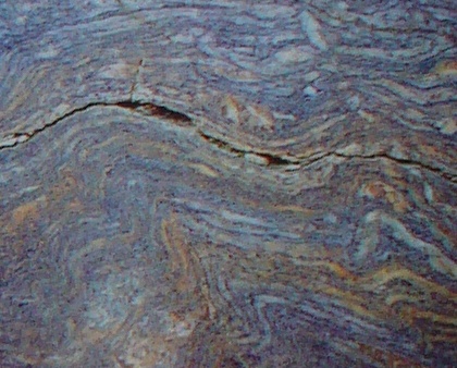
Cesko – bavorský geopark je ukázkovým územím s projevy stovky
milionu let trvajících geologických procesu podél významné
struktury tzv. oherského prolomu. Tato príkopová propadlina je
geologicky nejaktivnejší oblastí Ceského masivu. Ackoliv
nejmohutnejší geologické projevy v ní ustaly pred peti
miliony let, pretrvávající tektonika, vulkanismus, vysoký tepelný
tok, vývery termálních vod i seismická aktivita nadále lákají
pozornost laiku i specialistu. Geologické jednotky lemující prolom
dokumentují pres 600 milionu let starou historii Zeme a její
neobycejné nerostné bohatství. Všechny tyto procesy daly tvár
dnešní krajine, která je naším domovem. Naucme se jí chápat!
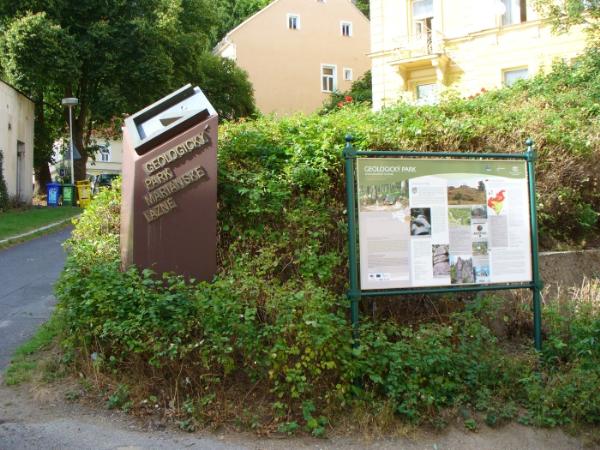
Geologický park
Zatímco s ukázkami zvláštních,
atraktivních, exotických ci jinak zajímavých minerálu a hornin se
lze seznámit ve vetšine muzeí, druhy bežne se vyskytující se kolem
nás v expozicích obvykle zastoupeny nejsou. A práve ze snahy
ukázat „obycejné kameny“ v trochu jiném svetle vznikl
mariánskolazenský geologický park.
V letech 1986-1987 byly postupne v terénu odebírány
vybrané ukázky hornin a po nezbytných úpravách instalovány na
vybraná místa. V léte 1988 byl geologický park jako jediná
expozice svého druhu ve strední Evrope otevren. Soucasne byl
natocen i krátký dvacetiminutový film dokumentující stavbu
geologického parku, který je ke shlédnutí v mestském
muzeu.
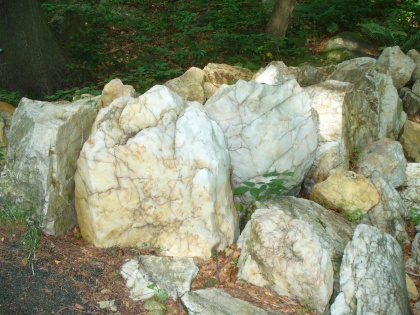
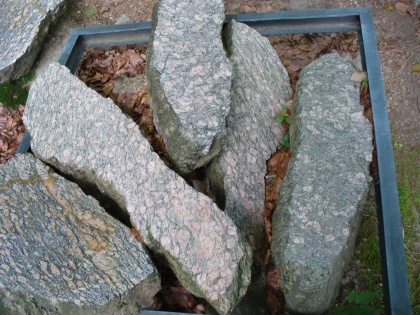
Jednotlivé ukázky hornin jsou predstaveny nejen v prírodním
neopracovaném stavu, ale casto mají vyleštenou plochu. Možná tak
prekvapí, jakou neobycejnou krásu muže v sobe skrývat i
obycejný kámen, po kterém denne šlapeme. Odborník ocení vnitrní
stavbu hornin, jejich struktury a textury. Vzorky Slavkovského lesa
mužete shlédnout na ploše skoro 10 hektaru – podél upravených
lesních cest je umísteno 316 horninových bloku, nejvetší
z nich váží pres 16 tun.
Nejen s geologickými zajímavostmi podrobne seznamuje 26
informacních tabulí instalovaných na úpatí prírodní rezervace
Žižkuv vrch. Pujdete-li tedy dále sítí cesticek s lavickami
zvoucími k odpocinku i rozjímání, pak se zde ve volné prírode
uprostred bukového lesa stanete návštevníky jedinecné expozice
v prírode GEOLOGICKÉHO PARKU.
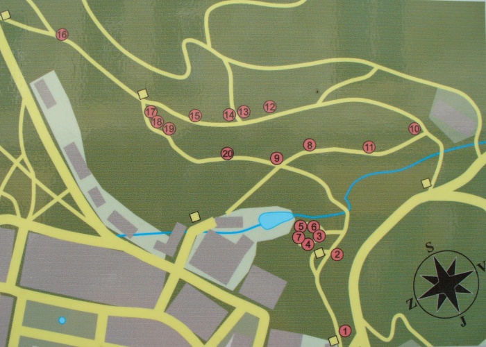
Vaše úkoly:
Ke splneni ukolu bude nutne projit skoro celou trasu a na nize
uvedenych zastavkach najdete nektere odpovedi na nase otazky.
Zbytek najdete na internetu. Velmi nas potesi, kdyz k logu
pripojite fotografii kamene ktery se vam nejvic libil.
|
Zastavka 07 - Kremenna zilovina
Jaky mineral vyplnuje pukliny na vystavenych ukazkach? A jake je
jeho chemicke slozeni?
N49 58.750 E12 42.444 |
|
|
Zastavka 08 - Biotiticka ortorula
Kde najdete velke teleso ortorul?
N49 58.792 E12 42.429 |
|
|
Zastavka 12 - Erlan
Co predstavuji modrave pasky na fotografii kremene na informacni
tabuli
N49 58.825 E12 42.408 |
|
|
Zastavka 17 - Cedic
Jak vznikaly cedice? a nezapomente prilozit vasi fotografii s
GPS a cedici
N49 58.808 E12 42.277
|

|
Czech – Bavarian Geopark
Earth’s Pulse in the Heart of Europe
The Czech-Bavarian Geopark, situated along the important Ohre
Rift structure, is an example of an area with occurrences of
geological processes lasting hundreds of millions of years. This
tectonic trench is the most geologically active area of the
Bohemian massif. Altrough the strongest geological processes ceased
five million years ago, the remaining tectonics, volcanism, high
heat flow, thermal springs and seismic activity still attract
amateurs and experts alike. Geological units bordering on the
trench valley demonstrate the over 600 million year history of the
Earth and its exceptional mineral resources. All of these processes
created the landscape that is our home today. Let us learn to
understand it!
The Geological Park
Although it is possible to view unique, attractive, exotic or
otherwise interesting minerals and rocks on display in the majority
of museums, the types that commonly occur in our surroundings are
usually not part of the exhibits. The Marianske Lazne Geological
Park was created precisely for the purpose of displaying the
„common stones“ in a different light.
In 1986-1987, selected rock samples were gathered in the field
and, after necessary preparation, installed in chosen areas. In the
summer of 1988, the geological park opened as the only exhibit of
its kind in Central Europe. At the same time, a short twenty minute
film documenting the building of the geological park was made,
which can be viewed as the Town Museum.
The individual samples of rock are displayed not only in their
naturally occuring and extraordinary beauty lies hidden even in
common stone, which we walk on everyday.
A scientist knows and appreciates the value of the rock fabrics
composition, its structure and texture. For your viewing pleasure,
the rock samples of the Slavkovsky les Mts. Are situated in area of
almost 10 hectares – 316 block of rock, the largest weighing more
than 16 tons, are placed along groomed forest paths.
The 26 educational signs installed at the foot of the Zizkuv Vrch
Hill Nature Reserve present detailed information of interesting
items and geological facts. By continuing along the network of
paths with its benches, offering a chance to rest and contemplate
out in the open nature amind a beech wood forest, you will witness
the unique natural exhibit offered by the GEOLOGICAL PARK.
Your task:
To fulfil the task it will be necessary to walk through the
entire route and at the following stops you will find some answers
to our questions. The rest of answers you will find on the
internet. We will be pleased if you attach photo of your favourite
mineral to your log.
|
Site 07 - Quartz gangue
Which mineral fills the cleft in exposed demonstrations ? And
what is its chemical structure ?
N49 58.750 E12 42.444 |
|
|
Site 08 - Biotite orthogneiss
Where do you find big mass of orthogneisses ?
N49 58.792 E12 42.429 |
|
|
Site 12 - Erlan
What means bluish stripes on the photography of quartz placed on
infoboard ?
N49 58.825 E12 42.408 |
|
|
Site 17 - Basalt
How was basalt formed ? And don't forget to attach your photo of
basalt with GPS .
N49 58.808 E12 42.277
|
|