WELCOME TO BLACK MOUNTAIN
Black Mountain is a stop on the 300 plus mile(when finished)Cumberland Trail, stretching from Cumberland Gap National Park (KY) South to Chickamauga Chattanooga National Military Park.
Black Mountain has so many geological features that I chose the whole mountain to be an Earthcache. Features include standing stones, arches, rockhouses, caves, and so much more. Black Mountain is part of the Cumberland Plateau which is actually the southern part of the Appalachian Plateau. To break it down even further, Black Mountain is part of Walden Ridge. The predominant rock here is sandstone which is a sedimentary rock. These rocks come from the Mississippian (318 to 359 MYO) and Pennsylvanian (318 to 299 MYO) geological age and are composed of near shore sediments washed westward from the Appalachian Mountains. Millions of years of erosion has produced the wonders you are about to explore.
There is a 1.5 mile loop trail that intersects the main Cumberland Trail. For those who aren't thru hikers, there is a large parking lot for the loop trail. The loop trail is where you will get most of your information for this Earthcache. Below is a map of the loop trail.
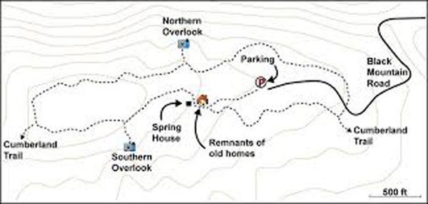
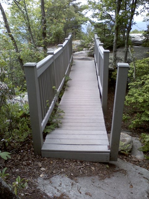
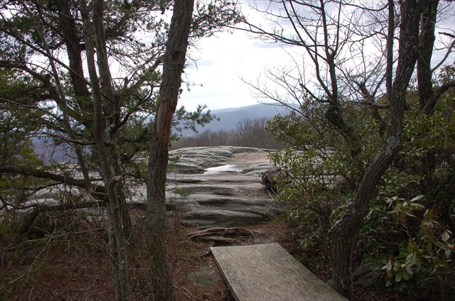
The coordinates above will take you to the southern overlook. Below is a couple of pictures of the overlook.
To claim this Earthcache you will need to complete three tasks.
1) Take a picture of yourself or group at he coordinates (overlook)
2) Name the mountain range you see in the distance (if cloudy or hazy you will need to look at a topo map
3) You must find another geological feature (examples given above) and take your picture (face and gps) at this feature. In the photo caption I want what kind of feature it is and the coords. You may NOT use the nearby Black Mountain Spring Earthcache to fulfill this requirement.
4) Using the profile link above, I want you to eamil me in your own words how you think this feature formed. I want you to describe which erosion process you think formed it. This is a 3.5 difficulty for a reason. I don't want answers like "Harry Potter made the arch" or "A big dinosaur took a bite out of the rock to make the rockhouse".
I've included a couple of pictures below of my kids at various features near the lookout. Mia (Pretty Little Monster) is 5yrs old and Cory (cj10) is 15. This cache is kid friendly if the parents have common sense and control of their kids. There are high cliffs where one could fall to their death so if you have wild ones, put'em on a leash or just by-pass this one!


This cache CAN NOT be done at night. You DO NOT need to be any where near the coordinates at night as this would be extremely dangerous!! Please be safe and enjoy this geological wonder
