Welcome to
Project Smiley - A series of caches dedicated to the fun side of
Geocaching. I will provide the eyes, nose and mouth,and visitors
are encouraged to complete the outside circle using the containers
and instructions in the 'Keimzelle' seed cache - This will result
in a smiley nearly 3km wide, similar to the
following:
"Have a break..." ist ein angenehmer 6km Familienspaziergang von
Gültlingen nach Holzbronn und zurück mit super Aussicht über
Gültlingen und das Nagoldtal. Er führt vorbei an einer örtlichen
Baumschule, einem Gestüt, einem Tennis Club und einer Firma die
Schneidemaschinen herstellt. Ihr könnt geteerten Straßen folgen,
bis auf eine 100m lange Schotterstraße in der Nähe des Startpunktes
und ca. 300m Graspfad kurz vor dem Final. Der Final befindet sich
unter einer Bank auf einer privaten Baumwiese (im Besitz der
Familie). Auf der Bank könnt Ihr den Cache loggen und die Aussicht
genießen. Bitte benutzt die Feuerstelle nicht da wir dafür zuerst
die Feuerwehr anrufen müssen.
"Have a break
..." is a pleasant 6km family walk from Gültlingen to Holzbronn and
back, with super views over Gültlingen and the Nagold valley. It
passes the local tree nursery, a horse breeding farm, a tennis club
and a company that produces cutting machines. You can follow tarred
paths all the way except a 100m section of gravel road near the
start and a 300m grass track just before the final. The final is
under a bench in a private apple orchard (owned by the family)
which you can use to log the cache while enjoying the view. Please
don't use the bonfire as we have to ring the fire brigade
beforehand!
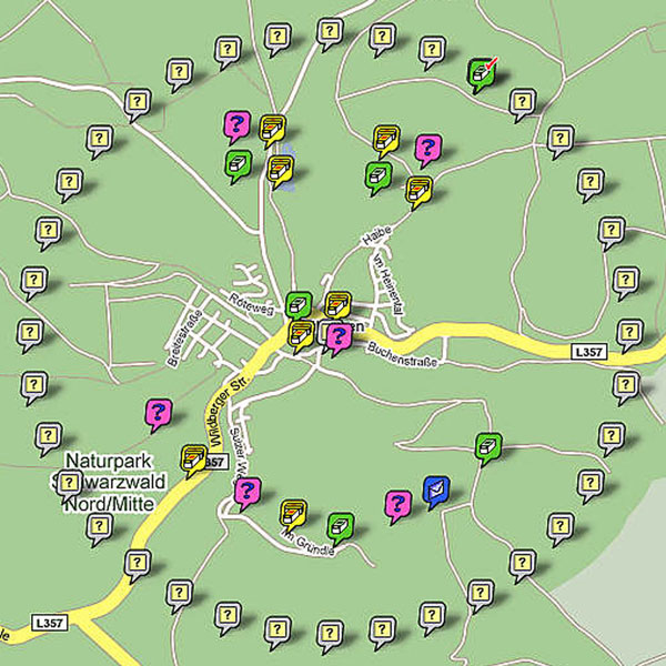
Parkt in der
"Röteweg" die an den gegebenen Koordinaten
beginnt.
Park in the "Röteweg" which starts at the given coordinates.
Stage 1:
Verkehrszeichen.
Signs @ N48° 39.037 E8° 46.275
A = Anzahl
der Räder auf dem/den
Zeichen
A = Number of wheels on the sign(s)
Geht die kurze
Straße, die bei Station 1 beginnt, nach unten. Unten angekommen
wendet Ihr Euch nach rechts und sucht den Namen der Straße.
B = Position des ersten Buchstaben des Straßennamens im Alphabet.
A=1, B=2,
...
Walk down the short road that starts at Stage 1. Turn right at the
bottom and look for the name of this road.
B = Position in the alphabet of the first letter of the road name.
A=1, B=2, ...
Folgt der Straße
bis zum Ende
zu...
Follow this road to the end to ...
Stage 2: "Baumschule" @ N48° 39.079 E8°
46.092
C = Die
Hausnummer der Baumschule 20m zu eurer
Linken.
C = The house number of the "tree school" 20m to your left.
Ihr könnt entweder der Schotterstraße
(welche zum Graspfad wird) folgen oder nach 200m rechts abbiegen
und der geteerten Straße folgen
nach...
You can either keep going along the gravel track (which becomes a
grass track) or turn right after 200m and follow the tarred road
round to ...
Stage 3:
Gestüt. Horse
farm @ N48° 39.094 E8°
45.590
Hier gibt
es eine Holztafel die den Namen des Gestüts sowie des Besitzers
anzeigt. Dazwischen ist ein Wappen mit einem einzelnen Buchstaben
darin.
D = Position des einzelnen Buchstabens im Wappen auf der
Holztafel. A=1, B=2,
...
There is a board showing the name of the horse farm and the owner.
In between is a crest with a single letter in it.
D = Position in the alphabet of the single letter on the sign. A=1,
B=2, ...
Stage 4: Bank und
Schild. Bench
and sign @ N48° 39.330 E8°
45.315
Genießt
die Aussicht von der Bank aus (die wilden Blumen die hier im Juni
wachsen sind einen eigen Besuch wert). Gleich um die Ecke befindet
sich ein hölzernes Schild mit einem Straßennamen.
E = Anzahl der Buchstaben des hölzernen
Straßennamens.
Enjoy the view at the bench (the wild flowers here in June are
worth an extra visit). Just round the corner is a wooden sign with
a road name.
E = Number of letters in the wooden road name
Folgt der geteerten Straße die nach links
führt...
Follow the tarred road going to the left ...
Stage 5: Tennis Club @ N48° 39.457 E8°
45.215
Addiere
die Ziffern der Hausnummer.
F = Summe der Ziffern der Hausnummer des Tennis
Clubs.
Add the digits of the house number.
F = Sum of digits of the tennis club house number
Stage 6:
Firmenschild.
Factory sign @ N48° 39.594 E8°
45.124
G =
Position des ersten Buchstabens des Firmennamens im Alphabet. A=1,
B=2,
...
G = Position in the alphabet of the first letter of the company
name. A=1, B=2, ...
Von gegenüber der Straße habt Ihr einen
super Ausblick über das Nagoldtal. Falls es trocken ist, geht
geradeaus weiter auf dem Graspfad bis zum Ende wo Ihr rechts
abbiegt auf was ich als "Holzbronn Sonntag-Spaziergang" nenne da
dieser Weg von den ansässigen bei gutem Wetter gerne genutzt wird.
Falls es sehr nass ist, könnt Ihr links abbiegen und einem
Schotterweg entlang der Grundstücke gehen und unten dann ebenfalls
rechts abbiegen. Wenn Ihr der Straße folgt und bei der Bank rechts
abbiegt, kommt Ihr
zu....
Just across the road there is a super view of the Nagold valley. If
it is dry, walk straight on along the grass track until you reach
the end where you turn right onto what I call the "Holzbronn Sunday
walk" as it is very popular with the locals in good weather. If it
is very wet you can turn left and follow a gravel track down at the
edge of the houses, also turning right at the bottom.
Following the road and turning right at the bench you end up at
...
Stage 7:
Wanderwegweiser.
Walking sign @ N48° 39.722 E8°
45.657
H = Die
Entfernung nach Gültlingen von
hier
H = Distance to Gültlingen from here
Geht weiter
entlang der Straße und folgt der Linkskurve, die Euch zur
Hauptverbindungsstraße zwischen Gültlingen und Holzbronn führt.
Seid vorsichtig beim Überqueren von Straßen! Auf der anderen
Seite, 75m entlang der Hauptstraße führt ein Pfad zurück zu Station
6. Nach weiteren 75m geht links auf den Graspfad und folgt ihm
hinunter und wieder hinauf bis Ihr eine Schotterstraße erreicht.
Dann sucht
den...
Carry on down the road following the left turn which brings you to
the main road between Gültlingen and Holzbronn. Careful
crossing! On the other side 75m down the main road is a track
going back to Stage 6. After another 75m turn left onto a grass
track and follow this down and up again until you reach a gravel
road. Then look for the ...
Final @ N48° 39.PQR E8° 45.XYZ
PQR = 6 + 20*(A+B+D+H) & XYZ = 6 +
20*(A+B+C+D+E+F+G+H)
!! Vergesst nicht, Euch die Bonus Nummer welche sich im
Cachecontainer befindet zu notieren. !!
!! Don't forget to make a note of the
Bonus number included in the cache container !!
Auf Eurem Weg zurück kommt Ihr vorbei
an:
On the way back you go past:
Genießt die Wanderung :o)
Enjoy the walk
:o)
Auf dem Weg zurück, könnt Ihr helfen, den Kreis
des Smileys zu vervollständigen indem Ihr folgenden Cache
besucht:
After logging this cache you can help complete the Smiley outer
circle by visiting
Many thanks to BlackforestMarty for the
translation to German :o)