Humphrey Head is a limestone headland in Morecambe Bay. A headland is an area of land adjacent to water on three sides. A large headland may also be called a peninsula. Long, narrow and high headlands may be called promontories. When headlands significantly affect the ocean currents they are often called capes.
A headland is a section of land that juts into the sea from the main land coast line. Headlands are shaped by erosion. They are formed when the sea attacks an area of the coastline consisting of alternating bands of hard and soft rock. The bands of soft rock such as sand and clay, erode more quickly than those of more resistant hard rock such as chalk. This would form a headland.
Limestone is a sedimentary rock composed largely of the mineral calcite (calcium carbonate: CaCO3). The deposition of limestone strata is often a by-product and indicator of biological activity in the geologic record. Calcium (along with nitrogen, phosphorus, and potassium) is a key mineral to plant nutrition: soils overlying limestone bedrock tend to be pre-fertilized with calcium. Limestone is an important stone for masonry and architecture, vying with only granite and sandstone to be the most commonly used architectural stone. Limestone is a key ingredient of quicklime, mortar, cement, and concrete. The solubility of limestone in water and weak acid solutions leads to important phenomena. Regions overlying limestone bedrock tend to have fewer visible groundwater sources (ponds and streams), as surface water easily drains downward through cracks in the limestone. While draining, water slowly (over thousands or millions of years) enlarges these cracks; dissolving the calcium-carbonate and carrying it away in solution. Most well-known natural cave systems are through limestone bedrock.
In order to claim this Earthcache please do the following tasks.
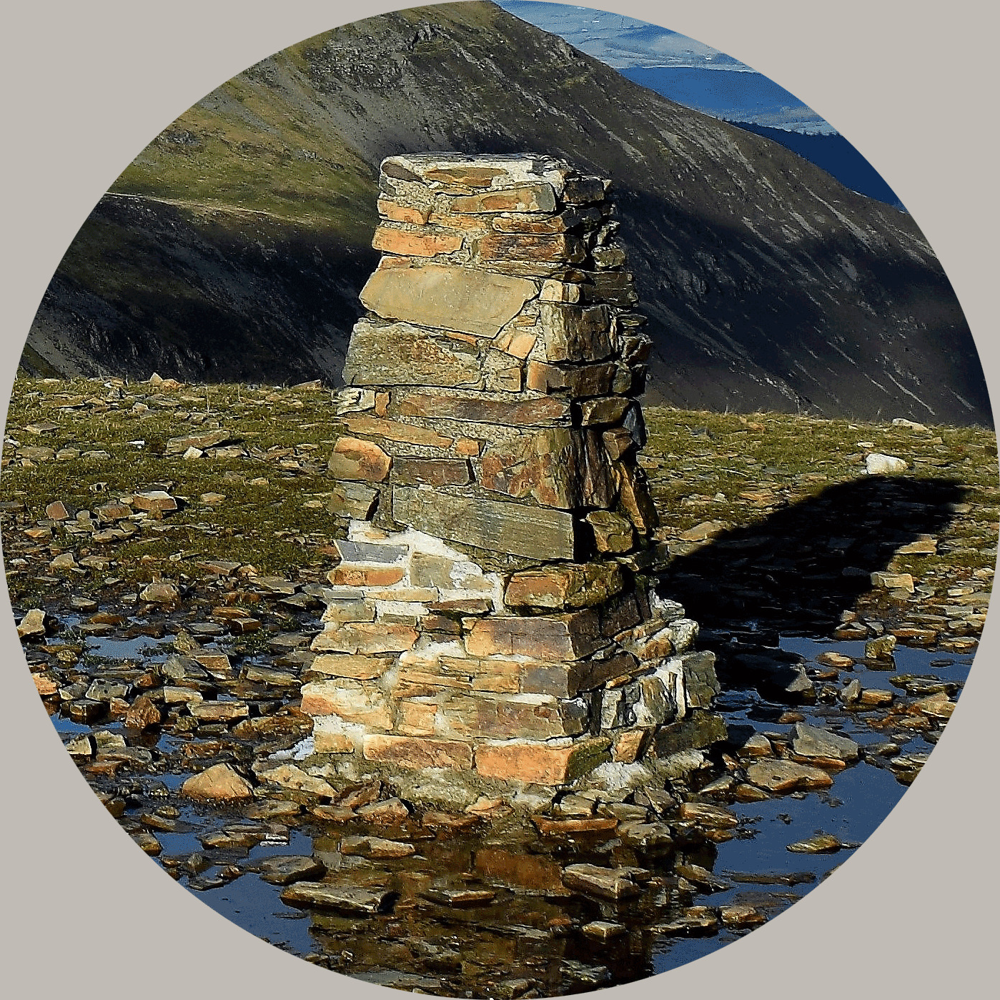
1) Take your picture at the trig point at the top of Humphrey Head
2) At the GZ you should see a small limestone pavement. Tell me the width of the gryke.
3) Name some aspect of the wildlife you have seen on your journey,
Remember to look out for the limestone arch if you can.
 <>
<>
About Ye Ole Survey Monuments
|
 |
Ye Ole Survey Monument (YOSM) is a captivating series of caches that pays homage to the remarkable legacy of OutForTheHunt's YSM series (GC45CC).
YOSM caches are strategically positioned at or near Trig Points. These triangulation stations have played a pivotal role as surveying landmarks, contributing to the mapping of expansive territories.
Some of these points, bearing historical significance, might now be situated on private land or have vanished with time. As a result, the caches are artfully placed in close proximity, reverently acknowledging the historical importance of these survey monuments.
|
More information, bookmarks and statistics can be found at the YOSM Website
If anybody would like to expand the Ye Ole Survey Monuments Series, please do.
I would ask that you request a number for your cache first at www.yosm.org.uk
so we can keep track of the numbers and names to avoid duplication