Since 1872 there has only been one earthquake centered in
Minnehaha County ever recorded. This occurred at 3:37 a.m. on
October 11, 1938 just outside of Sioux Falls. Residents were awoken
by the quake that measured 4.1 on the Richter scale. It affected
5000 square miles in the surrounding region, causing minor swaying
of loose objects, rattling dishes and windows, and jarring houses.
There were no injuries or deaths because of the quake and over 50
calls were made to that evening to the Sioux Falls police.
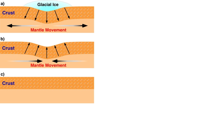
During the ice age, glaciers weighing millions of tons
compressed the earth’s crust; as they retreated, the crust
slowly began to rebound. In October 1938 the adjustment in the
crust suddenly released energy, the ground trembled, and vibrations
radiated out from the focus. This site is near the epicenter, the
point within the earth where energy was abruptly released.
Questions:
1.What did the earthquake measure on the Mercalli scale, and what
does the Mercalli scale measure?
2. What was the sceintific name the earthquake to occur in this
region?
3. Looking at this site is there any evidence of the
earthquake?
4. What is currently located at this site.
Please submit your answers and a photo of yourself or GPSwith the
surrounding area.(PHOTO IS OPTIONAL)