Idaho's first geocache
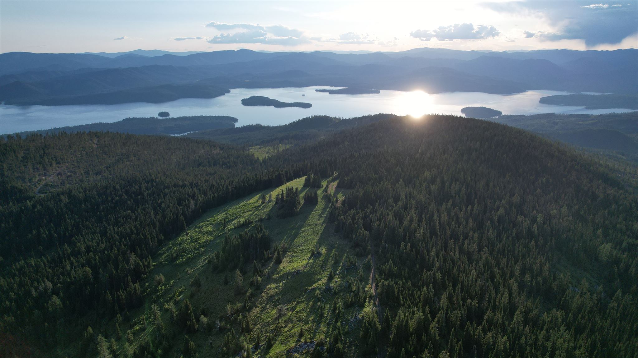
Aerial view over Camels Prairie (drone image courtesy of kootenay pirates)
| Season: |
Typically early June through late October (snow) |
| Driving distance: |
If you have a high-clearance vehicle that can make it up to the end of the rough and rutted Camels Prairie Road, then you can drive to within a couple of hundred yards/meters of the cache. This route is about 10 miles/6 km from the pavement of the East Shore Road, with most of that on good quality forest roads. Otherwise, you can park at the lower parking waypoint, which is approximately 8.5 miles/13.7 km from pavement. |
| Hiking distance: |
Just a couple of hundred yards/meters if you can drive up to the end of the Camels Prairie Road, or about 1.4 miles/2.3 km from the lower parking waypoint. |
Original description:
This stash is located near Priest Lake in the panhandle. It is a 5-gallon white bucket sunk into the ground with about 2 inches of the rim showing, and a lid labeled "GPS Stash." The stash site is located just off of a passable road near the summit, but those without a high-clearance/4x4 vehicle may want to park at the junction 1-1/4 miles below the stash site and walk the remaining distance. Overall, the stash is located about 10 miles off of the pavement.
Enjoy the hunt, and the spectacular views!
I have posted the route up to the cache from pavement on my personal Dropbox site in the following formats: