The Beginnings
When the ice melted in Alberta that signalled the end of the
last Ice Age over 10, 000 years ago, the landscape that remained
was empty and lifeless. Today the glacial drift that covered the
surface is largely hidden beneath thick, productive soils. On top
of these soils are found the plant and animal species that combine
to form the Natural Regions of Alberta. The climate that existed in
Alberta at the end of the Ice Age evolved to become the one that
exists today and is the single most important agent in the
establishment of Alberta's natural regions.
The Calgary Gravel and Ground Water EC -
CCARW10 is located along the boundary of two Alberta
eco-regions: the Grasslands; and the Parkland.
The Story of the Two Eco-regions
The Grasslands
Located in the south-central and south-eastern corner of the
province and comprises 14 percent, or approximately 30 million
acres, of Alberta's total natural landscape is a region referred to
as the Grasslands.
Alberta's grasslands are part of the Great Plains that stretch
from the Gulf of Mexico, through the United States and into
Canada's prairie provinces.
The Grassland Natural Region occupies a broad area of southern
Alberta and extends west to the Rocky Mountains and north to the
southern edge of the Parkland Natural Region in west and central
Alberta. The region is a flat to gently rolling plain with a few
major hill systems. Most of the bedrock is covered with extensive,
thick glacial till deposits. The diversity of the uplands is
increased by numerous areas of fine-textured materials laid down in
pro-glacial lakes and coarse-textured deposits in dune fields and
outwash plains, both of which are associated with pro-glacial lake
basins.
Rivers in the Grassland Natural Region are part of either the
Saskatchewan River or Missouri River systems. Where valleys are
carved deeply into bedrock, badlands have developed, notably along
the Red Deer River Valley. Numerous coulees and ravines are
associated with these river valley systems. Seven exposures of
igneous rock, all within the Milk River drainage, are the only
igneous exposures in the grasslands of western Canada. With the
exception of these isolated igneous outcrops, bedrock exposures are
all of sedimentary rock and commonly occur along stream
valleys.
The Parkland
Between the Grassland in the south and the Boreal Forest in the
north lies a subtle mosaic of aspen woodlands, fescue grasslands,
shrub-lands and wetlands on gently rolling landscape referred to as
the Parkland Region of Alberta.
This region comprises approximately 12 percent, or 37, 000 square
kilometres, of Alberta's territory and is considered to be an
eco-tone, or area of transition, as it is a region in which the
aspen groves are enveloped in a constant conflict with the
grasslands for supremacy.
The aftermath of the Ice Age is particularly evident in the
gently rolling blanket of moraines that overlay parts of this
region - an effect that was caused by the stagnation and melting of
the glaciers.
Remains of the Ice Ages - Gravel Deposits
The large gravel deposits found near this site are a common
geological feature, being formed as a result of the weathering and
erosion of rocks. The action of rivers and waves tends to pile up
gravel in large accumulations. This can sometimes result in gravel
becoming compacted and concreted into the sedimentary rock called
conglomerate. Where natural gravel deposits are insufficient for
human purposes, gravel is often produced by quarrying and crushing
hard-wearing rocks, such as sandstone, limestone, or basalt.
Quarries where gravel is extracted are known as gravel pits. The
north-west Calgary area possesses large concentrations of gravel
pits due to the widespread deposition of gravel in the region from
the Ice Ages.
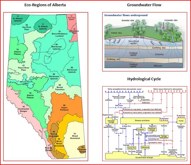
The Ground Water
In Calgary, we live in the Bow River basin. This tract of land,
extends from the Rocky Mountains, the City of Calgary, to the broad
prairies. In the basin, all waters flow to join the Bow River.
The city of Calgary lies at the junction of the Bow and Elbow
rivers, and deep down, there is a remarkable ground water flow. It
is so extensive that Calgarians refer to is as an
“underground river”. Calgary itself has over 4,000
water wells. When the new skyscrapers go up in the city centre, the
underground flow demands extensive pumping before the construction
can proceed.
Almost all the water in the Bow River comes from the Rocky
Mountains. This mountain chain causes the warm moist air to rise,
and in so-doing, these act as a rain shadow, and we receive little
precipitation here ( it used to be 16 inches in English, multiplied
be 2.54 to bring it to cms.) The water in the Bow comes chiefly
from the snow pack, that is dropped when the clouds are very high,
over the mountains. The Bow Glacier only contributes about 1% of
the river flow. Much of our water comes from the underground flow,
which joins the river itself. Numerous springs around the city are
seen. Because of these, there are many slumps in cliff sides about
our city.
Before the Pleistocene great Ice Age, before the KT catastrophe,
Alberta was under the Great Inland Sea. And as it dried up, this
area that was covered teemed with marine life. The land towards the
Rockies had many rivers and swamps. These decayed and their
remnants rotted to form the fossil fuels of Alberta. But before
they all went away, we had a huge dinosaur period here.
In the Glacial age, the Laurentide Ice Sheet, met the Rocky
Mountain glacier in a line that meets at Calgary, and goes parallel
to the Rockies. This Rocky portion brought down great rocks of
quartzite, the largest of which is the “Big Rock”,
south of Calgary . It is 9 metres high, 41 metres long, 18 metres
wide, and weighs 16,500 metric tonnes!
There is a string of these large mountain rocks in this course. The
Rocky Mountain ice sheet melted first, leaving a large lake next to
the Laurentide one, at what was then Lake Calgary.
Calgary has an active Groundwater Observation Network, where the
groundwater levels in the aquifers are measured. Some of these
wells are in the network to monitor the groundwater quality.
The Paskapoo aquifer, stretches from the northern part of
Calgary for about 100 kilometres, there are water wells and
springs, frequently along its course. It covers 10,000 sq, km. Of
the 600,000 groundwater wells in the prairies, over 100,000 are in
the Paskapoo formation. It is the largest single source of
groundwater there. Since this area is growing very rapidly in
population, moratoriums prevent new users from getting surface
licenses.

To log this EarthCache please complete the
following:
1. E-mail (do not post) the cache owner your estimate of the
height differential between the highest ridge top within two
kilometres to the east, and the lowest valley bottom visible from
the cache viewing site.
2. E-mail the cache owner (do not post) two visible landscape
characteristics that identify this area as potentially containing
rich gravel deposits.
3. Post a photo with your GPS in hand at the EarthCache
site.
Enjoy!
This cache has been placed for the CCARW10 event, held
May 1-2, 2010. This cache was released to the public on April 28,
but should not be located prior to noon, May 1. The caches for the
event are released early so that the caching community has an
opportunity to solve puzzles and plan their routes prior to the
event start.