Park Island #1: Zandvlei Hideaway

This is a replacement for cachecrusadR’s GCX5VN Vlei-watch which was placed on 16/7/06 and archived on 12/4/10 after some 4+ years of existence and 30 finds.
To reach the cache:
Park at the end of Park Island Way @ S34 05.332 E18 28.455 and enter through the pedestrian gate (open daily from 06h00-20h00). Follow your GPSr to the obvious location on the edge of the lagoon
The cache, a small flip-topped dispensing pot is hidden in this well-designed and located bird-watching hide.
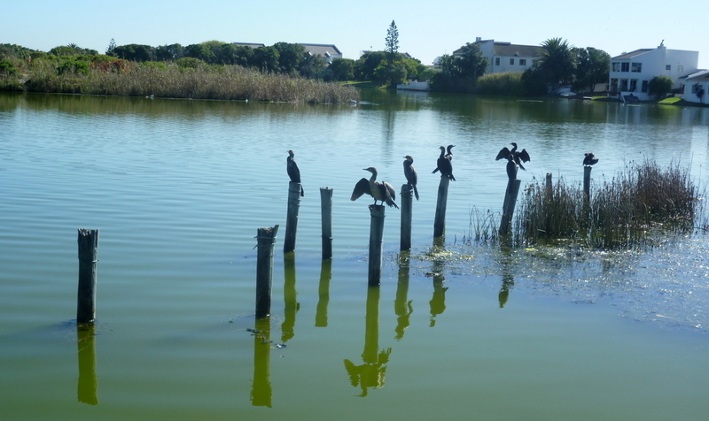 Zandvlei is a Category B (high importance) wetland, river system and estuary (of the Sand River) situated on the False Bay Coast near Muizenberg.
The natural lagoon is used for recreational purposes (sailing, canoeing, paddle skiing, windsurfing) with the Zandvlei Recreation Area on its western bank – a busy place on hot summer days! The Zandvlei Yacht Club is to the north of this as is the Naval Cadet/Sea Cadet training base and the Sea Scouts/Girl Guides base.
Other parts have been allocated as the Westlake Wetland Conservation Area, a marshland wildlife sanctuary at the north-western corner between the railway and the M4 road, and the Zandvlei Bird Sanctuary (at the northern end, accessed from Coniston Avenue) where some 130 species have been recorded. The nearby Rondevlei Nature Reserve has a species list of 226 (see here) recorded since it was established in 1952!
 The eastern side of the vlei is the location of a substantial housing development, Marina da Gama established in 1970 by the Anglo-American Corporation, with stylish townhouses built along a maze of water channels and on islands down the eastern side of the lagoon.
The level of the vlei (target 70cm above sea level) is carefully controlled by opening the mouth of the vlei where it crosses Muizenberg beach using a bulldozer to move the sand to each side of a channel which is created to allow the fresh water out when the levels get too high especially during the winter rainy season.
Numerous complex issues (see here) determine when this should be done (typically monthly at full and new moon). Because of the regular inflow of seawater at high tide, the water is part saline. Such salinity is necessary for preservation of fish and plant life in the lagoon.
However the mouth of the vlei is not opened during high use summer months as the water can be difficult to cross at high tide for people walking along Muizenberg beach.
The shoreline of Marina da Gama has artificial concrete linings which can be undercut if vlei levels are too low or backcut if the levels are too high - the critical water level variation is only +/- 0.3 meters!
Zandvlei is also the location of the Cape Town International Kite Festival hosted by Cape Mental Health. This is Africa’s biggest kite festival attracting over 20,000 visitors. See here for more details.
When I placed the cache there was a notice for a Saturday Craft Market from 09h00-14h00 at East Lake Island Shopping Centre - so if you would like to combine bird-watching, geo-caching and crafty shopping - take along some spending money and shopping bags as well as your GPS and binoculars! For this use an alternative parking spot on East Lake Island @ S34 05.379 E018 28.591. From here cross over the bridge to access Park Island Way and turn left to the Park Island entrance.