RIOS DE VIGO
LAGARES 1
Inicio esta serie de
caches que os quiere mostrar una parte de los ríos mas importantes
de la ciudad en unos puntos que suelen pasar desapercibidos,
comenzamos en el barrio de Cabral a orillas del principal río de la
ciudad el LAGARES
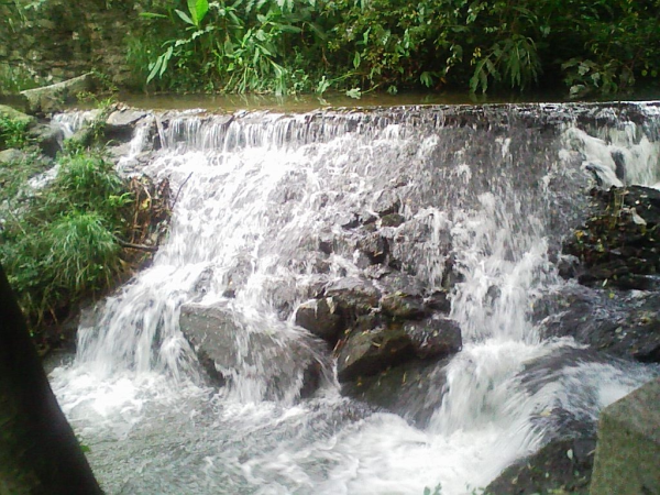
 Desde su nacimiento por la zona del
aeropuerto hasta su desembocadura en la playa de Samil, este rio
recorre varias parroquias y nos deja en sus orillas diversos
molinos de agua como este que mostramos, el muiño de
Severo.
Desde su nacimiento por la zona del
aeropuerto hasta su desembocadura en la playa de Samil, este rio
recorre varias parroquias y nos deja en sus orillas diversos
molinos de agua como este que mostramos, el muiño de
Severo.
Este molino vivienda
data aproximadamente del siglo XVIII, está parcialmente
reconstruído y pertenece al ayuntamiento de Vigo, este molino
consta de dos muelas y aún se puede apreciar los canales que
desviaban el agua para ponerlo en
funcionamiento.
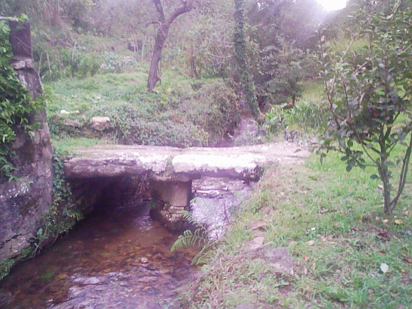
Enfrente se puede
encontrar el puente original formado por laxes (piedras), que
utilizaban los vecinos para moler el
maiz.
Se puede seguir el
sendero pegado al río hacia arriba hasta dar con una fuente, que es
mas o menos de esa fecha, pero no creo que sea potable, por si las
moscas no beber.
EL
CACHE
Se
trata de un pequeño tupper que contiene de inicio: logbook, lápiz,
afilalapiz y varios juguetes para los peques, el sitio es muy
tranquilo pero teneis que andar con ojo con la vivienda de
enfrente, ya que os pueden ver, si vais
con niños
pequeños, vigilarlosya que pueden caer al
río.
Prestar atención a la foto
spoiler y al aditional hint, ya que las coordenadas pueden bailar un
poco, y os doy otra pista, NO ESTA EN NINGUN
MURO.
ESPERO QUE OS
GUSTE
RIVERS OF
VIGO
LAGARES
1
Start this series of caches
that you want to show some of the major rivers in the city in a few
points that are often overlooked, started in the suburb of CABRAL
on the banks of the main river of the city
LAGARES
Since its
birth in the airport area to its mouth on the beach of Samil, this
river runs through several parishes and leaves us in its banks
several water mills like this that show the Muiño of
Severo.
The mill house
dating from about the eighteenth century, partially rebuilt, and
belongs to the city of Vigo, this mill has two wheels and you can
still see the channels that diverted water to make it
operational.
Opposite you can find the original bridge formed by
laxes (stones), used by neighbors to grind
corn.
You can follow the path up
stuck in the river until you find a source, which is more or less
of that date, but I do not think that it is safe, in case I do not
drink.
THE
CACHE
This is a
small tupperware containing Start: logbook, pencil, sharpener and
various toys for kids, the place is very quiet but you have to go
to eye with the home front, as you can see,
if you go with
children small, watch them as they can into the
river.
Pay attention to the photo and the aditional
hint spoiler, since the
coordinates can dance a little, and I give you another hint, NOT IN
ANY WALL.
I HOPE YOU
LIKE