IATCC - Balanced Rock EarthCache
-
Difficulty:
-

-
Terrain:
-

Size:  (other)
Please note Use of geocaching.com services is subject to the terms and conditions
in our disclaimer.

This is an Earthcache and as such there is no physical container to find at the listed coordinates, but rather an Earth science lesson to be learned. Failure to complete the logging requirements listed below may result in the deletion of your "Found it" log without notice.
Formation of the Rock
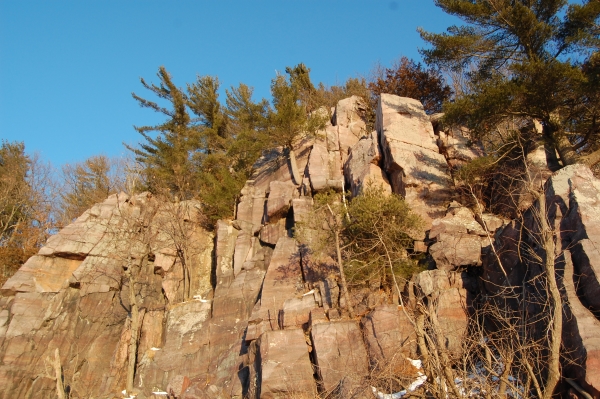
Approximately 1.85 billion years ago this area was covered by an ancient sea. For 200 million years the tributaries flowing into it carried quartz sand grains which were deposited in layers and cemented together, creating sandstone. A disturbance in the earth's crust occurred just to the south of here, about 1.65 billion years ago. The immense heat and pressure caused the sandstone to metamorph into Quartzite and uplift to create the Baraboo range. The layer of quartzite in this area is estimated to be over 4,000 feet thick. The pink to purplish colors are a result of iron and other colorants that were present in the sandstone.
Mechanical Weathering
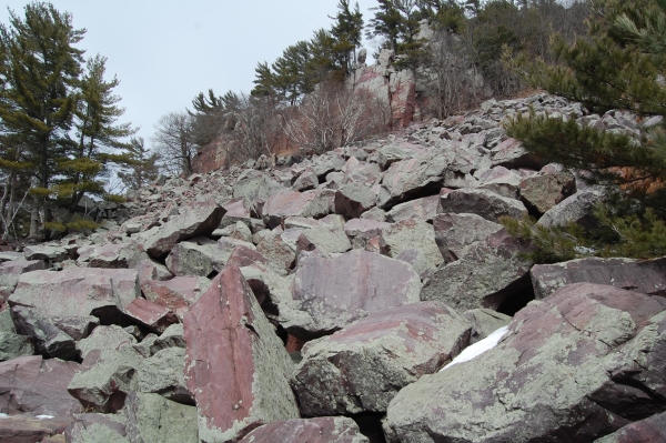
Beginning about one million years ago, at the onset of the Ice Age, extreme freezing and thawing cycles caused extensive fracturing of the exposed rock. The resulting debris is an accumulation of boulders of varying shape and size, called talus. This talus, sometimes referred to as scree, forms a pile at the base of the cliffs. The angle of the talus accumulation is referred to as the angle of repose and is a result of many factors including the particle size and shape, as well as the moisture content and durability of the rock.
Observing the Talus
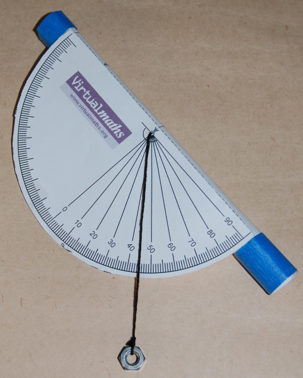
Various sources have estimated the angle of repose here as being between 20 - 35 degrees. Because of the varied size and angularity of the boulders, measuring the angle involves a degree of estimation. A device called a clinometer (or inclinometer) is used to measure slope and vertical angles. This simple, but suprisingly accurate DIY clinometer template will work great for measuring the angle of repose. Sight the clinometer along the slope you wish to measure and read the angle on the scale.
Logging Requirements
Park at the South Shore parking and proceed to the Balanced Rock Trail. While hiking up to the namesake rock formation, you will be walking among the talus and generally following the angle of repose. Complete the following tasks and email your answers to me - do not post them in your log.
1) Estimate the angle of repose. Use a clinometer, or any other technique you can devise, to measure the angle of repose. The boulder field will have high and low points - choose a line of sight to measure that is representative of the average angle.
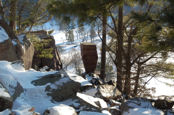
2) Estimate Balanced Rock's size. A rough estimate will do. Is it as tall as you are? Twice as tall?
3) Observe Balanced Rock and speculate if it is: a) talus - rock that has tumbled down the bluff and landed delicately balanced in it's current position, or b) not talus - it was once part of a much larger rock formation, the rest of which has broken away and become talus at the base of the cliff leaving Balanced Rock alone, waiting to become talus in the future.
The Devil's Lake State Park map will be a helpful resource when seeking this cache. A State Park sticker is required for all parked vehicles. The Geocache Notification Form has been submitted to and approved by Steven Schmelzer of the Wisconsin DNR.
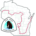
IATCC is the cache designation to highlight a series of EarthCaches along the Ice Age National Scenic Trail grouped into a special category called "COLDCACHE."
The Ice Age Trail is one of eleven National Scenic Trails designated by the National Park Service. This unique trail is entirely within the state of Wisconsin and follows along the terminal moraine of the most recent glacier.
This project is supported by the Ice Age Trail Alliance. The goal is to bring more visitors to the trail and promote public awareness, appreciation, and understanding of Wisconsin's glacial landscape. For those who have the Ice Age Trail Atlas, this site is located on map 61f.
More information on the Ice Age Trail Atlas, the ColdCache Project and Awards Program is available at http://www.iceagetrail.org/coldcache.htm.
Additional Hints
(No hints available.)