RIOS
DE VIGO
LAGARES
Vs
BARXA

Este
geocache pretende mostraros la desembocadura del segundo afluente
en
importancia del río lagares, el río
Barxa
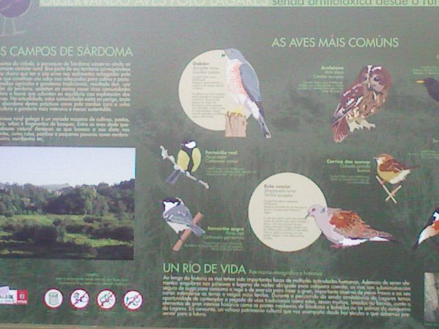
Nace
en los montes de Valladares, cerca del monte Alba, transcurre por
las
parroquias de Valladares, Beade, Castrelos y Sárdoma donde
desemboca, tras 5 kilómetros, en su recorrido nos muestra
varios molinos, en la zona de
Beade.
EL
CACHÉ
De
tamaño micro,
está colocado en el paseo del lagares, es un
contenedor
natural,
que solo sale
la
pieza de arriba,
ver la foto spoiler, contiene logbook, certificado FTF. ,
lápiz
y sacapuntas.
El
paseo es muy concurrido
tanto por paseantes como por ciclistas, haga el tiempo que haga,
ser
muy cuidadosos y procurar dejarlo
como estaba, bien encajado.
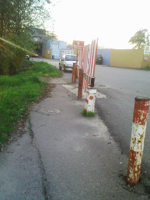
Dejo
dos waypoints, uno con aparcamiento, y el otro por el
polígono
industrial, este último aunque esté cerrado se puede
acceder sin problemas por el paso que está a su izquierda, el
sendero es público y en ningún momento os pueden
impedir el paso
espero
que os guste
RIVERS
OF VIGO
LAGARES
Vs
BARXA
This
geocache is intended to show you the mouth of the second
largest tributary of the River wineries, the river Barxa
Born
in the mountains of Valladares, near Mount Alba, runs through
the parishes of Valladares, Beade, Castrelos , and Sardoma,
where it ends after 5 Km in its route shows several mills in
the area of Beade.
THE
CACHE
Micro
size, is located on the promenade of wineries, is a
natural container, leaving only the top piece, see photo
spoiler, contains logbook, certificate FTF. , Pencil and
sharpener.
The
ride is very popular with walkers as both riders, then
the weather, be careful and try to leave it as it was
well embedded.
Left
two waypoints, a car park, and the other by the
industrial estate, the latter is closed but can be
accessed without problems for the step you are on your
left, the trail is public and at no time can you prevent
the passage