PT
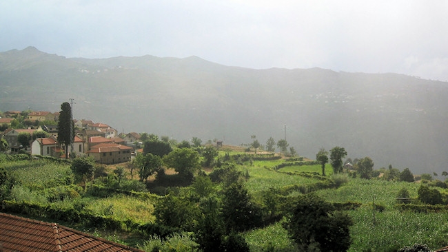
Esta é a mais fácil de um conjunto de três caches que mostram os
antigos caminhos rurais que durante centenas de anos serviram as
povoações destas regiões remotas do Douro.
EN
This is the easiest of three caches that shows the ancient rural
paths that for hundred of years served this rural comunities of the
Douro region.
 PT
PT
Dicas e Informações:
- Esta cache é a mais fácil das três. O ponto de partida para cada
uma das três caches ficam a poucos metros uns dos outros, por isso
o automóvel poderá ficar estacionado na berma da estrada e explorar
a zona a pé.
- A primeira coordenada mostra o inicio do trilho. As coordenadas
devem ser introduzidas pela ordem dada de modo a seguir pelos
percursos correctos.
- Seguir sempre pelos caminhos rurais (não entre em propriedade
privada) e quando houver encruzilhadas seguir na direcção das
coordenadas dadas.
1º ponto (inicio do trilho):
N 41° 02.920 W
08° 02.676
Introduzir a coordenada seguinte e seguir nessa direcção.
2º ponto:
N 41° 02.834 W
08° 02.784
Descer o trilho, não ter receio dos cães que se encontram
presos.
Pelo caminho terá uma fonte centenária onde poderá refrescar com as
águas destas montanhas...
Irá ter à Igreja que contém arte sacra de enorme valor, que poderá
visitar caso se encontre aberta.
3º ponto:
N 41° 02.820 W
08° 02.900
Continuar a descer até chegar a este ponto onde terá vistas para o
vale do Bestança de cortar a respiração...
4º ponto: Cache
N 41°
02.(863+N) W 008° 02.(878+N)
Para calcular a coordenada da cache, verificar a data na porta do
3º ponto. Pegar no número correspondente à década (19N9) e somar
esse número à coordenada indicada.
Se o ano fosse 1929 a coordenada final seria:
N 41°
02.(863+2) W008° 02.(878+2)
N 41° 02.865 W 008° 02.880
EN
Informations and Tips:
- This is the easiest of the LostTracks series. The start point for
each one of this three caches are few meters away from one another,
so you can leave your automobile in the road and visit all of
them.
- This first coordenate shows the beginning of the trail. The
coordenates should be introduced by the given order so you follow
the correct path.
- Always walk in the rural paths (don't enter privat property) and
in the crosspaths follow the given coordenates.
1st stage (trail start):
N 41° 02.920 W
08° 02.676
Introduce the following coordenate and follow that direction.
2nd stage:
N 41° 02.834 W
08° 02.784
Walk down the path, don't be afraid of the dogs.
You'll walk by an ancient fountain with fresh montain water.
Then you'll get to an old church with valuable religious art.
3rd stage:
N 41° 02.820 W
08° 02.900
Beautiful views to the Bestanca valley...
4st stage: Cache
N 41°
02.(863+N) W 008° 02.(878+N)
To calculate the final coordenate, check the date on the door of
the 3rd stage. Get the number refered to the decade (19N9) and sum
that number to the given coordenates.
If the year were 1929 the final coordenate would be:
N 41°
02.(863+2) W008° 02.(878+2)
N 41° 02.865 W 008° 02.880
Ab zrvb qr hznf ebpunf ab pnzcb qr pvzn. (aãb rfgá ab zheb)
Va gur zvqqyr bs gur ebpxf va gur hccre svryq (vg'f abg va gur jnyy)