Cape Þórðarhöfði Traditional Cache
tyndur: I do not live in the area anymore so it is impossible for me to maintain the cache. This cache needs frequent maintenance due to extreme weather conditions.
Please note Use of geocaching.com services is subject to the terms and conditions
in our disclaimer.
It is a nice 1 - 2 hour walk to the cache which is located nearby
the cliff of the cape Þórðarhöfði. The path lies through a rather
rough area so good shoes are desirable. There is no drinkable water
on the way so a bottle of water can also be a good idea. There is a
souvenir in the cache, so feel free to take one and leave one.
Many people mistake the cape Þórðarhöfði to be one of Skagafjörður
islands, but it is not an island. When you come closer you will see
there is a rough gravel ridge/isthmus lying to the "island".
 They are actually two but only one of them (the one further
north)is accessible, due to a river-mouth in the southern one.
There are several places where it is possible to park a car, one of
them is just beside the road, at N65°58.915 and W019°24.861. The
route is just under 6 km., from the given parking spot to the
cache. The path lies through a rather rough area so good shoes are
desirable. At first the path lies on a ridge/isthmus between land
and the cape.
They are actually two but only one of them (the one further
north)is accessible, due to a river-mouth in the southern one.
There are several places where it is possible to park a car, one of
them is just beside the road, at N65°58.915 and W019°24.861. The
route is just under 6 km., from the given parking spot to the
cache. The path lies through a rather rough area so good shoes are
desirable. At first the path lies on a ridge/isthmus between land
and the cape. 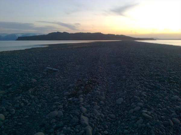 When the cape is accessed an area with rough tussock, heath and
ling welcomes you. There is no drinkable water on the way so a
bottle of water can be a good idea. The highest point of the cape
is 202 m. high and precipices are at the west side, facing the
fjord Skagafjörður. Be careful if you choose to go to the edge and
have a look, especially since the stones can be slippery and
unattached. The view up there is magnificent, especially in a good
weather or in the evening sun.
When the cape is accessed an area with rough tussock, heath and
ling welcomes you. There is no drinkable water on the way so a
bottle of water can be a good idea. The highest point of the cape
is 202 m. high and precipices are at the west side, facing the
fjord Skagafjörður. Be careful if you choose to go to the edge and
have a look, especially since the stones can be slippery and
unattached. The view up there is magnificent, especially in a good
weather or in the evening sun.
Additional Hints
(Decrypt)
Gurer vf n fznyy evqtr ng gur tvira cbfvgvba naq gur pnpur vf haqre n fgbar ng gur rnfg fvqr bs gur evqtr
Treasures
You'll collect a digital Treasure from one of these collections when you find and log this geocache:

Loading Treasures