| Koralleninsel vor
Okurcalar -
Mercan adadan Okurcalar-
Coral island off
Okurcalar

|
| Unweit des Strandes von Okulcalar befindet sich eine kleine
Insel, diese besteht zu 100% aus Korallengestein oder besser gesagt
Riffkalk.
Riffkalke werden durch Korallen, Schwämme und
andere riffbildende, aus Kalk bestehenden Meeresorganismen an
Küsten und in flachen Meeren gebildet. Korallenriffe
sind Bauten aus kalkabscheidenden Organismen und werden heute vor
allem durch Steinkorallen
gebildet. Die meist winzigen Steinkorallen haben die Fähigkeit, an
ihrer Basis Kalk abzuscheiden. Sie bilden im Laufe der Jahrtausende
meter- bis hundertemeter hohe Riffe. Die Riffkalke bestehen
teilweise auch aus Riffschutt, der durch die Meeresbrandung
oder Erdbewegungen entstand. Oft sind die Riffstrukturen, die die
Riffbildner erzeugt haben, in den Riffkalken noch erkennbar.
Dieses Insel ist warscheinlich ein kleiner Teil eines
Devon-Riff´s
|
|
Uzak olmayan
Okulcalar küçük
bir adanın plaja, bu 100 mercan kayalığı kalker kayaların% veya
daha iyidir.
Resifal kalkerler mercan, sünger ve kıyı
ve sığ
denizlerde kireçtaşı mevcut
deniz canlıları oluşan diğer resif
vardır. Mercan
resifleri kireçlenme ve organizmaların
binalarda çoğunlukla taş
mercanlar tarafından
üretilmektedir vardır.En küçük mercan kireç tabanında
yatırmak yeteneğine sahip.
Onlar metre
metre yüksekliğindeki kayalıklardan yüzlerce
binlerce yıl boyunca oluşturur.Resifal kalkerler
sörf ve toprak
hareketleri oluşturduğu Riffschutt, kısmen vardır.
Genellikle Riffbildner üretilen
resif yapıları hala
resifal kalkerler görülebilir.
Bu ada muhtemelen
Devoniyen resif
en küçük bir
parçasıdır.
|
Not far from the
beach of Okulcalar a small
island, this
is 100% of coral reef limestone
rock or
better.
Reef limestones are coral,
sponges and other reef-building
formed from
limestone existing marine organisms
in coastal and
shallow seas.
Coral reefs are buildings made of lime
deposits and organisms are being
produced mainly by stony
corals. The
most tiny
corals have the
ability to deposit at the base of
lime. They
form over the millennia to meter-high cliffs hundreds of meters. The reef limestones
are partly
from Riffschutt, formed by
the surf or earth
movements. Often
the reef structures that produced the
Riffbildner are
still visible in
the reef limestones.
This island
is probably
a small part of a
Devonian reef's
|
 |
|
Das Devon ist in der Erdgeschichte das vierte chronostratigraphische
System
bzw. die vierte geochronologische
Periode innerhalb des Paläozoikums.
Es begann vor etwa 416 Millionen Jahren und endete vor etwa 359,2
Millionen Jahren.
Dieses Gestein wurde in früher Zeit der Besiedelung dieser Küste
als Baumaterial abgebaut und über die damals noch vorhandene
schmale Felszunge an Land gebracht. Direkt auf der Insel sind sogar
noch Reste von Gebäuden und einer Zisterne zu finden, diese wurden
wohl damals von den Arbeitern genutzt.
Das Gestein wurde hier bis fast zum Wasserspiegel abgebaut und
dann wurde der Steinbruch aufgegeben.
|
|
Devon Paleozoik Dünya'ya
sistem kronostratigrafik veya
jeokronolojik dördüncü döneminde
dördüncü.
Bu 416
milyon yıl
önce başlayan ve 359,2 milyon yıl önce
sona erdi.
Bu taş
bir yapı
malzemesi olarak bu sahil yerleşim erken dönemde
ve mayınlı arazi
o dönemde var olan dar kayalık dil hakkında
getirildi. Doğrudan bina ve
bir sarnıç
kalıntıları ile adada bulunabilir, o zaman
muhtemelen işçiler tarafından
kullanılmıştır.
Kaya hemen
sonra su seviyesi
ve terk
edilmiş taş
ocağı için kadar burada mayınlı oldu.
|
The Devon is
the fourth in the
Earth system chronostratigraphic or
geochronologic the
fourth period in the Paleozoic.
It started about
416 million years ago and ended about
359.2 million years
ago.
This rock was
mined in the early
period of settlement of this coast as a building
material and brought about the then-existing
narrow rocky tongue of land. Directly on the island with the remains
of buildings and a
cistern can be found, then they were probably used by the workers.
The rock was mined here until almost to the water level and then
the abandoned quarry.

|
|
Das
Gestein
kaya
the
rock

|

|
|
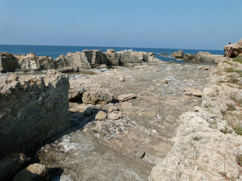
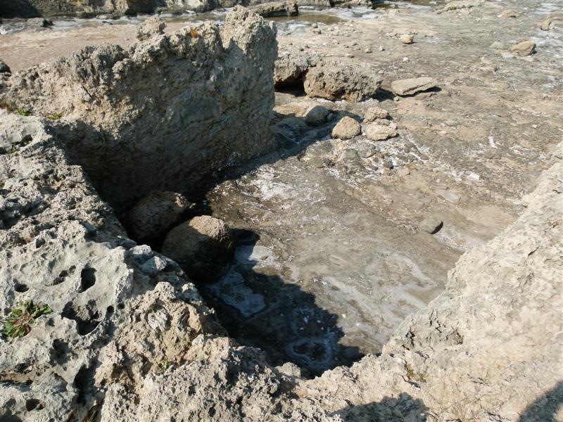
Auf dieser Insel findet man einige riesige Rechteckige Flächen
und Löcher.
Hier wurde Korallenstein abgebaut:
Wie bei einer archäologisches
Ausgrabungsgelände mit einem Raster auf dem Boden wurden in den
Korallenstein Rillen gehauen.
Mit Äxten schlugen die Männer nach einem
vorgegebenen Raster Rillen in den Korallenboden. Wenn die Rillen
tief genug waren wurde die obere Schicht abgetragen und wieder war
eine Lage Steine fertig.
So gruben sie sich Zentimeter um Zentimeter
immer tiefer in das Korallengestein.
|
Bu adada bazı büyük delikler
ve dikdörtgen
alanlar vardır.
Coral taş
burada mayınlı oldu:
Olduğu gibi katta bir kılavuz
ile bir
arkeolojik kazı mercan kaya oluklar halinde kesilmiştir.
Erkek mercan
katında önceden
belirlenmiş bir kılavuz
yivler eksenleri
ile savaştı.Oluklar
derin yeterli
olsaydı,
üst tabaka
tekrar kaldırılır ve
taş katmanı hazırdı.
Böylece mercan
kaya içine
inç derin
tarafından inç, kazdık.
|
On this island there are some huge
holes and
rectangular areas.
Coral stone was
mined here:
As with an archaeological excavation
site with a grid on the floor were cut into the coral
rock grooves.
The men fought
with axes to
a predetermined grid grooves in the coral
floor. If
the grooves were deep
enough, the upper layer was again removed and a layer of stones ready.
So they dug, inch by inch deeper into the coral
rock. |
|

und es entstanden solche Steine.
ve bu taşlar ortaya
çıkmıştır.
and there arose such stones.

Heute sieht das hier so aus:
Bugün burada görünüyor:
Today it
looks here:
besonders gut sieht man die Struktur des
Korallengesteins auf diesem Bild
Bu resimde
mercan kaya
yapısı özellikle görüldü
seen particularly well
to the structure
of coral rock in this
picture

Nun die Aufgaben für die Erlaubnis zum
Loggen:
1. an Punkt 2 findet Ihr eines
dieser rechteckigen Löscher. Wie lang ist die Kante (in
Schritten)?
2. an Punkt 3 findet Ihr den abgebildeten
Schnitt des Gestein`s. Wie hoch ist er (in Metern
(etwa))?
3. Was hat die Insel für einen Namen
?
|
Şimdi giriş için izin
görevleri:
1 noktada
2 bu dikdörtgen silgi birini bulacaksınız.Kenarı
(artışlarla) ne kadardır?
2 nokta
3. `s, ortalama kaya üzerinde gösterilir O (metre (yaklaşık)
olarak) ne kadar
yüksek?
3Ada için ne bir ad?
|
Now the tasks for which permission for logging:
1st at point
2 you will find
one of those
rectangular eraser. How long the edge
(in increments) is?
2nd at point
3 is shown above your average rock of the `s. How high is
it (in meters
(approximately))?
3rd What
a name for
the island? |
| Wie Ihr auf die Insel kommt ?
Mit dem Tretboot oder Schwimmen !
Nehmt unbedingt Badeschuhe mit die Steine der Insel sind sehr
sehr scharfkantig !
Olarak adaya olsun?
Bir pedal tekne
veya yüzmek
ile!
Adanın taşlarla terlik
mutlaka çok çok
keskin al!
As you get
to the island?
With a pedal boat
or swim!
Take necessarily
slippers with
the stones of the island
are very very sharp!
|
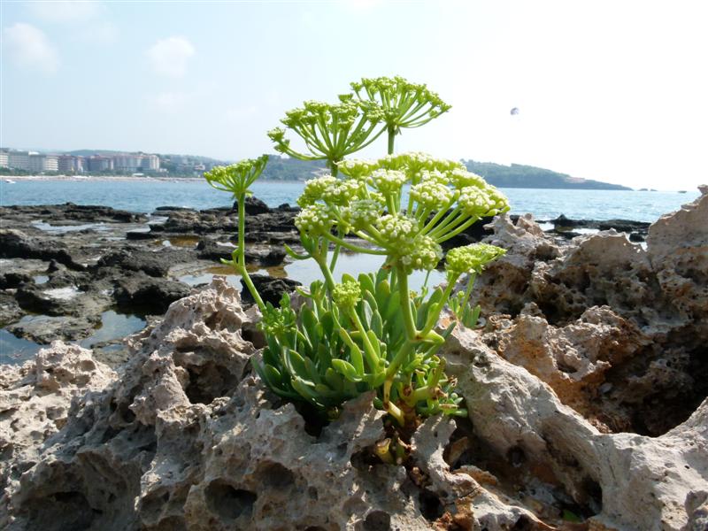
| Und nun noch einige schöne Bilder von unserem
Inselaufenthalt !
Ve şimdi
bizim adanın
bazı güzel resimler
için kal!
And now for
some nice pictures of our
island stay!
|


|