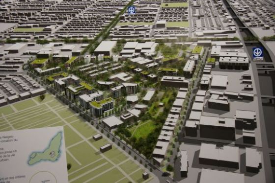
Le Triangle est un quartier résidentiel en plein développement au cœur de Montréal. Grâce à un projet de revitalisation d’envergure et à la vision moderne de nombreux professionnels en urbanisme et en architecture, ce secteur deviendra sous peu un espace urbain vert, un véritable oasis de fraîcheur et de quiétude. Accessible en transport en commun et à proximité de plusieurs grandes institutions montréalaises, ce quartier offrira rapidement un milieu de vie idéal à de nombreuses familles et jeunes professionnels.
Le secteur Namur—Jean-Talon Ouest (NJTO) est situé au nord de l’arrondissement de Côte-des-Neiges—Notre-Dame-de-Grâce, à l'est du secteur de l’hippodrome, entre l’autoroute 40, l’autoroute Décarie et Ville Mont-Royal. Il s’agit d’un secteur enclavé et délimité par la rue de la Savane au nord, la voie ferrée du Canadien Pacifique au sud, la rue Moutain Sights à l’ouest et le rue Victoria à l’est. Ces axes routiers créent une forme géométrique qui a inspiré le nouveau nom donné au secteur : le triangle. (ref. Ville de Montréal)
Le Triangle is a flourishing residential neighbourhood in the heart of Montréal. Thanks to a large scale revitalization project and to the contemporary vision of many urban design and architecture professionals, this sector will soon become an urban green space and a true oasis of freshness and tranquility. Accessible by public transit and close to many Montréal institutions, this neighbourhood will quickly become an ideal living environment for numerous families and young professionals.
The Namur-Jean-Talon West (NJTO) is located north of the Côte-des-Neiges-Notre-Dame-de-Grace borough, to the east sector of the Hippodrome, between Highway 40 , the Decarie Highway and Town Mount Royal. This is an area enclosed and bounded by the streets of de la Savane to the north, the Canadian Pacific Railway to the south, Mountain Sights Street to the west and Victoria Street to the east. These road axis create a geometric shape that inspired the new name given to the sector: the triangle. (ref. Ville de Montréal)
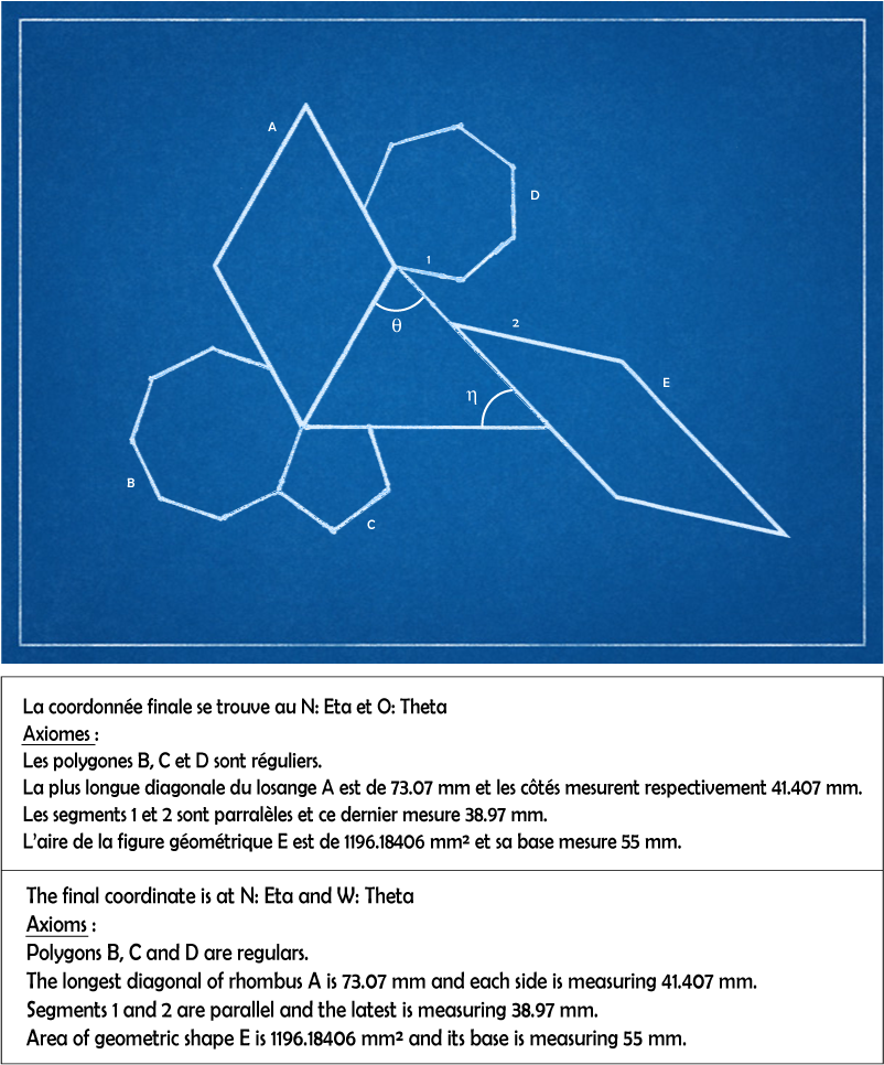
J'ai placé une nano dans le triangle et pour la trouver, vous allez devoir résoudre le problème suivant :
I put a nano in the triangle and to find it, you will have to solve this problem: