This is one of ten caches placed for
Cache Across Maryland (CAM) 2012.
Each location was picked specifically to give you a taste of the state
and show you just a part of its beauty.

By visiting all ten CAM caches, you'll be able to see why Maryland is truly
"America in Miniature". We hope you enjoy them!
THIS CACHE IS ONLY AVAILABLE FROM DAWN TO DUSK!

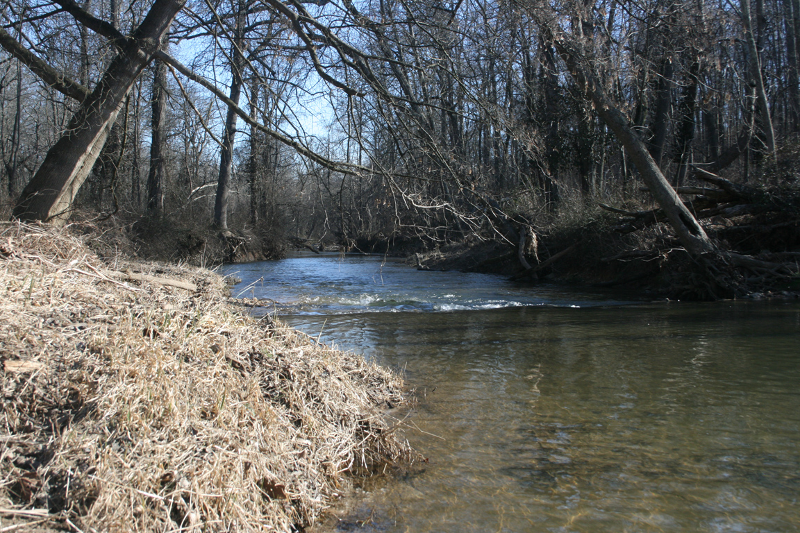
The Patuxent River State Park is located in Howard and Montgomery counties, along the upper 12 miles of the Patuxent River. The park is comprised of 6,700 acres of natural areas and farmlands. Over 5,000 acres of the park is hunting land open for forest game, upland game, dove, and deer hunting. The cache is in a clearly marked No Hunting area.
Downstream of the State Park, the Brighton Dam forms the Triadelphia Reservoir. Further downstream, the T. Howard Duckett Dam forms the Rocky Gorge Reservoir. These two reservoirs, covering 800 and 773 acres of surface area, are managed by the Washington Suburban Sanitary Commission and provide clean drinking water to Montgomery and Prince George’s Counties.
Roughly 100 miles downstream from the cache, the Patuxent River finds the Chesapeake Bay near the Patuxent River Naval Air Station. Up here closer to the river’s source, the Patuxent starts its trip as a stream. When you find the cache, you’ll be a little more than 9 miles from the source, which is near the intersection of I-70 and Rt. 27 south of Mt. Airy. The Department of Natural Resources has designated this part of the river as a catch-and-release fishing stream.
The new container as of 11/23/2014 is a roughly 8"x5"x3" 1 quart Rubbermaid clear locking container.
The cache is located on the Howard County side of the Patuxent River, less than 1 quarter mile downstream of the parking area along Howard Chapel Rd. From the parking area, there's a trail that is parallel to the river. It doesn't go very far. It did in 2012. After that, you'll deal with a combination of deer paths, tall grass, pricker bushes, swampy areas, bushwhacking, and places with no trail at all.
Yes, this is a miserable hike. "Nasty, brutish, and short." It's less than 1/4 mile dead straight from the parking area to the cache, but it's an ugly 1/4 mile.
Also, you know what? Just don't come searching for this cache. It's a nightmare to get back here. Just leave it. Honestly, I considered just archiving it. If this cache wasn't part of CAM, I probably would have. Since it was a CAM cache, I decided to keep it going. Don't come out here. And don't bring kids or pets! Thank you.