Abandoned Airfields - El Rancho Airport Mystery Cache
Abandoned Airfields - El Rancho Airport
-
Difficulty:
-

-
Terrain:
-

Size:  (micro)
Please note Use of geocaching.com services is subject to the terms and conditions
in our disclaimer.
THE CACHE IS NOT AT THE POSTED COORDINATES!
This is part of our Abandoned Airport Series.
This is a very simple mystery that can be solved with just the information on the cache page! We made this a puzzle so hopefully, you would take time to learn a bit of history about the old Airfields of the area.
El Rancho Airport was a private airfield on the West Mesa of Albuquerque. There is not a lot of information available on the field.
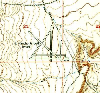
The first aerial images of the airfield were taken in 1959, but it was on the 1954 USGS Topo Map. The airport was not visible on 1951 aerial photos. This means it must have been built sometime between 1951 and 1954.
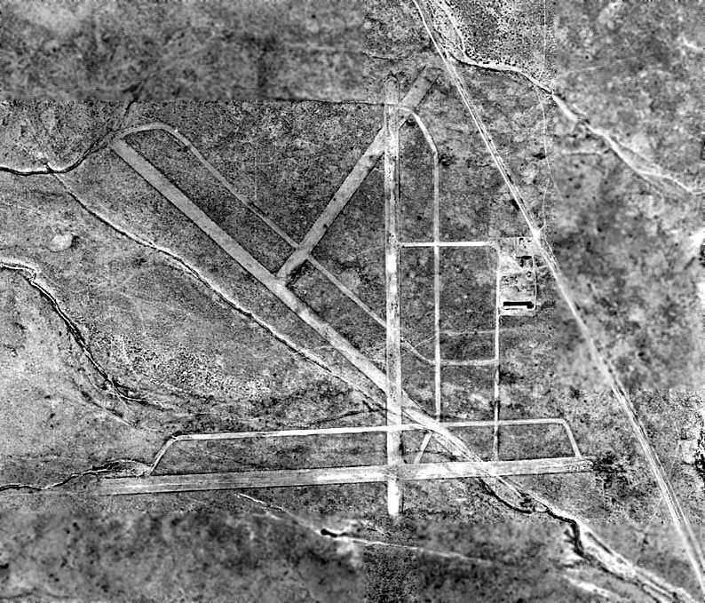
El Rancho consisted of at least 4 runways and at least 4 taxiways. It also appears to have had 2 buildings. In the 1959 aerial photo above, no aircraft are visible indicating the airfield may have been newly constructed at this point. It shows an elaborate runway pattern which may mean the airport was originally planned to serve a fairly high volume.
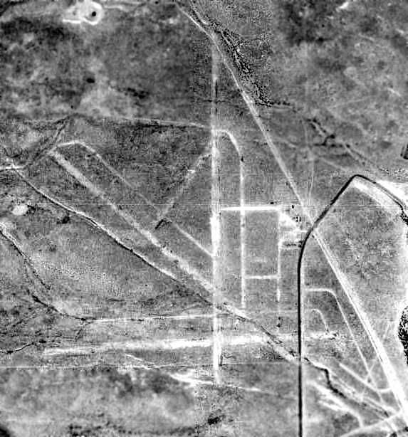
As evident by the 1967 aerial photo above, the airport had been abandoned at least by this time. It appears the dreams for this field never came to fruition. It must have closed sometime between 1959 and 1967. The buildings had been removed by this point as well.
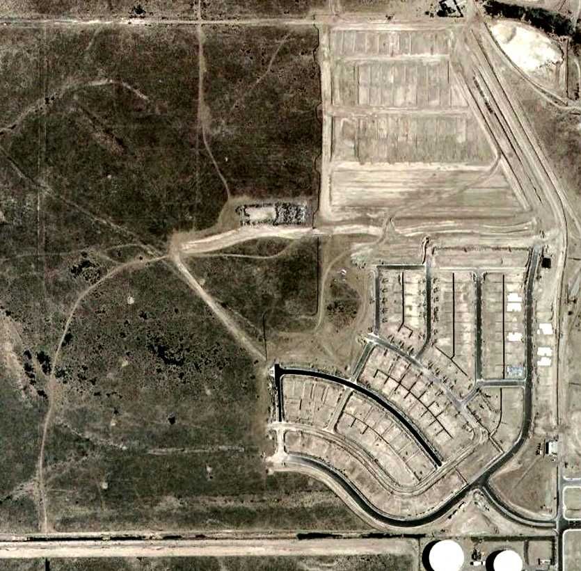
The 2006 satellite image shows a housing development being built over El Rancho Airport. To this point some of the runways can still be seen.
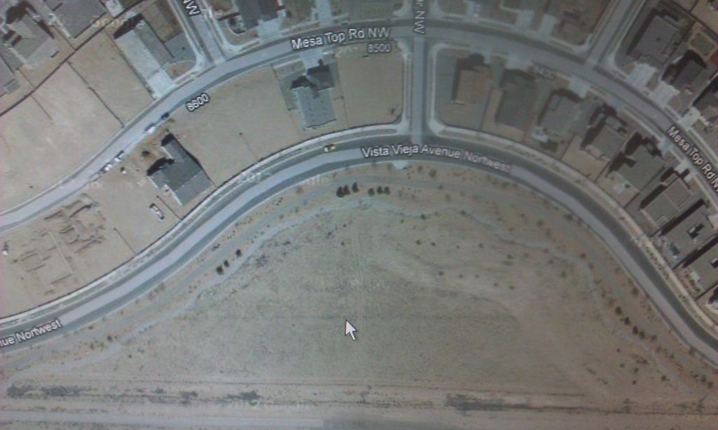
Now almost the entire airport appears to lie beneath the housing track. If you look closely at the cache location you may see the Southern edge of the Southern most East-West runway. I believe it is visible in the current satellite image, if only barely. The faint line I am referring to is pointed at by the cursor in the image above.
The cache is located at:
N 35 09.6A6
W 106 43.9BC
A = Last digit of year when the airport did not show up on aerial image.
B = Number of taxiways x2 C = Number of runways If you have any knowledge or experience with this place, we'd love to hear about it in your log.
Check out the others in the series:
Alameda - GC3PD8D
Coronado - GC2VE99
Western Express/West Mesa - GC2VDJN
Additional Hints
(No hints available.)
Treasures
You'll collect a digital Treasure from one of these collections when you find and log this geocache:

Loading Treasures