Welcome to Emerson Point Preserve!
Anyone can claim this cache, but to be eligible for the Taking Flight Tracking Tag you must answer the following question: Which estuary bird are you? Follow the directions at the cache site (please leave the activity card in the cache box!) in order to obtain your wing flapping rate and determine your estuarine bird. Write it down in your Passport.
This preserve, located on the tip of Snead Island, is a unique place where fresh and salt water meet. From the cache site, you will be able to see the saltwater Gulf of Mexico, the freshwater Manatee River, and the Tampa Bay estuary. As an estuary, Tampa Bay is a partially enclosed water body where the salt and fresh waters mix, it is in fact the largest open-water estuary in Florida, and includes nearly 400 square miles in three counties. Estuaries support a diverse variety of wildlife and plant species, providing nesting places for birds, food sources for all wildlife, and a sort of nursery area for juvenile fish and marine invertebrates like crabs and shrimp. Estuaries protect water quality by filtering out dirt and pollution. And, of course, estuaries play an important role in our own lives by providing us with opportunities to boat, fish, swim, and bird watch.
Fishing is great in the estuary at Emerson Point Preserve. Photo by Linda O'Connor-Levy
Manatee County is unique in that it falls within the project area of three different National Estuary Programs. These organizations are community-based programs that help safeguard the health of the coastal systems and watersheds of Tampa Bay, Sarasota Bay, and Charlotte Harbor. The three National Estuary Programs work with the Natural Resources Department in order to protect and restore sites like Emerson Point and the other preserves within Manatee County.

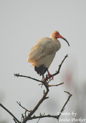
White ibis. Photo by Anita Parker

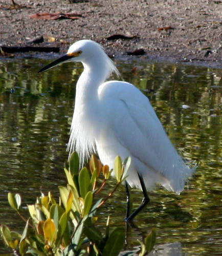
Snowy egret. Photo by Charles Taylor

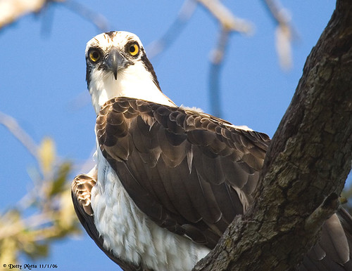
Osprey by Dotty Motta
Anyone can claim this cache, but to be eligible for the Taking Flight Tracking Tag you must answer the following question: Which estuary bird are you? Follow the directions at the cache site (please leave the activity card in the cache box!) in order to obtain your wing flapping rate and determine your estuarine bird. Write it down in your Passport.
Visit the sites along the Taking Flight GeoTour (TFGT) and learn about Manatee County’s wild spaces and the amazing feathered friends that live in them. Along the way, you will be challenged to become a citizen scientist, a preserve ranger, a detective, a historian, and of course an excellent geocacher in order to find all of the caches in the trail. Caches are located in birding “hot spots” throughout Manatee County’s publicly accessible conservation preserves. Each one highlights a specific bird species or aspect of bird life providing you with opportunities to learn more about these creatures and what we can do to help them survive. Caches also focus on protecting the region's waterways, bays, and natural watersheds, and habitat areas for many of our area’s feathered fliers.
The Taking Flight GeoTour includes 20 caches within Manatee County. A custom Taking Flight Geo Tour trackable geo tag will be awarded for locating at least 12 TFGT caches. To be eligible for the tag, geocachers must download a passport from the TFGT Website or pick one up at the Manatee County Natural Parks & Natural Resources Department office at GT Bray Park 5502 33 rd Ave. Dr. W., Bradenton, FL., Monday through Friday, 9 a.m. to 4 p.m. Geocachers must log at least 12 finds, answer the question from each cache on their passport, and complete any additional requirements for specific caches (such as posting photos for earth caches). After finding a minimum of 12 caches, participants can have their passports validated in person or via mail at the Manatee County Natural Parks & Natural Resources Department office at GT Bray Park 5502 33 rd Ave. Dr. W., Bradenton, FL 34209, Monday through Friday, 9 a.m. to 4 p.m. News and updates on tag availability and validation hours can be found online at the Parks & Natural Resources Department's website.
Thank you for assisting with the Taking Flight GeoTour: