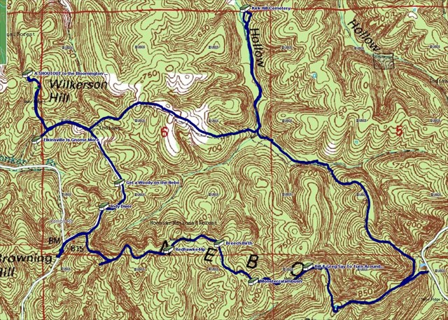
The above image will perhaps save you some time (then again it may not). It's just there for anyone curious as to what track I've taken and found to be the path of least resistance. I'll also include a link to the GPX file if you're curious about that as well and wish to load it onto your unit. Just right click one time and select "Save As" and save it wherever you want to be able to load onto your GPSr. Total loop distance is around 6.9 miles.
Nebo GPX
I've never been to the Nebo Ridge area and since I've had about 9 caches eating away at me for a long time I thought I'd make a few new ones to get some people out to visit. I parked on Berry Ridge Rd at the parking coords but there are several places to park. Dunno about vandalism or anything but I do know that this area is frequented by hunters so WEAR HUNTER ORANGE during the season. Also, be advised, the road goes to gravel for a couple miles before reaching parking coords. Nothing crazy but it is gravel....was nicely kept when I visited.