Umananda
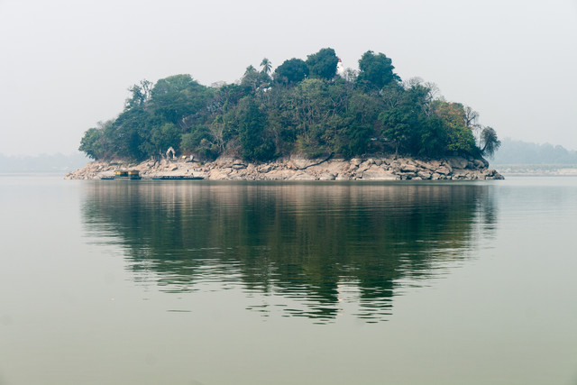
Located within the mighty Brahmaputra river, Umananda is said to be the smallest inhabited river island of the world. A Hindu temple was build in the 17th century on the top of the island. The British gave it the name Peacock Island for its shape whereas the alternative Assamese name Bhasmachal translates to “hill of ashes”. This comes from the Hindu mythology by saying that once, Sheva was in deep meditation on Umananda. When Kamadeva tried to interrupt Sheva, he used his third eye to burn Kamadeva to ashes.
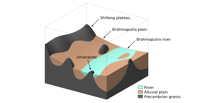
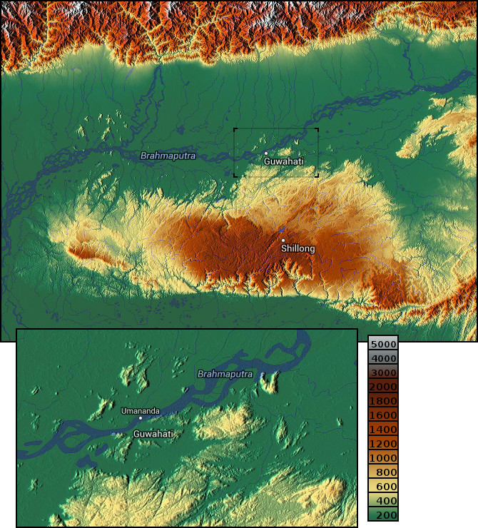
Umananda is also interesting from a geological point of view. In fact, this hillock rather consists of old gneissic rocks. Series of similar hillocks and hills that rise from the Brahmaputra plain can be found on several places along the plain on either side of the river. They all are continuations of the Shillong plateau which mainly consists of gneissic rocks from the Precambrian eon that have inhomogeneous appearance and color variation and that sometimes expose minerals in form of bands or spots. Rocks of this type were developed by a metamorphic process under high temperature and pressure conditions when the originally igneous or sedimentary rocks are deeply covered under other layers of rocks. The layers of original rocks are reflected by foliation called “gneissic banding”. Later on, gneissic rocks can appear at the surface when the covering layers are all eroded away and the low layers are lifted by tectonic forces.
The center of Shillong plateau is located in the south and raises about 1800m above the Brahmaputra. The remote continuations of the plateau rise at most a few hundred meters above the plain, whereas the valleys of Precambrian rocks are even at a lower level than the plain. These valleys are filled with alluvium consisting of cobbles, pebbles, sands of various grade, silt and clay. As a consequence, the Precambrian rocks are exposed in residual hills and hillocks that only have an underground link to the Shillong plateau.
However, at the intersection of the plateau and the river, one can find low-raising hillocks that form rocky islands in the river. Located right in the middle of the Brahmaputra, Umananda is a very beautiful island of such that kind.
Sources: Wikipedia, Gazetteer of India - Assam State Vol. 1, EIA Report - Proposed INDAdept Project - Guwahati Refinery, Maps-For-Free. Photos and diagram: own work ©.
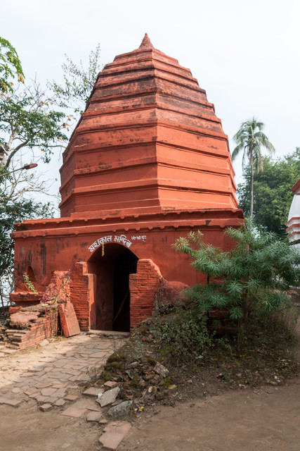
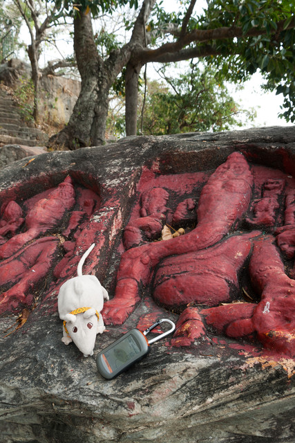
Umananda can be reached by ferry. On the island, you can find various Hindu temples and, if you are lucky, you might see some golden langurs on Umananda. However, the listing coordinates lead you to the west end of the island. It is a lookout point on top of the rock cliff from where you have a wonderful view over the Brahmaputra. Further, you can find several rock-cut reliefs depicting Ganesha.
Update: Now, there is a fence in front of the Ganesha reliefs. You don't have to cross the fence in order to answer the questions!
To log this cache, you have to visit the island and to answer the following questions.
- Minerals: Some of the big boulders reveal bands or spots of minerals that result from layers of other material during the metamorphism of the gneiss. At the listing coordinates, you can find boulders with bands and spots of minerals. Which mineral might it be and how does it look like?
- Erosion: All over the island, you'll find many huge boulders. What is the general shape of the boulders (entirely convex or do they also have concave erosions; especially near the water)? What can you conclude about the durability of these rocks?
Please, send me your answers before logging. It would be nice if you attach photos to your log.
